

North Mississippi Storm Chasers & Spotters. Social Media. Primary spotter network for local media, with working relations with multiple emergency agencies.
Union County, MS
Joined April 2009
- Tweets22.3K
- Following306
- Followers3.6K
- Likes1.2K





Pinned Tweet
We would like to announce that we can now accept your tax-deductible donations. We currently offer 3 ways:
1. Visit our website and click donate. (link in bio)
2. Text NMSC to 53555
3. Visit givebutter.com/Y3o6N9
Your donation supports us during the storm season and some community projects that we plan to announce in the coming weeks.

View of the Ashley County, AR, wildfire via the NMSC Greenville Skycam, sponsored by TecInfo Communications. Watch Live at hazcams.com/org/north-missis… or hazcams.com/station/greenvil…
@joel_off_air @ryanvaughan @JamesBryantWX @NWSJacksonMS

Crews are working to extinguish a wildfire near the I-10/Canal Road exit in Gulfport. Watch Live via the NMSC Biloxi Skycam: hazcams.com/station/biloxi-m…
The fire is approximately 13 acres on the south side of the interstate, burning on both sides. Law enforcement is on scene because the interstate is smoked out, and additional units are en route. #mswx
@NWSNewOrleans @WLOX @WXXV25

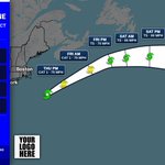
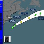
Post-Tropical Cyclone Josephine is about 235 miles east-southeast of Nantucket Massachusetts. Winds 65 mph. Josephine becomes a powerful extratropical low. A gradual turn toward the east is forecast on Friday and into the weekend. Moving northeast at 17 mph.

Subtropical Storm Josephine is about 200 miles southeast of Nantucket Massachusetts. Winds 65 mph. Josephine moving northeastward across the northwestern atlantic. Expected to become a powerful extratropical cyclone this afternoon or tonight. Moving northeast at 12 mph.

Subtropical Storm Josephine is about 195 miles south-southeast of Nantucket Massachusetts. Winds 65 mph. Josephine accelerating northeastward away from the united states. Expected to become a powerful extratropical cyclone. Moving northeast at 13 mph. As of Oct 22 at 4:00 AM CDT.

Subtropical Storm Josephine is about 245 miles south of Nantucket Massachusetts. Winds 65 mph. Josephine expected to move northeastward away from the united states on thursday. Forecast to become a powerful extratropical cyclone. Moving north-northeast at 6 mph.

Subtropical Storm Josephine is newly formed a few hundred miles offshore of the U.S. Mid-Atlantic coast. A disorganized trough east-southeast of Bermuda has a 10% chance of development through 48 hours and 10% through 7 days, with conditions becoming unfavorable by the weekend.

Subtropical Storm Josephine is about 265 miles south of Nantucket Massachusetts. Winds 65 mph. Subtropical storm Josephine forms. Forecast to move northeastward away from the united states. The storm should turn northeastward by tomorrow with a large increase in forward speed.


Offshore the mid-Atlantic, a storm-force non-tropical low has gained subtropical traits and has a 50% chance to become a subtropical storm tonight or early Thu. High winds, coastal flooding, and dangerous surf may affect the U.S. East Coast for the next few days.

A storm-force non-tropical low a few hundred miles off the North Carolina coast has showers and thunderstorms mainly west of its center. 40% chance of development through 48 hours and 7 days. High winds, coastal flooding, and dangerous surf may affect parts of the U.S.

Off the North Carolina coast, a storm-force non-tropical low attached to an occluded front has a 30% chance to develop in 48 hours and 40% in 7 days, with some organized convection. High winds, coastal flooding, and dangerous surf are expected along parts of the U.S.

Off the southeast U.S. coast, a storm-force non-tropical low attached to an occluded front has a 20% chance to develop in 48 hours and 40% in 7 days. High winds, coastal flooding, and dangerous surf are expected along parts of the East Coast for the next few days.

Atlantic Tropical Weather Outlook in effect for Atlantic until 2:43 AM CDT Monday. #1 48h 0% / 7d 40%.

A strong non-tropical low is expected to form by Sunday night off the southeast U.S. coast, moving slowly and erratically through midweek with some subtropical development possible. High winds, coastal flooding, and dangerous surf are likely; 7-day formation chance 30%.

A strong non-tropical low is expected to form within 1–2 days off the U.S. East Coast, moving slowly and erratically into midweek; some subtropical development is possible. High winds, coastal flooding, and dangerous surf are likely. 7-day formation chance: 20%.

Come by and see us at Crossroads Arena in Corinth for the Alcorn Health and Safety Fair from 9:00-2:00. @matt_laubhan

