

All Weather. All New Jersey.™ Be safe! JC
New Jersey
Joined February 2010
- Tweets23.2K
- Following162
- Followers29.3K
- Likes1.9K

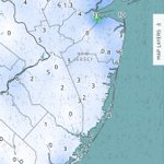


Why are so many losing their minds over this? People, there is no nor'easter coming for NJ, yet alone anything on a collision course with NJ. If you think N winds gusting to 25-30mph with tides 1-1.5ft above normal is "Jersey getting hit by a nor'easter" please go back to school if you're a pro.

Tidal guidance starting to adjust to what this storm really is, specifically the idea of N/NE winds, possibly even N winds along the coast on the W side of the cyclone. Not NE winds. What this does is mitigate the mechanism of water pushing into the inlets. Instead, ocean water is blown parallel to the coast not into it. Regardless, tidal guidance now only suggesting high-tide of 1-1.5ft above normal. The northerly, not northeasterly, winds should sustain 10-20mph with gusts to 30mph. A breezy fall day Wednesday. Be safe! JC


I'm starting to think the concept of a nor'easter varies by region. I've weathered out many along the Jersey coast and every single one has been associated with a coastal low.

OBX is actually closer to the high at this point than the low. You can clearly see the pressure gradient squeeze isobars into OBX from the NE. But the NE winds are not from the NW quadrant of the ocean low (the nor'easter zone). They are from the more general pressure gradient setup.


This everyone. This!

I want to address whether this coastal low-pressure system qualifies as a Nor'easter, a point of some debate.
The key is location! I tend to rely on the AMS Glossary (glossary.ametsoc.org/wiki/no…), which emphasizes the 100-mile coastline requirement. In previous model solutions, the storm was closer to the coast, which led to the term Nor'easter, but now the track is expected to be beyond 100 miles, making it an ocean storm.
SNJ Pine Barrens down to 36 already with low-30 dews. Very light winds and clear skies. Radiational cooling should produce an easy frost and may even take a run at 32.
Does anyone else want to tell me that New Jersey is getting hit by a nor'easter in 48 hours? Please provide evidence because what's currently showing on model guidance aint it.

Even the Stevens Flood Advisory System is suggesting only minor coastal flooding from a few days of built up easterly fetch (ensemble mean). This happens all the time in October and is definitely not a NJ nor'easter. If you don't know this, SENJ forecasting is not for you.

