

Weather and geography enthusiast | Meteorologist, OU ‘25 | Fresno, CA native | Opinions are mine, not my employer's
Norman, OK/Fresno, CA
Joined August 2021
- Tweets268
- Following1.3K
- Followers222
- Likes51.1K





Auroras haven’t been overly intense in Norman but the addition of lightning off to the east was a cool touch #okwx @MikeMorganKFOR


Michael Gonzalez retweeted

First supercells of day popping up a bit farther south than most favorable zone of coincident instability & shear might suggest--in central San Joaquin Valley near Fresno/Hanford! But I expect other strong to severe cells to develop rapidly farther north in next 1-3 hrs. #CAwx

Michael Gonzalez retweeted
There will be highly unusual widespread risk of severe thunderstorms in Sacramento Valley today (and locally elsewhere). Supercell/tornado risk may be somewhat conditional on differential heating (from sunny breaks in clouds), but otherwise environment looks very favorable. #CAwx

There is a Slight Risk of severe weather across parts of the Sacramento Valley. The strongest storms later this afternoon will be capable of a tornado or two along with more isolated/marginal hail and damaging winds. #cawx

Michael Gonzalez retweeted
There is a Slight Risk of severe weather across parts of the Sacramento Valley. The strongest storms later this afternoon will be capable of a tornado or two along with more isolated/marginal hail and damaging winds. #cawx
Michael Gonzalez retweeted

To sum up Hilary's rarity:
➡️ First time NHC has ever issued a Tropical Storm Watch in California
➡️ First WPC excessive rainfall high risk in the southern CA desert
➡️ Potential first tropical storm landfall in CA since 1939
This has potential to be a high-end event for CA.


Dewpoints in the San Joaquin Valley sat nearly 10° higher Sat. than models expected in the morning, helping keep highs a few degrees lower than forecast. Will be interesting to see how this impacts today (if moisture holds, maybe 110°+ will be harder to reach?) #CAwx


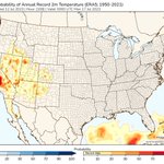
Heatwave this weekend has potential to flirt w/ all-time record highs in the San Joaquin Valley (which are generally near 115°F), especially Sun. In any case, 1 or 2 days of 110°+ highs seem probable for interior CenCal #CAwx

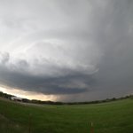
Cool little LP supercell I saw yesterday in Hemphill County near the OK/TX border. Hard to beat that kind of structure! (Shaky camera is b/c of wind, unfortunately I have a sub-amateur setup 🙃)
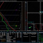
Accidentally stumbled upon the absolute worst shear profile I've ever seen (certainly the worst w/ non-zero CAPE anyway). Rarely do I find hodographs with comedic value, but this one is just hilariously pathetic. Truly a subversive masterpiece


Michael Gonzalez retweeted

Springtime weather can be interesting, and unpredictable. A funnel cloud was spotted in Fresno County by ABC30 insider Noah James Garcia. abc30.tv/3HFyMu8

Some views from yesterday. Stayed in the same spot (~2 mi ENE of Ninnekah) for nearly an hour and saw 2 separate supercells pass within our view (pictures 1 & 2). Just an incredible day #okwx


Michael Gonzalez retweeted

Tulare Lake, once the largest freshwater lake west of the Mississippi River is re-emerging in California's San Joaquin Valley due to huge runoff generated by heavy precipitation in California this winter.
As California's snowpack melts, the lake is expected to grow even bigger.


Another day, another textbook low-topped supercell in the Fresno area. Absolutely incredible radar presentation. Like yesterday, further intensification (and brief tornado threat) appears possible for the next hour or so given the environment #CAwx
Michael Gonzalez retweeted

Crazy fun day of storm chasing in the San Joaquin Valley. CAMs handled the setup nicely, which made for a fairly easy day. Even though the forecast verified, I still found myself in shock at the beauty and strength of the storm as it tracked across the valley.
#CAwx @NWSHanford – at Salinas, CA


Michael Gonzalez retweeted
A #Tornado warning has been issued for #Fresno County due to reports of funnel clouds. Please seek shelter immediately indoors in an interior room without windows on the lowest floor if possible. #CAWx.

ALT Tornado warning in effect for parts of Fresno County until 4:15 PM PST March 11