

World Travel/Media Sales/International Relations Master. Enjoying a front row seat on this wild ride into history! Military, Trade, Freedoms, Stewardship
Amsterdam, 🇳🇱
Joined June 2015
- Tweets3.1K
- Following256
- Followers421
- Likes2.3K




Mark C. Trebels retweeted

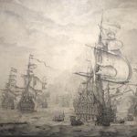
A small marsh republic became a naval superpower not by size, but by efficiency and ingenuity.
Shipyards were their factories.
Windmills their engines.
Warships their leverage.
A unique triad that made the Dutch one of the most powerful forces in the age of sail.

ALT Scale model in the Rijksmuseum.
Mark C. Trebels retweeted
Very interesting thread which points out that much of the wood needed to build Dutch ships came from Baltic trade.
A lot of it also came from Germany where large pines in the Black Forest were named "Holländer," as they were traded to the Netherlands via rivers on huge rafts.


Mark C. Trebels retweeted

Pascaert vande Noort-Zee om Achter Yrland en Schotland om to Seylen/ Mare Germanicum ac Tractus Maritimus Retro HIberniam et Scotiam, Frederick de Wit ca 1675 @SjoerddeMeer

Mark C. Trebels retweeted
An elegant nautical chart of the Baltic Sea, with a mariner utilizing a cross-staff to find his correct latitude; here titled the "Oost Zee" or "East Sea" in 1654 by Frederik de Wit, while Estonians know it as the "West Sea," or poetically the "Evening Sea." #maps #HarvardLibrary

ALT Image of a nautical chart with rhumbline networks and two compass roses on either side of the sheet. Also, with a title cartouche in the lower right and the mariner with the cross-staff to the right of the title.
Mark C. Trebels retweeted

"Chart of the Eastern Sea (Baltic Sea)" (1650). This detailed maritime map of the Baltic Sea (Oost-Zee / Maris Balthici) was published in Amsterdam by Johannes Janssonius (1588–1664), one of the major figures of the Dutch Golden Age of cartography. The composition focuses on the Baltic basin and surrounding coastlines, with carefully structured shorelines, sailing routes, and coastal markers intended for mariners. The map is part of the Nieuw(en) Atlas series, one of the major publishing projects of the Janssonius, issued in multiple volumes and editions throughout the mid-17th century.


Mark C. Trebels retweeted

Princess Elisabeth of Hesse, later Grand Duchess Elizabeth Feodorovna of Russia, wife of Prince Sergei Alexandrovich and sister of Empress Alexandra Feodorovna. Photographed by Hayman Selig Mendelssohn in 1887.





Mark C. Trebels retweeted
"Map of the Kingdom of Poland and the Grand Duchy of Lithuania" (1705) by Pieter Pickaerdt (c. 1668–1737) and Adriaan Schoonebeek (1661–1705). An interesting map published in Russian, in Moscow in 1705, showing the territories of the Polish–Lithuanian Commonwealth, parts of Muscovy, and neighboring lands. It was engraved by the Dutch-born artist Pieter Pickaerdt, while the decorative cartouche was created by Adriaan Schoonebeek. What makes this map particularly interesting is that it was produced during the reign of Peter the Great, at a time when the Commonwealth was still one of the largest states in Europe, although already in a period of political decline. The map was printed in Moscow's Kremlin Armoury and reflects Russia's growing interest in the lands to its west.

Mark C. Trebels retweeted
"Map of the Grand Duchy of Lithuania and Its Neighboring Lands". Commissioned by Mikołaj Krzysztof Radziwiłł, created in 1625 by Willem Janszoon Blaeu, Joan Blaeu, and Hesselus Gerardus. From the collection of the National Museum in Kraków.

Mark C. Trebels retweeted
"Prvssia accvrate descripta - Prussia Accurately Described” (1635)". A detailed copper engraving map of the Duchy of Prussia published in Amsterdam in 1635 by Willem and Joan Blaeu, based on the earlier work of Kaspar Hennenberger. Measuring around 38 × 50 cm. The title appears in an elaborate ornamental cartouche surrounded by 4 allegorical figures and crowned with the Prussian coat of arms beneath a princely crown. The map includes the cardinal directions in Latin - Septentrio, Meridies, Occidens, Oriens. The geographic content and legend on the map itself are largely in Latin. At this point the word "Prussia" still did not yet carry that later harsh militaristic sound it would gain in European history, but things would begin changing not even a century later.

Mark C. Trebels retweeted
"Brandebvrgvm Marchionatvs cum Ducatibus Pomeraniae et Mekelenbvrgi - The Margraviate of Brandenburg with the Duchies of Pomerania and Mecklenburg" (1635). Poland’s lovely sneaky neighbour. A richly detailed copper engraving map published in Amsterdam in 1635 by Willem and Joan Blaeu. Measuring around 39.5 × 52 cm, the map presents Brandenburg together with Pomerania and Mecklenburg in the elegant decorative style. The title is placed on an ornamental pedestal decorated with the coat of arms of Brandenburg and an allegorical figure.

Mark C. Trebels retweeted
"Tartaria sive Magni Chami imperivm - Tartary, or the Empire of the Great Khan” (1635). A large copper engraving map published in Amsterdam in 1635 by Willem and Joan Blaeu, showing the enormous and still only partly understood lands of Tartary stretching across northern Asia and Siberia. At the time, for many Europeans this vast region was still a distant, semi-mythical world associated with the Mongols, steppe peoples, caravans, and the legacy of the Great Khan. The map measures around 38 × 49 cm, the title appears inside an ornamental cartouche in the lower right corner.

Mark C. Trebels retweeted

Roman Empire 125AD. Physical map with main roads, major cities, legion names, location of legionary and naval bases, gold and silver deposits, location and linguistic group of barbarian tribes. redd.it/c962r1 #MapPorn
