

International disaster mapping charity working to ensure humanitarian responders have access to the maps & data they need to save lives & relieve suffering.
UK, Germany, Caribbean
Joined July 2009
- Tweets5K
- Following921
- Followers8.8K
- Likes2.2K




Pinned Tweet
We are always looking for new ways to narrate what we do at #MapAction. Our latest effort is this 145-second animation. #VIDEO: tinyurl.com/y46zm4st

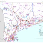
UN (@UNOCHA) Humanitarian Chief Tom Fletcher (@UNReliefChief) inspects MapAction maps on the 'mapwall' in #Venezuela. This is MapAction's 75th+ response alongside a UN agency since 2002.
More updates in our blog: mapaction.org/updated-mapact…
#mapssavelives


MapAction retweeted

How volunteer map makers save lives in a disaster bbc.in/4gV9vhY

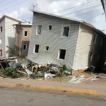
📷These images shared by our team following an assessment in Catia La Mar give a glimpse of the destruction. More than 25,000 buildings in #Venezuela incurred some kind of damage in June 24th's two #earthquakes. More updates in our blog: mapaction.org/updated-mapact…
#mapssavelives


More updates and maps from #Venezuela in our blog: mapaction.org/updated-mapact…
#mapssavelives
#VenezuelaNoEstáSola
🤖 Made with AI

Check out MapAction's history with #earthquake responses as we continue to support the UN response to earthquakes in #Venezuela. More in our blog: mapaction.org/updated-mapact…
#gis4good #mapssavelives
🤖 Made with AI

With the main airport near Caracas closed, this #MapAction map shows which airports are still operational in #Venezuela. This helps search and rescue and aid teams plan their responses to the #earthquakes more effectively.
#mapssavelives

A team of two experienced Spanish-speaking humanitarian mappers is en route to the Bolivarian Republic of #Venezuela to support the office of the United Nations Disaster Assessment Coordination (UNDAC) in the emergency response to two devastating #earthquakes.
🤖 Made with AI

MapAction retweeted


In emergencies, information saves lives. In Chuuk, #FSM 🇫🇲, the integrated OCHA/UNDAC team, with @IMMAP_inc and @mapaction, has been working with DECEM, Chuuk DCO, and IOM to turn data into decisions for the #TyphoonSinlaku response.


📷 Jamaica, Mozambique, Vanuatu – with pitstops in St Vincent and the Grenadines, Myanmar and Micronesia; a quick tour of seven #MapAction maps from emergency responses in the last few years.
#mapssavelives
#gis4good
#maps
mapaction.org/seven-maps-fro…
🙏🤝@AuswaertigesAmt

Technical support can be "the connective tissue that allows local leadership to function at scale." Find out how MapAction and partners are working together to reinforce a locally-led information management landscape in #Lebanon. icvanetwork.org/topics/5517/…
#DataForGood #LocalAction

We are delighted to be able to continue this partnership with @KenyaAsal (Arid and Semi-Arid Lands Network) to strengthen local civil society resilience to droughts.

@KenyaAsal & @oxfamkenya has kicked off data and GIS training supported by @mapaction with the hope to strengthen data collection, analysis and mapping, with a goal of improving coordination, evidence-based decision-making, and timely humanitarian response across ASAL regions.


MapAction retweeted

@KenyaAsal & @oxfamkenya has kicked off data and GIS training supported by @mapaction with the hope to strengthen data collection, analysis and mapping, with a goal of improving coordination, evidence-based decision-making, and timely humanitarian response across ASAL regions.
MapAction has sent a team of humanitarian mappers to support @UNOCHA in #Mozambique, where #floods have affected more than 700,000 people. Updates in our blog. mapaction.org/updates-mapact…

MapAction member Claudia Offner who was in Jamaica in response to Hurricane Melissa highlights three maps that had impact for partners.
#HurricaneSeason2026
#HurricaneMelissa
#maps
#humanitarian
Meet MapAction's new CEO, who brings 35 years experience as a fire fighter and strategic command officer to the role. mapaction.org/former-fire-ch…
#disasterpreparedness
#Ready2Respond
#humanitarian

The MapAction team providing daily insights for humanitarian agencies in #Jamaica has handed over to two new experienced members.
More updates on our response to #HurricaneMelissa in our blog: mapaction.org/mapaction-resp…
This work is supported by @AuswaertigesAmt
#mapssavelives

To plan how to get where by helicopter in a landscape where the geography has changed and where complex operations are evolving by the hour, humanitarian agencies need maps based on the latest data. This work is supported by @AuswaertigesAmt
#mapssavelives #HurricaneMelissa


MapAction's latest map from our team working on the response to #HurricaneMelissa in #Jamaica highlights which marooned communities have been assessed and which haven't, as well as which ones can be reached by land or air only.
#mapssavelives
Supported by @AuswaertigesAmt

The latest situation overview map from MapAction in #Jamaica shows landslide and flooding sites, with roads and transport hubs highlighted too. More updates in our blog: mapaction.org/mapaction-resp…
#hurricanemelissa
#mapssavelives
This work is supported by @AuswaertigesAmt

This map by our team in Jamaica shows the extent of damage to buildings, with more than 40% of all buildings damaged in several urban areas. In Black River, it is 65%. In western #Jamaica alone, nearly 25,000 buildings were damaged. This work is supported by @AuswaertigesAmt
