

Iowa State University Extension and Outreach | Agricultural Climatologist | Tweets are my own | born at 368.38 ppm atmospheric CO₂
- Tweets237
- Following264
- Followers307
- Likes661






ALT A slide titled "Snowfall Later Saturday into Sunday" displaying two maps of Iowa. The maps convey that the heaviest snow (3-6 inches) and highest probability of exceeding 4 inches (40-69%) are concentrated in the northern and northwestern parts of the state, tapering off significantly towards the southeast.


ALT Winter Storm Enters the Northern U.S. Winter system will enter into the Northern Plains by Tuesday morning, moving east across the Upper Midwest through Wednesday leading to periods of heavy snowfall. Heavy lake effect snow will impact the snow belt downwind of Lake Superior on Wednesday as the main storm moves to the northeast. Lake effect snow will continue into Thanksgiving morning. Timing and Location of Snowfall Snowfall will begin Tuesday morning across North Dakota, spreading east into central and northern Minnesota by Tuesday night. Heaviest snow will occur Tuesday night into Wednesday across the Minnesota Arrowhead, northern Wisconsin into the western portions of the Upper Peninsula of Michigan. Impacts from Heavy Snowfall Snowfall totals of 4 to 8 inches with locally up to 12 inches are forecast across portions of North Dakota through Minnesota. 1 to 3 feet is forecast downwind of Lake Superior. Heavy snow and gusty winds will help to reduce visibility.

ALT A stylized graphic depicting a road with seasonal Thanksgiving imagery.

ALT A swath of heavy snow and gusty winds will bring winter weather impacts to parts of the northern Plains and Upper Midwest during the Tuesday-Wednesday timeframe. Areas of heavy rain and showers on Tuesday will sweep across the lower Mississippi Valley into the Southeast on Wednesday. Thanksgiving Day will feature gusty winds and lake effect snow downwind of the Great Lakes as well as unsettled weather across the Pacific Northwest. Much cooler temperatures will prevail across most of the country.


ALT National Weather Service Weather101 flyer listing free online weather classes for the week. Topics include Severe Storms tonight at 8 p.m., The Basics on Tuesday, Flash Flooding and Storm Damage Surveys on Wednesday, Rip Currents on Thursday, and Hurricanes on Friday. Classes are hosted by NWS meteorologists, open to all ages, and last about an hour with a Q&A. Registration link: weather.gov/ohx/weather101.

ALT Weather graphic bringing attention to the state of Iowa where rain and a rain/snow mix are possible Monday night into Tuesday. Right image is a map showing the rain/snow mix likely across northern Iowa and northeastern Iowa. Area's south of this region can expect all rain as the precipitation type. A few rumbles of thunder are possible across southern and eastern Iowa. Timing for precipitation will begin in the late Monday afternoon across western Iowa and become more widespread across eastern Iowa overnight. Winds on Monday will be breezy increasing to 20 to 25 mph.


ALT Graphic showing elevated fire weather conditions for Wisconsin this afternoon with minimum relative humidity values of 25 to 30% and west winds gusting up to 30 mph.


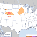
ALT The graphic has one map of Iowa showing the severe weather outlook for Monday. The best severe weather threat is located across northern and western Iowa. Hail and damaging winds will be the primary threats.


ALT Enhanced risk of severe storms with damaging wind over northwest and north central Iowa. Slight risk over the rest of the northern two thirds of the state.

ALT Marginal Risk for severe weather over portions of Iowa after midnight tonight and later Wednesday.


