

Meteorologist for Harris County
- Tweets20
- Following105
- Followers23
- Likes3






ALT National Weather Service Houston/Galveston graphic detailing a cold front expected on Friday, bringing cooler and breezy weather, a wind shift to north/northeast, possible rain ahead of the front, and weekend temperatures with highs in the 70s to 80s and lows in the 50s to 60s.

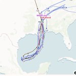
ALT National Weather Service Houston/Galveston graphic detailing late-week hazardous marine conditions behind the first fall front, featuring strong winds and hazardous seas, Small Craft Advisory conditions Friday night into Saturday, an increasing chance of gale conditions, and seas of 5 to 8 feet with potential for over 10 feet.

ALT National Weather Service Houston/Galveston probability map graphic showing the chance of temperatures falling below 60°F during the weekend, featuring high probabilities (>80% chance) north of I-10 and medium probabilities (50-60% chance) south of I-10 following the season's first real fall front.


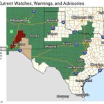
ALT A National Weather Service map and graphic detailing a Flood Watch for Southeast Texas, in effect through Friday evening, October 2, 2026. Listed counties include Austin, Brazos, Burleson, Colorado, Fort Bend, Grimes, Harris, Jackson, Montgomery, Walker, Waller, Wharton, and Washington. The graphic warns of heavy storms producing rainfall rates of 2-4 inches per hour and rapid runoff, leading to potential flooding in low-lying areas, rivers, creeks, and roads. Safety messaging advises turning around and not driving through flooded waters, and displays key impacted locations including Houston, College Station, Galveston, Conroe, and surrounding communities.





ALT Map of Texas showing the Weather Prediction Center Excessive Rainfall Outlook for Thursday, featuring a Marginal Risk (Level 1 of 4) across much of the area and a Slight Risk (Level 2 of 4) over portions of the region, indicating areas where localized heavy downpours and minor street flooding are possible.

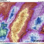
ALT Map showing forecast rainfall amounts across Southeast Texas for Thursday through Saturday, highlighting regions expected to receive precipitation and potential localized heavy rainfall totals.


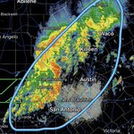
ALT National Weather Service Houston/Galveston Excessive Rainfall Outlook slide for late Wednesday through Friday. It highlights a Slight Risk (level 2 of 4) and Marginal Risk (level 1 of 4) for Southeast Texas, noting potential impacts such as locally heavier thunderstorms with heavy rain and gusty winds, and minor street flooding. Key actions advise staying tuned for updates. A flash flood risk scale is also displayed, ranging from Marginal (>5%) to High (>70%).

ALT A weather forecast graphic layout for the Extended Weather Outlook, issued by the National Weather Service in Houston/Galveston, Texas. Image indicates increased rain chances beginning Wednesday and continuing through the weekend.