

The Department of Design and Construction is the primary agency responsible for the implementation of the City’s Capital Improvement Program (CIP).
- Tweets162
- Following36
- Followers38
- Likes12







ALT Two-panel outdoor interpretive sign titled “Waipahu Sports Legends,” framed in blue with a gingham border and a green sugarcane-patterned base. It profiles local athletes: Crispin “Cris” Mancao, James Moniz, Richard Noda, Richard “Ricky” Oamilda, and Henry “Prince” Oana on the left; Albert “Al” Silva, Mitsuru “Brown” Watabu, the Fighting Yasuis (Johnny, Eddie, Freddy, and Chester), and Masa Yonamine on the right. Sepia historical photos of a cycling race and a boxing match appear behind the text.

ALT Display at a ballpark dugout: a headless mannequin in a vintage cream pinstriped baseball uniform with navy Old English lettering, a flat cap, a dark kukui nut lei, and a wooden bat in hand. Behind it, a second pinstriped jersey reading “Queen Street” hangs on a green metal locker. On a black-draped table in front are old photographs, scrapbooks, open history books, brochures, and a woven lauhala box.

ALT At an outdoor ceremony at a ballpark, a man in a black jacket shakes hands with a man in a cream-and-green vintage baseball jersey wearing a maile lei, in front of the “Waipahu Sports Legends” display. Other attendees, a camera operator on a tripod, and a white event tent are in the background, with a covered grandstand to the right under cloudy skies.

ALT Inside the Honolulu City Council chamber, four people wearing purple lei stand in front of a podium beneath the City and County of Honolulu seal, while a person in a white shirt with a lei speaks at the podium. Council members sit at curved wooden desks in the foreground, and an audience sits in the background.

ALT Numana Road bridge under construction with a fresh concrete deck, white metal railings, and a steel guardrail on the far side, with orange traffic cones and construction barriers nearby.

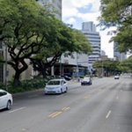
ALT Street view showing a portion of Kapi‘olani Boulevard with vehicles on the roadway. Tall trees are present along each side of the road, and large buildings are in the distance.

ALT Image of Neal S. Blaisdell Center on a bright sunny day. Coconut trees can be seen in the foreground in a grassy area to the right of the Center. The pond appears behind it as well as other palm trees, colourful brushes and a monkey pod tree on the right of the building. Tall high rise buildings can be seen in the background and the covered parking lot appears on the left. Honolulu Star Advertiser presents Career Expo 2026 serious opportunities for serious seekers.

ALT City skyline showing downtown Honolulu on a bright sunny, partially cloudy day.

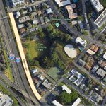
ALT Satellite image showing the location of the project site (outlined in orange) on Magellan Ave. between Frear Street and Miller Street. H1 highway runs to the left of Magellan Ave. Image also shows Dole Community Park and Dole Community Garden near the site and nearby streets Alapai St, Prospect St and Manele St.

ALT Satellite image showing the location of the project site (outlined in orange) on Magellan Ave. between Frear Street and Miller Street. H1 highway runs to the left of Magellan Ave. Image also shows Dole Community Park and Dole Community Garden near the site and nearby streets Alapai St, Prospect St and Manele St.

ALT Photo of a section inside the Kailua Municipal Parking lot. Several cars are parked in parking stalls under tall trees with buildings in the distance.

ALT Satellite image showing the project location on Moanalua Rd, near Pearl Ridge Community Park and fronting Pearl Ridge Elementary School outlined in orange. Nearby streets are also identified: Kaonohi St, Moanalua Loop, Kanuku St, Oa St, Hekaha St, Ponohana Loop and Pono St, as well as Waimalu Neighborhood Park and Queen Lili‘uokalani Highway (H1).

ALT Satellite image showing the location of the project site at the end of Aukai Ave. Also identified are the locations of neighboring streets, Kolohala St, Koloa St, Kāhala Ave and Pueo St.

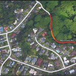
ALT Satellite image showing the project location outlined in orange and the road closures on Maunawilit Road and Kelewina Street outlined in red. Image also shows the neighboring streets: Aloha ʻOe Drive, Maleko St, Puualoha St and Lola Place.

ALT Satellite image showing the project location outlined in orange on ʻIolani Avenue. The image also shows the locations of neighboring streets: Pele St, Miller St, Frea St and Magellan Ave.

ALT UH Manoa College of Engineering. Part of the "Gate of Hope" sculpture in front of the building can be seen on the left. The sculpture is by Ukrainian-American Alexander Semeonovitch Liberman (magazine editor, publisher, painter, photographer, and sculptor).

ALT Campus Center - UH Manoa Image showing stairs leading up to campus center

ALT A curving two-lane road passes over the Waipahu Street Arch Bridge, flanked by orange and white traffic barriers and chain-link fencing. Lush trees line both sides, with a car approaching in the distance, houses visible through the foliage, and a blue sky with scattered clouds overhead.


ALT Satellite image of Hanauma Bay on a sunny day showing the location of the project sites (outlined in orange): “Parking Level Improvements” and “Beach Level Improvements.” The image also shows the roadways Hawai‘i Road, Hanauma Bay Road, and Catafalque Dr. above the project sites.
