

🗺️ Dataviz, 3d cartography, infographic 🚀 Beyond data, inside art ✉️ [email protected] 🕸️ Shop our maps at https://xitter.cf/t.co/cTjhBsXe6Y or https://xitter.cf/t.co/otHG4KOUp6
Joined October 2020
- Tweets1.2K
- Following415
- Followers3.1K
- Likes4.8K



Pinned Tweet
This is the second version of the map shared days ago, this time we made it without bathymetry and the final effect is quite different. Which one do you prefer?
#cARTography #map #italy #gis #dataviz #shadedrelief

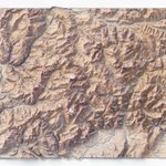
Dating from 1909, this map of the High Alps has been carefully restored and enhanced with shaded relief.
The map includes Mt Pelvoux (3,946 m), the town of Briançon and the course of the River Ubaye.
#cartography #map #shadedrelief

🗺️ 𝗠𝗔𝗣 𝗜𝗡𝗙𝗢
Carte du département des Hautes-Alpes / dressée sous l'administration de M. Reyss, préfet du département, par M. Chaix, agent voyer en chef. 1909.
Source: BnF.
Discover the map: vizcart.io/products/hautes-a…

We created this shaded relief illustration of the Dolomites using a map published in 1911.
#shadedrelief #Cartography

🗺️ 𝗠𝗔𝗣 𝗜𝗡𝗙𝗢
Dolomiten — Kümmerly & Frey, 1911.
Source: Bibliothèque nationale de France (BnF).
vizcart.io/products/dolomite…

We are producing a new set of vintage shaded relief maps; this is the first in a new series.
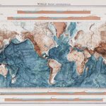
As a topographical map of the world was a major omission from our collection, here it is: a bathymetric world map from 1920.
#worldmap #shadedrelief #cartographyart #vizart #bathymetric


🗺️ 𝗠𝗔𝗣 𝗜𝗡𝗙𝗢
World – bathy-orographical, Bartholomew, John George, London: The Times, Survey Atlas of the World, 1920.
Source: National Library of Scotland.
vizcart.io/collections/other…

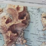
A few shots of the map of the island of Vestvågøya, part of the Lofoten archipelago in Norway.
The original map dates from 1907; following a meticulous digital restoration, we createt the shaded relief.
vizcart.io/products/vestvago…


Several years ago, we created a mini-app dedicated to Palermo’s cultural heritage; I’m pleased to hear that it’s still working today.
(ITA only)
patrimoniodipalermo.netlify.…
#palermo #culturalheritage

As of today, users in China and Singapore can no longer access the website. Again, if you are legit contact us.

Service announcement: we are forced to disable access to vizcart.io from Hong Kong because of bots. If you are from there and legit, reach us. We are sorry for that

Service announcement: we are forced to disable access to vizcart.io from Hong Kong because of bots. If you are from there and legit, reach us. We are sorry for that
Map of the Balkans, centred on Albania, the country that gives its name to the entire map.
This map is taken from ‘The World Atlas’ produced and published by the cartographic administration of the Soviet Union in 1967.
🔹Base map credit: @rumseymapcenter


Mount Dom, on Swiss Alps with a strong post production. Ortophoto and Dem from @swisstopo
#3dmountain #blender #cartography

Italy's soil map from 1966.
🗺️ 𝗠𝗔𝗣 𝗜𝗡𝗙𝗢
Soil Map of Italy - Carta dei suoli d'Italia. Società Geografica, Mancini F.;1966.
Source: EUDASM
#italy #3dmap #cartography #vintagemaps


Kristiana was the old name od Oslo, used since the 1924, when parliament decided to restore the original medieval name.
Map info:
Kristiania amt nr 77: Kart over Kristiania.
Amtskartsamling, Oslo 1901.Norsk Lithgr. officin, Oppmaalingsvæsenet i Kristiania
Source: kartverket.

We talk about the origins of the name Kristiania here: vizcart.io/blogs/news/oslo-k…


VizArt retweeted

I love this exaggerated relief map of Italy because it emphasizes the role of the Po Valley so beautifully. It's Italy's most important industrial and agricultural area and an important reason Northern Italy is much richer than Southern Italy. Source: buff.ly/45jNBvv
