

Geography teacher (20 yrs) | Geo + EdTech nerd | Creator of https://xitter.cf/t.co/iWHaCBzCQ5 | Turning maps + code into curiosity | Always wandering, always mapping
Austin, Texas
Joined July 2012
- Tweets2.1K
- Following570
- Followers785
- Likes2.7K




Same Earth. Different Boundaries and Toponyms?
Updated side project with two 3D #GoogleMapsPlatform globes side by side. Explore variations in boundaries and names.
Blog Post: geteach.com/blog/2026/07/10/…
Website: geteach.com/boundaries/

ALT A side-by-side comparison of Google Maps borders. The left map (Ukraine view) shows the national border including the Crimean Peninsula as Ukrainian territory. The right map (Russia view) shows a national border drawn at the isthmus, placing Crimea within Russian territory. Both differences are circled in red.


jwilliams retweeted

Check out this episode of The Current, where Dr. Joann Zadrozny talks with TXST President Kelly Damphousse about all things geography education and her work in Powerful Geography. #powerfulgeography #geographyeducation

President Damphousse talks to Dr. Joann Zadrozny about her decision to enroll at TXST, why she is so passionate about geography education, and her focus to help reshape how geography is taught, learned, and applied in the real world. youtu.be/RftRF_wx_kE?si=CpPv…

geteach.com is officially outgrowing the free internet... exceeding the 10,000 free map-load limit again in April. Community support has successfully offset April's growth.
Help maintain the momentum. Please share or RT.
buymeacoffee.com/geteach
#geteach #geography

A change in scale changes the story!
2k views in 7 days as classrooms globally explore the world. With the light traffic of Easter Weekend.
4 donors gave $110 to keep us ad-free & private! $5 covers ~1k map loads. Please share/RT!
buymeacoffee.com/geteach
#geography #geogchat

New Bivariate Climate layer - geteach.com
Temperature AND precipitation in one 2D color map. Pair it with Cropland and explore.
Full lesson at the link: geteach.com/blog/2026/04/05/…
Open this view: geteach.com/?m1=1004&l1=1&p1…
#geography @GMapsPlatform

Updated geteach.com to balance costs with classroom experience.
New: Donation prompt with 24-hr "snooze" and 1-yr "thank you" flags, stored in your browser... sticking with the site's "no login" feature. #geography #maps
Explanation + Costs:
geteach.com/blog/2026/04/02/…
15 years. 1.3 million map views. $400 to keep it running. geteach.com is a free, no login interactive map platform for K-12. Free for you = out-of-pocket for me. Support if you can ->buymeacoffee.com/geteach
#APHuG #GeographyTeacher #EdTech #GoogleMapsPlatform
I scored 22,035 on the @geteach Climograph Challenge! #Geography #ClimographChallenge geteach.com/ClimographChalle…
youtu.be/nBqx5sgNR-8

🌍 I scored 22,131 on the @geteach Climograph Challenge! #Geography #ClimographChallenge geteach.com/ClimographChalle…

New Layers (Climate Graphs and Climograph Challenge) from geteach.com using @googlearth engine with @GoogleMapsPlatform. Read the post here: geteach.com/blog/2026/03/18/…
#Geography #GoogleMapsPlatform #GoogleEarth #geoEducation #GoogleEarthEngine @AmericanGeo
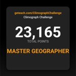
🌍 I scored 23,165 out of 25,000 on the @geteach Climograph Challenge! #Geography #ClimographChallenge
geteach.com/ClimographChalle…
I created this game, and this is officially the 1st time I’ve managed to hit the highest rank (>22,000 pts).

Working on a new way to interact with climate data:
A 5-round exercise in spatial reasoning. Analyze the temperature and precipitation patterns, then identify the region on the map. Watch to see how I fared.
Not optimized for phones
Try it here: geteach.com/ClimographChalle…
#Geography
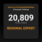
🌍 I scored 20,809 on the @geteach Climograph Challenge! #Geography #ClimateGuessr geteach.com/ClimographChalle…

🌍 I scored 20,809 on the @geteach Climograph Challenge! #Geography #ClimatographChallenge geteach.com/ClimographChalle…

Created a new Earth-Sun layer on geteach.com
Solar angle, daylight, and vegetation—linked month by month. #geography #maps #earthscience
Toponym & Border Differences: See the world from different regional perspectives. geteach.com/boundaries/ An @GMapsPlatform experiment. #Maps #Geography #Toponyms #Map3D
Try it here: geteach.com/maps3d/worldcup2…
Take a quick tour of the 16 stadiums hosting the 2026 FIFA World Cup across the U.S., Mexico, and Canada—mapped in 3D with @GMapsPlatform.
Click to fly, view Street View, see match schedules, and explore host cities.
jwilliams retweeted
Map of the Month!
Check out this amazing @NASA animation that reveals the extent of the Mississippi Watershed! svs.gsfc.nasa.gov/4493
Teachers, tell us how you would use this in your classroom!