

Global fire detection bot using satellite imagery from Copernicus #Sentinel2. Near real time.
Earth
Joined May 2022
- Tweets34.9K
- Following473
- Followers1.4K
- Likes582




Pinned Tweet
Showcasing some of the most interesting fire detections by @FirewatchBot ⬇️

In 2022, I created @FirewatchBot to automatically detect wildfires using Sentinel-2 imagery.
Since then, it has analyzed TBs of data and detected more than 24k fires!
➡️ Today, I created a website to showcase some of the most interesting detections: firewatch.space

Fire detected from #Sentinel2
🗺 Place: Mojuí dos Campos, Pará, #Brazil
🕛 Date: 2026/10/27 14:03UTC
View location: maps.google.com/?q=-3.116805… (-3.1168, -54.6722)


Fire detected from #Sentinel2
🗺 Place: Uruará, Pará, #Brazil
🕛 Date: 2026/10/27 14:03UTC
View location: maps.google.com/?q=-3.238998… (-3.239, -54.1688)


Fire detected from #Sentinel2
🗺 Place: Almeirim, Pará, #Brazil
🕛 Date: 2026/10/27 14:02UTC
View location: maps.google.com/?q=-1.203233… (-1.2032, -52.136)


Fire detected from #Sentinel2
🗺 Place: Monte Alegre, Pará, #Brazil
🕛 Date: 2026/10/27 14:02UTC
View location: maps.google.com/?q=-1.477004… (-1.477, -54.2727)


Fire detected from #Sentinel2
🗺 Place: Kayes, Région de Kayes, #Mali
🕛 Date: 2026/10/27 11:27UTC
View location: maps.google.com/?q=14.224389… (14.2244, -11.3579)


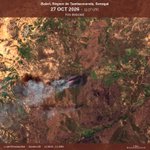
Fire detected from #Sentinel2
🗺 Place: Bakel, Région de Tambacounda, #Senegal
🕛 Date: 2026/10/27 11:27UTC
View location: maps.google.com/?q=14.694470… (14.6945, -12.3096)


Fire detected from #Sentinel2
🗺 Place: Goudiry, Région de Tambacounda, #Senegal
🕛 Date: 2026/10/27 11:27UTC
View location: maps.google.com/?q=14.043805… (14.0438, -12.8383)


Fire detected from #Sentinel2
🗺 Place: Bakel, Région de Tambacounda, #Senegal
🕛 Date: 2026/10/27 11:27UTC
View location: maps.google.com/?q=14.127962… (14.128, -12.0289)


Fire detected from #Sentinel2
🗺 Place: Goudiry, Région de Tambacounda, #Senegal
🕛 Date: 2026/10/27 11:27UTC
View location: maps.google.com/?q=13.973619… (13.9736, -13.4868)


Fire detected from #Sentinel2
🗺 Place: Yélimané, Région de Kayes, #Mali
🕛 Date: 2026/10/27 11:27UTC
View location: maps.google.com/?q=14.778217… (14.7782, -10.8086)


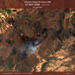
Fire detected from #Sentinel2
🗺 Place: Kayes, Région de Kayes, #Mali
🕛 Date: 2026/10/27 11:27UTC
View location: maps.google.com/?q=14.448642… (14.4486, -11.8205)


Fire detected from #Sentinel2
🗺 Place: Oudalan, Sahel Region, #BurkinaFaso
🕛 Date: 2026/10/27 10:36UTC
View location: maps.google.com/?q=14.462520… (14.4625, -0.5593)


Fire detected from #Sentinel2
🗺 Place: Seno, Sahel Region, #BurkinaFaso
🕛 Date: 2026/10/27 10:37UTC
View location: maps.google.com/?q=13.767853… (13.7679, 0.3335)


Fire detected from #Sentinel2
🗺 Place: Gnagna, Est Region, #BurkinaFaso
🕛 Date: 2026/10/27 10:37UTC
View location: maps.google.com/?q=13.055014… (13.055, -0.1806)


Fire detected from #Sentinel2
🗺 Place: Namentenga, Centre-Nord Region, #BurkinaFaso
🕛 Date: 2026/10/27 10:37UTC
View location: maps.google.com/?q=13.294618… (13.2946, -0.5712)


Fire detected from #Sentinel2
🗺 Place: Soum, Sahel Region, #BurkinaFaso
🕛 Date: 2026/10/27 10:37UTC
View location: maps.google.com/?q=14.071844… (14.0718, -0.575)


Fire detected from #Sentinel2
🗺 Place: Raga, Western Bahr el Ghazal, #SouthSudan
🕛 Date: 2026/10/27 08:57UTC
View location: maps.google.com/?q=9.4303214… (9.4303, 24.9938)


Fire detected from #Sentinel2
🗺 Place: Um Dafoug, South Darfur, #Sudan
🕛 Date: 2026/10/27 08:57UTC
View location: maps.google.com/?q=10.621335… (10.6213, 23.6528)


Fire detected from #Sentinel2
🗺 Place: Al Radoum, South Darfur, #Sudan
🕛 Date: 2026/10/27 08:57UTC
View location: maps.google.com/?q=10.036466… (10.0365, 24.5179)


Fire detected from #Sentinel2
🗺 Place: Raga, Western Bahr el Ghazal, #SouthSudan
🕛 Date: 2026/10/27 08:57UTC
View location: maps.google.com/?q=9.3343668… (9.3344, 25.3745)

