

EOSDA is an AI-powered satellite intelligence provider that transforms raw multi-sensor data into trusted outcomes.
USA
Joined November 2015
- Tweets2.4K
- Following447
- Followers2.7K
- Likes1.3K
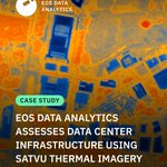



EOSDA, together with @satellitevu , monitored a data center site in Marsden Park, Australia. SatVu provided high-resolution thermal data, while we combined it with other geospatial inputs to assess activity across the site.
🔗 Read the full case study: eos.com/blog/eosda-assesses-…

Our team is attending World Space Business Week in Paris, hosted by @Novaspace_
To book a meeting, please send a message to [email protected].
See you there!
#WSBW26

Our forest monitoring project in Portugal reached a new milestone.
In partnership with CIM Coimbra under @esa ’s InCubed programme, we delivered updated satellite maps to help local teams manage seasonal wildfire risks.
Read more: eos.com/blog/incubed-wildfir…


How can agricultural businesses navigate risks efficiently? It’s one of the main questions for Ukrainian growers and traders today, and it was highlighted prominently at Agro Ukraine Week 2026.


The “road to zero” for Ukrainian agriculture is about more than just meeting distant green targets. It means managing operational risks down to zero. It is about using precision data to ensure stability and navigate a highly constrained economic environment.
🔗 To reduce risks to your agribusiness amid these conditions, try our Risk Monitoring platform, designed to help you manage pests, diseases, weather, and water stress. Become an early adopter of our Risk Monitoring platform risk-monitoring.eos.com/?utm…

Technology is now essential for agribusiness development — especially when it comes to monitoring large areas of land efficiently.
✉️ Book a meeting with our team at Agro Ukraine Week to learn more about how our solutions can help protect your yields: [email protected]

A local industrial development authority in the UAE was struggling to stay up to date across its sites using periodic ground inspections. We built a satellite monitoring workflow that gave them a plot-level view of active development areas.
Read more: eos.com/blog/eosda-tracks-co…


#SmallSat Europe is over! Sharing a few final moments from the conference with Artem Berehovyi, CBDO at EOSDA, and our colleagues from @dragonfly_space 🛰️
#EarthObservation #SpaceTech #SatelliteData
We’re launching a Risk Monitoring platform to help you detect field risks early, before they become losses.
Be among the first to try the platform: risk-monitoring.eos.com
#DigitalFarming #AgTech

Introducing Crop Yield Intelligence — a platform that turns raw data into clear insights for your fields.
🔗 Learn more about our solutions for agriculture and land use management:eos.com/industries/agricultu…
#AgTwitter #DigitalFarming #AgTech
EOSDA and @dragonfly_space will jointly present optical and SAR payloads to the market at SmallSat Europe 2026 in Amsterdam.
If you want to discuss partnership opportunities, book a meeting with Artem Berehovyi, CBDO at EOSDA: [email protected].
@SatNewsEvents @SpaceNews_Inc

Satellite data is no longer a niche capability — it's becoming part of how industries operate at scale.
Our team shared their key takeaways from the Geospatial World Forum. Read them on our blog: eos.com/events/gwf-2026-movi…


How can satellite data help assess flood damage?
In our new case study, we used SAR and optical imagery to analyze the #Coimbra floods from the #Mondego River overflow to specific building damage.
🔗 Read the full case study eos.com/blog/validating-sate…
#portugal

We attended Geospatial World Forum 2026! Five days of networking, partner meetings, and insightful sessions with experts in satellite and geospatial technology went by quickly.
Here are a few moments we’re glad to share 🛰️
@geospatialworld #gwf26
EOS Data Analytics is among the technology providers featured in the @EU_Commission “Study on the automatic delineation of parcels,” prepared by @PwC.
🔗 Explore the case study: op.europa.eu/en/publication-…

🇮🇩 Rice monitoring in #Indonesia is often limited by cloud cover and gaps in field data. We combine #SAR and optical data to ensure consistent rice field detection across the season.
➡️ Swipe to see how it works and read more: bit.ly/4dGulAl


