AMS Certified Broadcast Meteorologist (CBM) and Storm Chaser at KFOR-TV (NBC) in OKC. https://xitter.cf/t.co/mkTIJezHws Insta/TikTok: emilyrsutton

Oklahoma City, OK
Joined March 2009
Wow 🤩 4 PM 9.10.26 #okwx
6
1
50
2,733
The storm near Kingfisher is severe, moving ESE at 25 mph towards Guthrie and Edmond. Quarter size hail & 60 mph winds are poss. It looks like rain is going to graze the Metro…at least north! 🎉 11:56AM Fri @kfor #okwx
10
2,505
12:30PM Sat and the heat index is already brutal. My family and I were out in the heat to watch the #icfworldchampionship at @RiversportOKC and it was awesome to watch but HOT!!!🥵 @kfor #okwx
1
8
2,740
Lots of wonderful rainbow sightings this evening! 🌈⛈️🌅 📸: Kelly Herring @kfor #okwx
5
1
2
22
3,616
A strong storm continues to lift north through #OKC, towards Edmond. Watch for localized flooding and up to 50 mph winds. 7PM Fri @kfor
1
1
8
3,074
A SEVERE THUNDERSTORM WATCH is in effect for portions of northern and central OK until 10PM. Up to quarter size hail, 70 mph winds and localized flooding is possible. There are already scattered storms developing in this area. Watch for lightning ⚡️ 4:15PM Sat @kfor #okwx
1
5
20
2,893
Norman had a 90 mph wind gust and #OKC set a new daily rainfall record with 1.76” of rain ☔️ vs 1.72” in 2005. A #4thofJuly to remember, for sure! @kfor #okwx
4
4
1
51
4,205
Many Oklahomans lost power due to high winds on the evening of the #4thofjuly - especially in the Norman area. Evan Soderberg shared this video, showing the dangers of a downed power line! #okwx #severeweather #highwinds #stormdamage
1
4
1
54
7,169
Mother Nature’s fireworks 🎆 ⚡️⚡️ Thanks to Amelia Rangel for sharing this incredible shot from north Edmond on the 4th of July 🇺🇸 #okwx #lightning @kfor
1
35
2,416
A localized area of 90+ mph winds slammed through Norman at around 10:15PM on the 4th of July - snapping trees, downing power poles and lines and busting windows! These are tracker pics from the Taco Bell. #okwx @stevejkfor
1
3
1
29
5,096
A SEVERE T-STORM WATCH has been issued for the northern 2/3 of OK until midnight. Localized gusts to 85 mph, hail to tennis balls and an isolated tornado will be possible. Stay plugged in and have a shelter plan for outdoor activities. 🎆 5PM 7.4.26 @kfor #okwx
5
1,655
Watching for continued storm development in this area. Watch out for lightning ⚡️ 4:25PM 7.4.26 @kfor #okwx
7
1,909
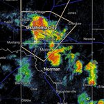
⚡️HEADS UP⚡️ Latest data suggests that the #OKC Metro area could be impacted by storms around fireworks time (9-10PM). The risk has been expanded. Here’s a poss future radar snapshot at 9PM⬇️ stay plugged in, we will keep you 4Warned. 3:15PM 7.4.26🇺🇸 @kfor #okwx
5
7
56
9,604
Happy #independenceday! Today will be dangerously hot and humid with a heat index from 105-109🥵 ⛈️ There’s a risk of severe storms late this afternoon-overnight, especially across northern OK. 60-80 mph winds & up to golfball size hail are poss. An iso. tornado is poss. 11:30AM
1
17
2,060
Check out some of the impressive rain totals from last night’s storms! Guthrie had nearly 5” of rain! .69” officially at Will Rogers. I’m glad that the weather is calming down but it’s going to be MUGGY with a heat index well over 100 this week. 12PM Sat @kfor #okwx
2
1
17
3,416
The storm over Calumet could have up to tennis ball size hail and 60 mph winds! Moving east at 35 mph towards El Reno. 60 mph winds heading towards the Village/north OKC and Edmond. Watch for flooding! 12:05AM Sat @kfor #okwx
7
2,697
Scattered showers and storms are developing across northern OK from Woodward to Enid to Perry. A few are marginally severe with up to 60 mph winds and up to quarter size hail. Localized flooding is possible. 6PM Fri @kfor #okwx
4
1,204
A severe storm from Watonga to Weatherford could have winds to 70 mph, especially the area north of Hydro, where it’s starting to bow. This will continue ESE towards El Reno & then the south Metro in the next hour or so. Watch for flooding. 9:15PM Thu @kfor #okwx
8
1,608
New SEVERE T-STORM WATCH for portions of central and southern OK through 4AM Friday. This includes the #OKC Metro. 60-80 mph winds, some hail, and flooding are the main threats. An isolated tornado is possible. 9PM Thu @kfor #okwx
5
1,997
Emily Sutton retweeted
4
18
2,754