

*Mostly Tracking Weather in the Western Pacific. *I've been Tracking Storms Since Year 2017. *Making Updates on the Latest Activity around the WesternPacific
Philippines.
Joined March 2021
- Tweets8.8K
- Following235
- Followers152
- Likes12.8K


Pinned Tweet
My unofficial analysis on 2026 Pacific Typhoon Season so far (October 12, 2026) Currently we have 35/15/10 (4 C5'S) with unofficial ACE of 340+ Strongest storm is Sinlaku reaching 165kts 886mb. And our ACE producer being Dolphin at 61.89. i know the ratio is crazy (1.)


SuperTyphoon Tracker retweeted

The cloud shield of Super Typhoon Champi now stretches from the Philippines to mainland Japan.

SuperTyphoon Tracker retweeted

Typhoon Champi's journey from a pinhole eye to a massive category 5 super typhoon:

SuperTyphoon Tracker retweeted

EPAC people when they have locked up the most active season on record and WPAC people when they’re at 350 ACE, and a Gay 1992 is in the works, after just producing 3 majors and 160kt Cat 5s earlier this month and still has all of Nov and Dec to go after IN-FA

SuperTyphoon Tracker retweeted

24-hour loop of Super Typhoon #Champi
SuperTyphoon Tracker retweeted
Sunrise is setting up on Super Typhoon Champi☀️ looking for the fast hours it's looks phenomenal and truly showing how beautiful and majestic it is and one of the Powerhouse that Wpac provides.
JTWC clutch up to 160kts 895mb.
My unofficial estimate gone with 165kts 892mb.


Sunrise is setting up on Super Typhoon Champi☀️ looking for the fast hours it's looks phenomenal and truly showing how beautiful and majestic it is and one of the Powerhouse that Wpac provides.
JTWC clutch up to 160kts 895mb.
My unofficial estimate gone with 165kts 892mb.


SuperTyphoon Tracker retweeted
Typhoon Champi over the Philippine Sea. 🌀
Its almost circular eye is surrounded by the eyewall, where the strongest winds and heaviest rainfall occur.
Champi’s eye passed approximately 16–20 kilometres south of Guam’s southern tip on 17 October, before continuing across the western Pacific.
SuperTyphoon Tracker retweeted
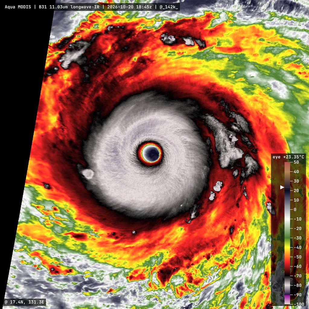
Sunrise over Super Typhoon #Champi reveals one of the most mesmerising TC satellite presentations of the year.
You can see mesovortices within the eye, while the pronounced stadium effect is accentuated by the low sun angle, leaving residual shadow.
SuperTyphoon Tracker retweeted

Super #Typhoon #CHAMPI is trekking across the open Pacific with estimated intensity at a whopping 160 knots/895 mb. That's up there with MELISSA when it hit Jamaica last year. An extreme specimen. It'll likely impact #Japan's Ryukyu Islands in a few days at much lower intensity.

SuperTyphoon Tracker retweeted
Absolutely incredible typhoon out in the western Pacific today.
#Champi has reached 160kts and a pressure of 895mb, and the satellite presentation is some of the best I’ve ever seen


SuperTyphoon Tracker retweeted

Super Typhoon #CHAMPI continues to strengthen, with winds now up to 160 kts (185 mph) and a pressure down to 895 mb.
This storm is one of the most impressive I’ve ever seen — going through multiple replacement cyclones and able to intensity afterwards to this degree.


SuperTyphoon Tracker retweeted
Category 5 Super Typhoon Champi now has extremely violent sustained winds of 185 MPH (298 kph) and an insane core pressure of 895 MBAR, tying her with Super Typhoon Sinlaku as the world’s STRONGEST storm of 2026 by wind speed.
You are looking at a meteorological Megalodon.
SuperTyphoon Tracker retweeted
#Champi has become an incredible Category 5 typhoon again with winds of 155kts and a pressure of 899mb


SuperTyphoon Tracker retweeted

Subsurface temperatures in the equatorial Pacific have soared 12°C (21.6°F) above average, the highest of this El Niño, with actual temperatures reaching 33.4°C (92.1°F).
The y-axis maximum was raised again to accommodate this extreme warmth.
We are witnessing climate history.
