

A side project of @owenboswarva. Pushing out free #opendata products and tools because I'm nice like that.
United Kingdom
Joined June 2016
- Tweets659
- Following582
- Followers608
- Likes30






Datadaptive retweeted

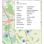
Quarterly extracts from BEIS's Renewable Energy Planning Database gov.uk/government/publicatio… and Heat Networks Planning Database gov.uk/government/publicatio… now with interactive maps #renewables #renewableenergy #datavis #opendata

Datadaptive retweeted
Locations of Large Raised Reservoirs in Wales also released as open data owenboswarva.com/blog/post-n… #reservoirs #opendata
@NatResWales has kindly given me permission to re-use a list of reservoirs under OGL. I've collated the data for England and Wales as a download and on a map.

Datadaptive retweeted
I had some spare time this week, so I made an interactive cluster map of new build homes in England and Wales. owenboswarva.com/blog/note-h… #ukhousing #proptech #datavis
This is based on build period estimates in VOA's latest Council Tax statistics. gov.uk/government/statistics… #opendata

Datadaptive retweeted
Sold-off #publicland is creating minuscule amounts of #affordablehousing neweconomics.org/2020/02/sol… | analysis by @wheatleyhanna via @NEF | updated @mhclg dataset gov.uk/government/publicatio… | #ukhousing #affordablehomes #housingcrisis #opendata
xitter.cf/wheatleyhanna/status/1…
Datadaptive retweeted
Open data sites maintained by UK local authorities datadaptive.com/laod/ | interactive map and lookup, updated for 2019 (blog post to follow) | #localgov #opendata

Datadaptive retweeted
UK Parliament Deposited Papers Index datadaptive.com/?pg=13 | @datadaptive | Excel workbook containing data from a fresh scrape of parliament.uk/depositedpaper… – re-usable under the Open Parliament Licence | #datascraping #parlidata #opendata
Datadaptive retweeted
New interactive chart: #insolvencies in local authority areas in England and Wales, 2000-2018 owenboswarva.com/blog/note-i… #ukpoverty #datavis #opendata
#Torbay had both the highest average rate (37.3 per 10,000 adult population) and the highest rate in a single year (58.2 in 2010).

Datadaptive retweeted
How many schools in England are built on historic #landfill sites? I made a map. owenboswarva.com/blog/note-e… #leafletjs #datavis #wastedata #opendata

Datadaptive retweeted
Another experiment with #Leafletjs: an interactive map of location records from a BCT dataset on #batroosts in England owenboswarva.com/blog/note-b… #js #datavis #opendata #lovebats #ukhousing #biodiversity 🦇

Datadaptive retweeted
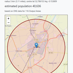
Experimenting with #Leafletjs for interactive thematic mapping: a visualisation of small area population estimates in Peterborough owenboswarva.com/blog/note-p… #js #datavis #opendata

Datadaptive retweeted
#Noisepollution – where are Defra's new strategic noise maps for England? owenboswarva.com/blog/post-e… | new blog post, with some mappy things | #noisemapping #geospatial #defradata #opendata

Datadaptive retweeted
Number of full driving licences held in Britain, compared to the estimated population by year of age of licence holders
Data: DVLA data.gov.uk/dataset/d0be1ed2… + ONS ons.gov.uk/peoplepopulationa… #transportdata #opendata 🚗

Datadaptive retweeted
Updated: Index of UK Parliament Deposited Papers, 1987 to present datadaptive.com/?pg=13 | #parlidata #opendata

Datadaptive retweeted
Southport and Brighton and Hove have the oldest #housingstock in a comparison of major town and cities in England and Wales owenboswarva.com/blog/post-h… | new blog post with a ranking calculated from @VOAgovuk + @ONSgeography data | #ukhousing #ageofhousingstock #geospatial #opendata
Datadaptive retweeted
What's new on DGU? datadaptive.com/dgu/ | a daily list of the latest dataset records added to @DataGovUK | #psiuk #opendata #metadata #datadiscovery
#GDSteam recently stopped publishing dumps of the catalogue, so I've updated this tool to pull data from the #CKAN API instead.
Datadaptive retweeted
Map: the median #CouncilTax band for two bedroom properties in each local authority district in England and Wales | underlying data gov.uk/government/statistics… | #ukhousing #datavis #opendata

Datadaptive retweeted
City of London is the only council area in England where the majority of housing is one bed properties. gov.uk/government/statistics… #ukhousing #opendata
More surprisingly Hyndburn in Lancashire seems to be the only council area where most housing units are two bed properties. 🏠🛏️

Datadaptive retweeted
Government Satellite Data and Its Role in Advancing Global Development medium.com/radiant-earth-ins… | @OurRadiantEarth CEO @Anne_Miglarese | #earthobservation #copernicus #eodata #geospatial #devdata #opendata
Datadaptive retweeted
What's new on DGU? datadaptive.com/dgu/ | a list of the latest records added to the @DataGovUK catalogue, updated daily | #psiuk #opendata #metadata #datadiscovery #ux
Datadaptive retweeted
Unlocked: spatial data for historic landfill sites in England owenboswarva.com/blog/post-l… | Historic Landfill in England (Redacted) dataset datadaptive.com/?pg=20 (SHP + CSV) | #landfill #wastedata #geospatial #eadag #opendata