

NYC - Weather Geek - Mostly Interested in Hurricanes - No BS Follow my Youtube: https://xitter.cf/t.co/xwBl3uodtf
New York City
Joined October 2023
- Tweets3.3K
- Following392
- Followers1K
- Likes94.6K





Pinned Tweet
My Final August hurricane season predictions are out (I released them on Youtube last night but here is a recap): In the Atlantic, I'm predicting 12 NS, 4 HU and 2 MH (including what we have had so far), and probably 70-75 ACE. For the Pacific, 19 NS, 9 HU and 7 MH.


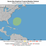
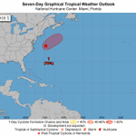
Hurricane season may not be over yet, as both the GFS and the Euro are indicating a potential HURRICANE to develop off the east coast this weekend. The NHC has now given a 0/20 chance for development... gonna watch this area real closely 👀.


Danilo Evangelista retweeted

This El Niño is coming with much more ocean heat than the biggest events that came before it.
There's a much broader area of extreme warmth near South America as well as warmer waters near California and in the Gulf — factors that could add to extreme winter weather.

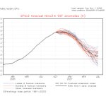
The MDR is currently the warmest on record to date, and has skyrocketed in SSTAs in recent weeks thanks to the -NAO we've had. This will obviously not mean anything for the remainder of the 2026 hurricane season, but 2027 on the other hand could be very interesting.


La Niña chances for next year beginning to go up 👀.

El Niño continues to strengthen, with a strong-to-very strong El Niño likely through January-March 2027 (remaining greater than a 79% chance). An #ElNino Advisory remains in effect. #ENSO cpc.ncep.noaa.gov/products/a…

ALT A bar chart showing the chance of El Niño (red bars), ENSO-Neutral (grey bars), and La Niña (blue bars) provided for 9 upcoming, overlapping 3-month seasons (each letter represents a month, for example, F = February). The color shading within the bars indicates the chances of different categories of El Niño or La Niña strength (weak, moderate, strong, and very strong). Alternatively, the table at the internet address below presents the percent chances of each strength category in numerical form. https://cpc.ncep.noaa.gov/products/analysis_monitoring/enso/roni/strengths/
Danilo Evangelista retweeted
El Niño's warm water is still moving east across the Pacific, and more strengthening is expected.
Subsurface ocean waters just reached their most anomalous point in this event so far: 12.2°C above average in the Niño 3 region — with water temperatures around 30.8°C (87.4°F).
Yikes. Really hope this doesn't impact peoples ability to be able to get to the polls today. Sometimes flood events like these go under the radar.

Absolutely devastating floods today in Brevard County, FL.
Expected a simple rainy Monday, not to be woken up at 4am with an emergency flash flood emergency warning and 20+ inches of rain over 12 hours.
We were lucky with no damage, but my buddy nearby was not...
1
7
446
Danilo Evangelista retweeted

No hurricane. No tropical storm. Just a random Monday. Looking at many videos and images I’d estimate upwards of $100M in damages. Incredible, near un-forecastable event.

We are nearing the end of hurricane season, but it is not over quite yet. The NHC has highlighted a new area for development NE of the Bahamas today, with a 0/20 chance. Decent amount of model support on both AI ensembles, so we'll see what comes out of it. Next name up is #Kyle.

It is the start of November, which means new monthly climate model releases. Models currently have the El Niño likely peaking in intensity by next month or January, then quickly dropping afterwards as we go further into 2027.


This El Niño is not dying down just yet... the Nino 3.4 is holding steady at near record territory, with incredible amounts of subsurface warmth still lurking below the surface. Another mother of all WWBs will be arriving in the first week of November to add onto this El Niño...


Danilo Evangelista retweeted

Incredible loop of Hurricane #Melissa's Jamaica landfall 1 year ago today. Tied as the strongest storm ever recorded in the Atlantic by winds.
Danilo Evangelista retweeted

What really stands out to me here is how shear never got at all favorable, even at peak. 1997 and 2015 both dipped down to near average briefly in September, but this year basically had June-level shear or more for the entire season. Just a complete wipeout over the MDR.

Several factors made this Atlantic hurricane season one of the least active on record but one in particular stands out. Wind shear wasn't just high, it was record-shattering high. Today's newsletter is packed with all the details ⬇️
michaelrlowry.substack.com/p…


After being quiet for the most of the year, the Indian ocean has erupted to life, and we now likely have a major hurricane strength cyclone bearing down on the east coast of India with #Arnab. Hopefully everyone is taking the necessary precautions needed.
38
1,908
Today's Tropical Weather Outlook video uploaded to Youtube - make sure to check it out!
youtu.be/ccqHSsv1s-M
2
278
Danilo Evangelista retweeted

NHC will initiate advisories on Subtropical Storm Josephine (formerly AL93), located offshore of the U.S. East Coast, at 500 PM EDT (2100 UTC).
Updated NHC TWO increased Invest #93L's chances to 70/70. Earlier today, ASCAT found that the low pressure of #93L might be barely dethatched from front. If so, I think #Josephine is very likely going to come soon.

