

Severe weather research group founded by Jared A. Stevenson, Blaize Edwards, and Evan Coverdill.
Joined October 2021
- Tweets31
- Following18
- Followers26
- Likes17




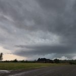
Tornado forming at 7:05 PM EDT yesterday crossing into West Central Auglaize County, OH, in between SR 29 and US 33. @SevereStudios @spann – at St Marys, OH
Not for Re-Use or Re-Broadcast. For licensing information, please reach out to [email protected] – at Columbus, OH
CONVEX is officially partnering with @SevereStudios for the 2024 season and beyond! SevereStudios Inc. is the leader in live severe weather streaming. We are so excited for this partnership, and we are proud to be providing a dedicated probe & research team for them!

CONVEX retweeted

Hats off to @NWSSPC and the local NWS offices for an incredible forecast and prompt warnings during yesterday's tornado outbreak!


CONVEX retweeted

Surprised at how many people are calling the left turn of the Lockett tornado “unexpected.” It’s common knowledge in supercell dynamics that decaying tornadoes and mesocyclones generally turn left and move rearward into the storm.

Sitting north of Cleo Springs, OK. Looking like it could be a very dangerous day for Oklahoma and Kansas. Stay safe everyone.


CONVEX retweeted

We are confirming damage ratings for 4 tornadoes from yesterday, April 12, 2022.
🌪️EF-2 near Palmer/Gilmore City
🌪️EF-1 near Rutland
🌪️EF-2 east of Bradgate
🌪️EF-0 in Kanawha
Paths/info is preliminary and subject to change.
More details in🧵and nwschat.weather.gov/p.php?pi….
#iawx


youtu.be/IS57AHzSrMU Probe video from the tornado near Gilmore City, IA today. @spann @ReedTimmerAccu @theScantman @NWSDesMoines



CONVEX retweeted

We are monitoring the fluid situation following last night's violent tornado outbreak, and today's severe weather potential. Our sawyer and equipment team is preparing for deployment.
There are many areas that have been devastated.
📸 - @ChrisJacksonSC
