
Marine Geologist; geohazards, paleoclimate and seascape evolution; tweets (my own) about science, soccer and occasional other miscellany; she/her
Joined July 2011
- Tweets236
- Following128
- Followers171
- Likes281


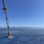
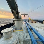
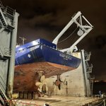


Ever wonder what happens to all those sediment cores we’ve been collecting offshore and in lakes? Here’s a great overview of our USGS PCMSC core lab in Santa Cruz. Full video in the link shows some of our amazing imaging capabilities. #mud #science

By collecting information about the past found within core samples, #geologists contribute towards a better understanding of how conditions may change in the future. Ready for a virtual tour of the @USGS Sediment Core Lab? We thought you'd never ask! ow.ly/bja250QCQM1
A nice piece about some of the behind the scenes work our group does - data access for all!
To foster scientific exploration and understanding of the seafloor and offshore geohazards, the @USGS and @BOEM have collaborated to expand data access on the National Archive of Marine Seismic Surveys (NAMSS) portal: ow.ly/iS3450QuP2i
This is a super cool new paper that highlights innovative, interdisciplinary methods for addressing earthquake hazards. Nice job @swampmonstah and team!
science.org/doi/10.1126/scia…

Alright, anyone have an invite code to share? I’ve missed the #science convos that used to happen here and we’ve got a lot going on with Cascadia and Alaska to share (mostly #earthquakes, #landslides, #tsunamis, + #paleoclimate) #Bluesky
Happy #FieldworkFriday!

#Fieldwork: @USGS & @uafairbanks researchers are collecting sediment cores from shallow parts of the Bering Sea to reconstruct past #BeringLandBridge vegetation & sea ice and primary productivity as the ice age receded ~8,000-13,000 years ago. #ClimateR_D @NSF

ALT Two women are standing on the deck of a research vessel, wearing hard hats and water-safety gear smile for their picture while holding a sediment core. Credit: JR Ancheta, UAF
Lots of new seafloor mapping happening along the #Alaska #Aleutian margin this summer! Our USGS Marine Geohazards project is supporting the mapping offshore Kodiak for #earthquake, #landslide and #tsunami #hazards. @JTWcoastal @DBrothersSC @MarineGeohazard
Starting in May 2023 in the Gulf of Alaska, @USGS, @NOAAcharts, and partners are conducting a regional seafloor mapping campaign called Seascape Alaska: ow.ly/ZjQj50Os7Uf
📷: NOAA

I’m giving a talk @theNASEM today highlighting our work on submarine #landslides & #earthquakes in Cascadia —
Bathymetry and Topography at the Land-Ocean Interface: Committee on Solid Earth Geophysics Spring 2023 Meeting nationalacademies.org/event/…
Check out our exciting new tool for deep water oceanographic instrumentation. It will be deployed in Astoria Canyon, offshore Washington next month as per our joint project with @UW to investigate #oceanographic vs #earthquake triggered turbidity currents.
The Free Ascent Tripod tested here will be deployed in deep-sea environments along the Cascadia Subduction Zone. It will provide @USGS an up-close look at the seabed, measuring processes such as sediment transport thousands of feet beneath the surface: ow.ly/IWOM50N2uHE
Dr. Jenna Hill retweeted

The Free Ascent Tripod tested here will be deployed in deep-sea environments along the Cascadia Subduction Zone. It will provide @USGS an up-close look at the seabed, measuring processes such as sediment transport thousands of feet beneath the surface: ow.ly/IWOM50N2uHE
These slides are active…it’s not one and done.

Timber. 🌲
Road impacts from this storm could last for a bit in some areas. Check local road conditions at sccroadclosure.org.
I’m a little late for #TurbiditeTuesday, but isn’t this lovely? A new #albumcover for @MarineGeohazard!

Wow what a game!!!! Both Messi & Mbappé 🔥 Felicitaciones Argentina!! 🇦🇷#WorldCupMagic
#Earthquake! This is what it looks like in Santa Cruz when a bunch of geologists/geophysicists get feel a little shake and get all fired up lol. @JTWcoastal @DBrothersSC

We had some ship troubles, so we had to cut it short & leave some mud in the ocean for next time, but we still got a pretty good haul with 3 full crates like this! Hopefully we’ll be back soon to scoop up the rest 😉 Also, check out our USGS video in the 🧵👇🏻

Our awesome @USGSCoastChange #SciComm worked with our technical and research staff to put together a nice video explainer about our recent #Cascadia cruise w/@JTWcoastal & @NorskiGeo usgs.gov/centers/pcmsc/news/…
186m of core so far and still mud left in the ocean, so we’re not done yet! @JTWcoastal @NorskiGeo We’re offshore #Cascadia testing hypotheses - in our latest paper, we propose most of the earthquake turbidite record here comes from lower slope failures…

And perhaps this means that the most intense shaking is closest to the deformation front. With all these we should be able to create a more robust earthquake record with less uncertainty…