

hike · map · photograph
The Bluegrass
Joined January 2009
- Tweets582
- Following203
- Followers138
- Likes138

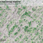



Estimated tree removal and decrease in height, 2010-2019. Lexington, Kentucky. #KyFromAbove #lidar
uky-gis.github.io/lexington-…

1
60
Estimating Lexington's tree canopy height by combining NAIP NDVI with DSM height rasters. There are some challenges. #KyFromAbove #lidar #kyraster #ukgeog
uky-gis.github.io/lexington-…

2
62
Boyd retweeted

We’ve just been approved to hire a Visiting Assistant Professor in Applied Environmental and Sustainability Studies. Review of applications will begin on June 28. ukjobs.uky.edu/postings/4714…


Helping a student visualize average temperature change by month, decade, and county from 1900. More than a few challenges. Video shows 15 seconds of a browser iterating over a 16MB JSON. flic.kr/p/2owZNsy
1
71

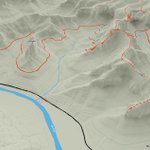
If water levels rose 25 feet above Troublesome Creek, these areas would be inundated. uky-gis.github.io/geo509/sli…

1
1
Kentucky Association of Mapping Professionals presentation, September 28, 2022 uky-gis.github.io/pro-relief…
1
Boyd retweeted

Interested in doing a MA or PhD degree in the Dept of Geography at the University of Kentucky? See below. Or message me with questions. Applications due January 15, 2023
@ukgeog @universityofky @theAAG

Fully Funded Graduate Study @ukgeog for PhD and MA students.
Come join our exciting program and world-class faculty geography.as.uky.edu/
Apps due Jan 15, 2023.
Contact @mattzook with questions.

Minimal old-school GPS in your mobile browser tuned to #outrageGIS maps using @turfjs.
Draft: outrageGIS.com/gps

2

Animation of above-ground digital surface model youtu.be/PYkf_omlMHo via @YouTube #KyFromAbove #lidar


Lidar point cloud > Digital Surface Model > Raster tileset. #kyfromabove @qgis @ArcGISPro @LeafletJS 🇺🇦 uky-gis.github.io/geo409/map…

1
Boyd retweeted
Some of the first park rangers in America weren’t rangers at all. They were Buffalo Soldiers - African Americans who served in the U.S. Army after the Civil War. These dedicated men protected wildlife from poachers, built trails, and forged a proud legacy in our nation’s history.

Boyd retweeted
Congrats, @patriciaehrkamp!
This Post is from an account that no longer exists. Learn more


