

Bringing the traditions of cartography to the web.
Tex./Mass./NY/UK
Joined April 2009
- Tweets411
- Following330
- Followers3.4K
- Likes12







Axis Maps retweeted

Waiting for the #BiennaleArchitettura2021 | #BiennaleSneakPeek
How will we live together?
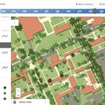
@Rice_HRC, @axismaps, @imoreirasalles have embarked on a project to integrate historical photography and cartography of #RioDeJaneiro into imaginerio.org → bit.ly/elDahdah-Metcalf-Heym…

Excited to see our just-finished work appear on the @HISTORY home page today! An interactive, scrolling map of Ulysses S. Grant's key Civil War battles: history.com/shows/grant/inte…

Now that you're back from Labor Day (in the US, at least), consider devoting some labor toward building great web maps with us. Seeking applications for our web map developer job by tomorrow! axismaps.com/jobs/
Don't be shy about getting in touch if you haven't mastered the listed technical skills yet but are on a path to learn them. We welcome a range of experience levels for consideration! axismaps.com/jobs/
👋 Apply for our web map developer job by next Wednesday!
Whether full time or part time, seasoned expert or early in your career: if you love making maps and want to keep improving your skills, we'd like to hear from you!
axismaps.com/jobs/
Problem: we've got data and ideas waiting to be turned into dazzling web maps.
Solution: you!
Apply by September 4 to come work with us as a web map developer! axismaps.com/jobs/
Monday commute got you down? If you were our developer, you'd ✨never have to get out of bed✨ as long as your laptop's within reach. Apply by September 4! axismaps.com/jobs/
Happy weekend! It’s a nice time to relax with some ☕️ or 🍵 and think about applying for our web map developer job, wouldn’t you say? axismaps.com/jobs/
🗺️Come help us build great web maps!🗺️
We are now hiring for a web map developer position. Please apply and share!
axismaps.com/jobs/
Another approach to dense proportional symbols, this time with multiple symbols per location (metropolitan areas), from insights.transitcenter.org/. A force layout displaces circles to prevent overlaps—both within and between metro areas—but on zoom they stick with their group.
An interactive map can have more than one "right" projection. Age of Exploration follows voyages around a globe (orthographic)—especially useful near poles—but also transitions to Robinson, more appropriate for worldwide overviews. More on this project: axismaps.com/projects/explor…
Hot off the presses! We worked with @TransitCenter to develop Transit Insights, where you can explore ridership trends (and more) across transit agencies and metro areas in the US. insights.transitcenter.org/

When processing global OpenStreetMap data, a little laptop won’t do. Here’s a walkthrough of getting 50 cloud computers to do it. axismaps.com/blog/2019/03/bi…