




𝑩𝒆𝒄𝒌𝒚 𝑩𝒆𝒂𝒍𝒍 🌴 retweeted

Just boarded my flight in Nashville and the whole @SouthwestAir plane is lit up pink, with @DollyParton playing loud on the speakers as we board. 🦋💝 #Dolly – at Nashville, TN


𝑩𝒆𝒄𝒌𝒚 𝑩𝒆𝒂𝒍𝒍 🌴 retweeted

There's nothing quite like a Sunday Sea Day Brunch with Regent Cruises. Have you had the pleasure of joining us?
📸 Ubaldo Armellino, Master | #WeAreRegent #MyRegentExperience


𝑩𝒆𝒄𝒌𝒚 𝑩𝒆𝒂𝒍𝒍 🌴 retweeted
From gingerbread to shortbread, our bakers are creating a festive array of cookies you can enjoy only this season. Treat yourself while they last. #ExperienceTheUnrivaled #EpicureanPerfection #Holidays

Cruise Critic is turning 30 and giving away 30 cruises in 30 days. I’m in — are you? NoPurchNec. 50 US/DC, 21+. Ends 10/30/25. Sub2Rules campaign.rtm.com/realtimesoc…
45
Leaving the Rocket City 🚀 this morning and the wind is gusty, it’s 78° and partly cloudy. Perfect for flying flags. Happy Sunday all! @spann #iHeartHsv

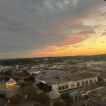
Enjoying an anniversary getaway at Element by Westin in @Go2HuntsvilleAL! Our 10th floor view is overlooking Bridge Street Town Centre. The sky is gorgeous this evening! Peep the carousel towards the bottom of the left side. #sunset #glow #unfiltered @spann #iHeartHsv

1
3
193


The aftermath of a stormy afternoon! So beautiful. #GodsPromises #LoveNSB #LoveFloridaBeaches @spann

1
152

Traveling south through Florida and it looks like we are about to get wet! ☔️ #UnFiltered @spann

🌈 Driving south on I-65 towards Montgomery and ahead is this lovely view. (And before everyone comes for me, I am the passenger not the driver.) @spann #rainbows #GodsGotUs

Thank you, Brian! Cait was able to help me upgrade the line. She was professional and knew her stuff. After how many people I talked to that had no clue how to do their job, I say…give Cait a big, fat raise! Thanks again!

Hello Becky, we really appreciate you for being a long time customer. Upgrading your phone shouldn't be difficult, we're disappointed to hear it took several transfers just for the call to drop at the end. We'd love the opportunity to turn this around, please send us a PM, so we can help resolve this. ~Brian
43
If only this really meant something. An hour on the phone transferring from person to person times four, just to upgrade a phone and ending in being disconnected. Why is it so hard to honor your word? @Verizon @VerizonSupport

1
86
𝑩𝒆𝒄𝒌𝒚 𝑩𝒆𝒂𝒍𝒍 🌴 retweeted
SIGNIFICANT SEVERE WEATHER THREAT: A high end severe weather risk is setting up for Alabama in the broad window from 10pm Friday through 3am Sunday. All of Alabama is in an "enhanced risk" as defined by SPC, NOAA's Storm Prediction Center. There will be two primary rounds of thunderstorms.
ROUND ONE: 10pm FRIDAY - 8am SATURDAY: The first batch of storms associated with this very dynamic storm system will move into Northwest Alabama Friday night. These storms will continue into Saturday morning over the northern half of the state; hail and damaging winds are possible along with an isolated tornado or two.
ROUND TWO: 12 NOON SATURDAY - 3am SUNDAY: This will likely be the “main show”. Storms will be capable of producing large hail, damaging winds, and tornadoes. Based on forecast parameters, a few strong/long track tornadoes will be possible (EF-2 or higher). These storms should be out of the state by daybreak Sunday.
Key messages this evening...
*It is helpful to look and see what an atmospheric setup like this has produced in the past. Some of the analogs that continue to show up include April 8, 1998, December 16, 2000, and November 24, 2001. These days all featured numerous severe thunderstorms including some very significant tornadoes.
*April 27, 2011 is NOT an analog for this event. That is generational... days like that tend to happen every 40 years or so.
*For those that have weather anxiety, just remember that even during high end severe weather events, odds of any spot being hit by a tornado are relatively low. But stronger wording is appropriate for this type of threat. We sure don't want to generate fear, but we have to use bold language so people understand the danger.
*Our goal for any severe weather event in Alabama is no loss of life, and no serious injuries. It takes us all working together to make that happen. The key part of preparedness is being sure you have a reliable way of hearing warnings. Never, ever an outdoor siren. Never. A NOAA Weather Radio should be in every Alabama home and business. On your phone, have WEA enabled (Wireless Emergency Alerts), and have the 33/40 weather app installed.
*In your safe place, have helmets for everyone, including adults. Most serious injuries in tornadoes involve blunt force trauma above the shoulders.
*If you live in a mobile home, know the location of the nearest shelter, or business open 24/7 that can serve as a shelter. Have transportation arranged so you can get there quickly.
*If you are reading this, you pay attention to weather. Understand many people don’t keep up with the weather, so you can be a hero during the severe weather event. If you have a friend or loved one in a tornado warning polygon, be sure and call or text them to let them know of the immediate danger. Let them know now that severe storms are likely late Friday night through early Sunday morning.
*Soon we will be within the 60 hour window (tomorrow morning), when high resolution, convection allowing model data will be available. This is when we can be more specific about timing and the event in general.

