

UARK Alumni 🐗 | Christ follower | Owner of @225Weather | Asperger’s is my super power! | Isaiah 6:8 | https://xitter.cf/t.co/KICNuIVGWy | Covering parts of AR, MO, OK 24/7
Dallas, TX ⏩ Fayetteville, AR
Joined April 2021
- Tweets7.3K
- Following433
- Followers412
- Likes10.8K
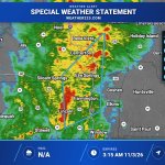



Special Weather Statement has been issued for Benton and Washington Counties and is valid from 2:48 AM to 3:15 AM. Radar-indicated strong thunderstorms may bring wind gusts up to 40 mph, with gusty winds possibly knocking down small limbs and blowing unsecured objects.

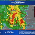
Tornado Warning has been issued for southwestern Washington County in northwestern Arkansas and southeastern Adair County in northeastern Oklahoma, valid from 2:23 AM through 3:15 AM CST. Radar indicated rotation near Stilwell moving NE at 25 mph; take cover now.

A Tornado Warning remains in effect for Crawford and Washington counties in Arkansas until 3:00 AM. A confirmed tornado is near Natural Dam moving NE at 45 mph; take cover now as damaging debris and possible mobile home and roof damage threaten.

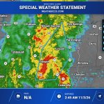
A Special Weather Statement has been issued for Benton, Washington, Northern Crawford, Adair, Northern Sequoyah. Expires Tuesday, 11/3/26 at 2:45 AM | Hail: 0.0 inches | Wind: 40 MPH

A Tornado Warning has been issued for Crawford, AR, Washington, AR. | Max Hail: 0.0 inches | Expires Tuesday, 11/3/26 at 3 AM. Take shelter immediately!

Special Weather Statement is in effect from 1:35 AM through 2:15 AM for Delaware, Cherokee, Adair, Muskogee, Haskell, Northern Sequoyah, and Central and Southern Sequoyah. Radar-indicated strong thunderstorms may bring wind gusts up to 40 mph.

A Severe Thunderstorm Warning has been issued for Sebastian, AR, Le Flore, OK, Sequoyah, OK. | Max Hail: 0.75 inches, Wind: 60 MPH | Expires Tuesday, 11/3/26 at 2 AM.

Tornado Warning remains in effect for Craig, Mayes and Ottawa counties in Oklahoma through 2:00 AM. A radar-confirmed tornado is on the ground near Big Cabin moving northeast at 35 mph; take cover now as flying debris is dangerous and mobile homes may be destroyed.

Tornado Warning has been issued for Craig, Mayes, and Ottawa counties in northeastern Oklahoma, valid from 1:11 AM through 2:00 AM CST. Radar indicated rotation near Adair, moving NE at 35 mph; take cover now as flying debris and mobile-home damage are possible.

A Severe Thunderstorm Warning has been issued for Craig, OK, Mayes, OK. | Max Hail: 0.75 inches, Wind: 60 MPH | Expires Tuesday, 11/3/26 at 1:45 AM.

Strong storms are moving across eastern Oklahoma and will slide into far western Arkansas toward Fort Smith over the next couple hours, with severe wind and perhaps a brief tornado. Farther south, storms near Texarkana may bring occasional severe gusts early.

Severe Thunderstorm Warning has been issued for Haskell, Latimer, Le Flore, Pittsburg, and Pushmataha in southeastern Oklahoma, valid 12:10 AM through 1:00 AM. Radar-indicated storms may bring 60 mph wind gusts and damage; move to an interior room on the lowest floor.

Severe Thunderstorm Warning for Northern Nowata County in northeastern Oklahoma is in effect from 11:43 PM CST through 12:15 AM CST. Radar-indicated storm near Lenapah moving NE at 40 mph may bring 60 mph wind gusts and 0.75-inch hail; seek shelter if a tornado forms.

Severe Thunderstorm Warning has been issued for Craig, OK, Nowata, OK, and Rogers, OK, valid from 11:23 PM through 12:15 AM. Radar-indicated storm near Talala may bring 60 mph wind gusts and damage to roofs, siding, and trees; remain alert for a possible tornado.

Special Weather Statement has been issued for Tulsa, Creek, Okfuskee, and Okmulgee and is valid from 10:57 PM through 11:30 PM. Radar-indicated strong thunderstorms may bring wind gusts up to 50 mph, with possible impacts to small tree limbs and unsecured objects.

Severe Thunderstorm Warning has been issued for Creek, Okfuskee, and Okmulgee counties in northeastern/east central Oklahoma and is in effect until 11:00 PM. Radar-indicated storms may bring 60 mph wind gusts and penny-size hail; move to an interior room on the lowest floor.

Special Weather Statement is in effect for Washington, Western Osage, Northeast Osage, and Southeast Osage through 10:30 PM 11/2/26 as radar-indicated strong thunderstorms move northeast; wind gusts up to 40 mph may knock down small limbs and blow around unsecured objects.

Special Weather Statement has been issued for Tulsa, Creek, and Okfuskee and is valid from 9:32 PM to 10:15 PM. Radar-indicated strong thunderstorms may bring wind gusts up to 50 mph, including along I-44 between mile markers 178 and 208.

Linear storms drift slowly east across Oklahoma into far North Texas, with the strongest near the Red River. Warm, humid air keeps QLCS tornadoes possible into the overnight. Peak tornado intensity 85-110 MPH; straight-line gusts up to 60 MPH.

