
FCast (@WXFCast) header
FCast (@WXFCast) profile picture

Providing thorough daily and severe weather forecasts for the United Kingdom, covering all seasons.

United Kingdom
Joined July 2020
Photo by FCast (@WXFCast)Photo by FCast (@WXFCast)Photo by FCast (@WXFCast)Photo by FCast (@WXFCast)Photo by FCast (@WXFCast)Photo by FCast (@WXFCast)Photo by FCast (@WXFCast)Photo by FCast (@WXFCast)Photo by FCast (@WXFCast)Photo by FCast (@WXFCast)
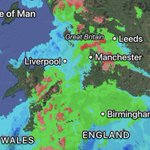
Very sleety mix it turned out to be, with snow restricted to higher elevations of around 180m^. Rain elsewhere… This should all clear by tomorrow morning.
5
468
Yikes, I don’t even think a snowfall graphic is necessary with overnight model output… 🫣
6
821
Snow risk now does look to be more towards wales / northern England. ICON being the furthest south with precipitation brining the snow risk all the way down to Dorset, although barely any support for such a southerly track. Let’s see what models suggest this evening.
3
1
16
2,391
This weekend will bring a welcome change to temperatures with 13-14c possible, however it does look cloudy. Make the most of this as it looks to become wet again the following week.
1
10
412
What looked like a possible snow event for southern England yesterday now looks like just rain. Totals off 20-30 mm expected for coastal areas, 10-20 mm elsewhere.
1
8
412
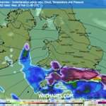
I wouldn’t discount a more northerly track to this low, bringing snowfall to Midlands and Wales and a lot of rain to the south. A slight shift north in model output today bringing the lows centre across the south coast of England.
1
1
12
947
Snow risks aside - Temperatures could reach the mid teens this weekend in the south / southeast. A lovely early taste of spring!
1
3
45
3,820
Looking at the higher res models, most are showing rain for southern counties with snow restricted to higher ground. Would bank on these for a more realistic forecast come Wednesday/Thursday.
2
1
9
1,337
Most models now indicating that this will affect the UK in some way, although cross model agreement on where snow will fall is still poor. GFS, UKMO, UKV, ICON showing more of an intense system allowing snow to fall more readily, while others show it more north or mostly rain.
Small chance at the moment of a low far enough north to bring snow to southern England next Wednesday/Thursday. Model agreement is poor with a 50/50 split of it going into France or not. From past experiences, it’s usually a France event.
3
11
3,574
Precipitation now clearing east with milder air moving across the UK. A few convective showers expected further west throughout the day.
8
413
Support for temperatures to rise by next weekend, with models suggesting low teens. Would bring a nice change if we’d be able to get some sunshine…
2
23
3,209
Small chance at the moment of a low far enough north to bring snow to southern England next Wednesday/Thursday. Model agreement is poor with a 50/50 split of it going into France or not. From past experiences, it’s usually a France event.
3
1
13
5,322
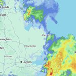
As rain clears east later today, it’s expected to turn into snow over East Anglia. Although ground is wet precipitation will be intense with the risk of a 1-3 cm in places.
9
1,069
Snow Advisory 15th February 2026 A band of precipitation off the Atlantic will collide with colder air over the UK throughout early hours of Sunday morning, although settling snowfall will be mainly restricted to higher ground 200m^. (1/2)
2
4
18
4,844
Risk of accumulations of 5-10cm over highest ground across northern England and Scotland. Small chance of settling snowfall to lower levels across areas precipitation is more intense. (2/2)
243
Models now generally showing more milder outcomes than colder. High pressure incursions over the UK will allow for hopefully a drier and sunnier outlook towards the end of February. Although Atlantic doesn’t look far away. 🤞it stays this way ☀️
3
2
17
1,473
Models still showing a ridge of high pressure developing over the Atlantic from the 20th. This would allow a break from the Atlantic. We’ll have to keep watching to see what influence it’ll have on the UK later this month.
The Atlantic looks to continue influencing our weather after this brief colder spell with low pressure systems bringing more rain and wind for the foreseeable. There is a chance higher pressure may build from the 20th onwards. Just flagging a possibility. Would be nice.
2
12
1,968
This mornings 03z vs yesterday’s 15z UKV. Less development in general and less of a widespread risk. Models still trying to figure out how fast and how developed this will be so expect more changes.
2
10
1,241
Models now generally showing more of a weaker front for Sunday, reducing the snow risk further south. Further north precipitation looks more developed and therefore producing snowfall espically across higher ground. Wouldn’t rule out a few cm’s to lower levels too.
1
13
1,609
Looking at a small chance of a more defined risk of snowfall on the 15th as milder air pushes back in. Low pressure passing to the north caused by a jet stream positioned over the UK, this will then clash with colder air to the east. Although some models do have mostly rain.
1
11
1,657