

VOLTA - Innovation in geospatial and 3D data. H2020 Marie Skłodowska-Curie RISE project, Grant Agreement No 734687
Joined June 2017
- Tweets347
- Following78
- Followers143
- Likes245

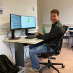
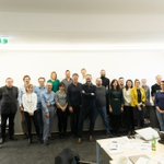


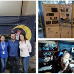


a nice video of our last meeting at @vexcel_imaging!
youtube.com/watch?v=oSQjBXgQ…
@tudelft3d @3DOMFBK @ICGCat @geodepartment @AVT_Geomatics @OrdnanceSurvey @Geoimaging @UniHannover @IGNFrance @FBK_research
#CNC @MSCActions #mapping #photogrammetry #LiDAR #geospatial #AI #segmentation

Vexcel Imaging participated in VOLTA – Innovation in geospatial and 3D data, an EU MSCA Research and Innovation Staff Exchange project.
Watch the video to learn what participants had to say about the project: bit.ly/3F78iQ5
@VOLTA_MSCA
#vexcelimaging #mapping
enjoy 5 years of project in 2 min!
youtu.be/DdMS-__zumw
@3DOMFBK @ICGCat @geodepartment @AVT_Geomatics @OrdnanceSurvey @Geoimaging @UniHannover @IGNFrance @vexcel_imaging @tudelft3d @UniWarszawski #CNC #GZC @MSCActions
#mapping #photogrammetry #LiDAR #semantics #classification
joint publications sparked from our project secondments (6/6):
Robustifying relative orientations with respect to Repetitive Structures and Very Short Baselines for Global #SfM
ieeexplore.ieee.org/abstract…
@UniHannover @vexcel_imaging @MSCActions #3D
joint publications sparked from our project secondments (5/6):
Comparison of #RF, #SVM and Neural Networks for Post-Disaster #Forest Species #Mapping of the Krkonoše/Karkonosze Transboundary Biosphere Reserve
mdpi.com/2072-4292/13/13/258…
@MSCActions @UniWarszawski @ICGCat #sentinel2

joint publications sparked from our project secondments (4/6):
Sentinel-2 and AISA #Airborne #Hyperspectral Images for Mediterranean Shrubland Mapping in Catalonia
mdpi.com/2072-4292/14/21/553…
#ecosystem #shrub #scrub #sentinel2 #classification #AI @MSCActions @UniWarszawski @ICGCat
joint publications sparked from our project secondments (3/6):
Comparison of Support Vector Machines and Random Forests for Corine Land Cover Mapping
mdpi.com/2072-4292/13/4/777
@MSCActions @UniWarszawski @ICGCat
#landcover #mapping #Corine #RandomForest #SupportVectorMachine #AI

joint publications sparked from our project secondments (2/6):
- Urban #Classification from #Aerial and #Satellite Images
sciendo.com/article/10.2478/…
- #LiDAR Initiatives at the National Center of Cartography Romania
lidarmag.com/2020/11/01/lida…
@MSCActions @AVT_Geomatics @geodepartment

two other succesfull project secondments coming to an end: Erik Bollmann (@AVT_Geomatics) and Vasilis Petrou (@Geoimaging) visiting @3DOMFBK in #Trento
#mapping #photogrammetry #LiDAR #classification
@MSCActions @FBK_research


joint publications sparked from our secondments (1/6):
- LOD2 Building Generation Experiences & Comparisons sciendo.com/article/10.2478/…
- Aerial #Pointcloud #Classification Using an Alternative Approach for the Dynamic Computation of K-Nearest Neighbors
sciendo.com/article/10.2478/…
2 succesfull days of meeting, presentations and fruitful discussions with all partners hosted by @vexcel_imaging in #Graz
@tudelft3d @3DOMFBK @ICGCat @geodepartment @AVT_Geomatics @OrdnanceSurvey @Geoimaging @UniHannover @IGNFrance @UniWarszawski #CNC
@MSCActions


thank you @vexcel_imaging !!
@3DOMFBK @tudelft3d @ICGCat @geodepartment @AVT_Geomatics @OrdnanceSurvey @Geoimaging @UniHannover @IGNFrance @UniWarszawski #CNC
It is a great honor for us to host the closing event of the EU project initiative VOLTA here in Graz today and tomorrow!
Vexcel Imaging was the selected camera manufacturer to participate in this project.
See some images of the event below:
#vexcelimaging #voltaproject


VOLTA retweeted

Open PhD position in our group on
META-LEARNING FOR EFFICIENT 3D REPRESENTATIONS
in collaboration with @uniud
Deadline: December 12, 2022
#pointcloud #classification #AI #PhD #3D #geospatial #deeplearning

VOLTA retweeted

1.🔄Does your organisation need to consolidate its #research and #innovation capacity through international staff exchanges?
Join our #MSCA Staff Exchanges Info session & discover the Action’s main features, impact & application process: europa.eu/!DkcTMb
🧵see thread👇

Finally physically back all together for the 1st day of the final project meeting & workshop!
thanks to @vexcel_imaging for the kind hospitality!
#mapping @tudelft3d @3DOMFBK @ICGCat @geodepartment @AVT_Geomatics @OrdnanceSurvey @Geoimaging @UniHannover @IGNFrance @UniWarszawski


VOLTA retweeted

[Coming soon] 2nd @EuroSDR workshop on geoprocessing and archiving of historial aerial images
🗓️5&6 December 2022
📍 Roma 🇮🇹
More informations ans registration 👉eurosdr.net/news/2nd-worksho…

VOLTA retweeted
from our series "old but gold":
“MAPPING VERTICAL CLIFFS” (2010)
#integration of terrestrial and aerial laser scanning
drive.google.com/file/d/17Hn…
#LiDAR #dolomites #3D #mapping #fusion

our partners from @AVT_Geomatics, @vexcel_imaging, @UniHannover and CNC Romania visiting @InsideIntergeo in #Essen
#3D #photogrammetry #LiDAR #mapping @MSCActions

VOLTA retweeted

Already almost two weeks at my #secondment at @Geoimaging in Cyprus! Got a very warm welcome here, now getting into the challenges of cypriotic flat roofs within #pointcloud classification and enjoying mediterranean food and wheater. Great to be part of the @VOLTA_MSCA project!

VOLTA retweeted
we introduced #logic rules within #NeuralNetworks in order to drastically improve unbalanced classes and achieve more accurate results. Code and article coming soon
@FBK_research @DI_FBK #deeplearning #pointcloud #semantic #segmentation #3D #classification #KENN
VOLTA retweeted
image #orientation with #DeepLearning tie points
int-arch-photogramm-remote-s…
int-arch-photogramm-remote-s…
int-arch-photogramm-remote-s…
link.springer.com/chapter/10…
#photogrammetry #3D #aerial #UAV #heritage


