

🗺️Mapping 1️⃣2️⃣~ x Native Languages of British Isles 🇬🇧(🏴🏴🏴NI〓〓)🇮🇪🇮🇲🇯🇪🇬🇬
🇬🇧🇮🇪🇮🇲🇯🇪🇬🇬
Joined April 2016
- Tweets3.4K
- Following5.8K
- Followers4.9K
- Likes9.9K



Pinned Tweet
🧵⬇️
🟦#Gàidhlig|#Gaelic Ability Map🗺
130k🗣📖✍️💭
•57% Outer #Hebrides;
72%#Scalpay
70%+#Eriskay/#SouthUist
66%#Barra
63%#Benbecula/#NorthUist
60%#Harris
51%#Stornoway
•29% Inner #Hebrides;
44%#Tiree
36%#Skye
25%#Islay
18%#Mull
•16% NW #Highlands
🔗scotlandscensus.gov.uk/atlas…


1️⃣8️⃣9️⃣1️⃣ #Scotland|#Alba 🏴
Language Map🗺⬇️
🔵#Gaelic/#Gàidhlig Speakers 🗣
📍#Highlands & #Hebrides
254k 🗣; 44k Mono/211k Bi
🔴#Scots & #English [4m🗣] [@scotslanguage]
🗣@SpeakGaelic
📺@bbcalba
📻@BBCRnG
🎓@SabhalMorOstaig
🔗behance.net/gallery/11091124…

British Isles Linguistic Maps retweeted

What language is the official language in the most countries?
Data for the most speakers: brilliantmaps.com/most-spoke…

British Isles Linguistic Maps retweeted

Alongside 'ginnel', 'snicket' is also used across Yorkshire to refer to alleyways, while 'cut' is a common term in the North East, 'jitty' can be found in the East Midlands, and 'entry' is used on Merseyside and parts of the West Midlands
yougov.com/en-gb/articles/55…

British Isles Linguistic Maps retweeted
What do you call an alleyway? Across Britain, there are more than a dozen dialect words for a narrow passageway, with 'ginnel', 'cut' and 'snicket' among the most common
Alley: 84%
Passage: 31%
Ginnel: 14%
Cut: 7%
Snicket: 6%
Entry: 6%
Close: 6%
Gully: 4%
Jitty: 4%
Wynd: 2%
Vennel: 2%
Twitten: 1%
Tenfoot/eightfoot: 1%
Pend: 1%

British Isles Linguistic Maps retweeted

Belfast to get first Ulster Scots street sign since rule change. bbc.in/3VFRN9I

British Isles Linguistic Maps retweeted

Lake Michigan’s largest island was once the centre of a self-declared Mormon kingdom.
Then the “king” was shot, his followers were driven off, and the island became mostly Irish, with Catholic services still being held in Irish Gaelic decades later.
This is Beaver Island.
1/n

British Isles Linguistic Maps retweeted
🧵⬇️
🟦#Gàidhlig|#Gaelic Ability Map🗺
130k🗣📖✍️💭
•57% Outer #Hebrides;
72%#Scalpay
70%+#Eriskay/#SouthUist
66%#Barra
63%#Benbecula/#NorthUist
60%#Harris
51%#Stornoway
•29% Inner #Hebrides;
44%#Tiree
36%#Skye
25%#Islay
18%#Mull
•16% NW #Highlands
🔗scotlandscensus.gov.uk/atlas…
1️⃣8️⃣9️⃣1️⃣ #Scotland|#Alba 🏴
Language Map🗺⬇️
🔵#Gaelic/#Gàidhlig Speakers 🗣
📍#Highlands & #Hebrides
254k 🗣; 44k Mono/211k Bi
🔴#Scots & #English [4m🗣] [@scotslanguage]
🗣@SpeakGaelic
📺@bbcalba
📻@BBCRnG
🎓@SabhalMorOstaig
🔗behance.net/gallery/11091124…
British Isles Linguistic Maps retweeted
ℹ️1/11🧵⬇️
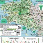
#Breizh|#Bretagne 𝍎𝌆🇫🇷
📍maps.app.goo.gl/uTuhf4yrZUXs…
🟩#Brezhoneg|#Breton Map 🗺
131k Speakers🗣|*237k Ability
6%|*13% W #Brittany
🔻1950, 1.1m|75%🗣
🔁#Celtic;#Cymraeg+#Kernewek
ℹ️@OPAB_OPLB+fr.brezhoneg.bzh/
🌐en.wikipedia.org/wiki/Breton…
🎥youtu.be/cUtxMV7O00A?si=tUN3… – at Carhaix-Plouguer, France


British Isles Linguistic Maps retweeted

How does ability to speak Welsh look when measured by geographic county?
Our latest graphic uses Census 2021 data, aggregated to the 13 geographic counties - with Merionethshire / Meirionnydd the highest at 56.9%.
More Census data by geographic county at RealCounties.com.

ALT Census 2021 - number of people who can speak Welsh by geographic county - from RealCounties.com
British Isles Linguistic Maps retweeted

🇬🇮 Gibraltar National Day
Map ⬇️ created by my brother H/T @UKLanguageMaps
The spirit of the image is to highlight the vital military value 🇬🇮 provides 🇬🇧 and the vast historical ties that bind us.
A wealth of information is included, covering military, census information, previous borders etc.
🇬🇮🤝🏻🇬🇧
*C.2025, so some information dated such as HMS Trent currently.
@dparody @key2med @Gibdan1 @86SirRoge @BritishOverseas


British Isles Linguistic Maps retweeted

#OTD 1 Sep 1737 (the historically accepted date), the first edition of the Belfast Newsletter is published- the oldest continuously published English language daily newspaper in the world. The oldest extant copy is from October 1738

British Isles Linguistic Maps retweeted
Use of Backend vs Autumn In The UK & Ireland
brilliantmaps.com/backend-vs…

British Isles Linguistic Maps retweeted
Names of European Languages In Their Own Language
credit: @JakubMarian
List with over 500 speakers: brilliantmaps.com/european-l…

British Isles Linguistic Maps retweeted

Gŵyl/Gouel Chwoant will be a celebration of Welsh and Breton, bringing young people together to learn and co-create – get involved 👇
facebook.com/events/48116186…
Shared cultural and linguistic heritage is at heart of the long-standing relationship between Wales and Brittany
British Isles Linguistic Maps retweeted

You can travel most of the world by learning just four languages: English, Russian, French and Spanish. Source: buff.ly/2NJHDg3

British Isles Linguistic Maps retweeted

“Every language offers a different window onto the world.” 🌍
Irish poet Ailbhe Ní Ghearbhuigh introduces us to 5 beautiful Irish phrases that offer more than just a glimpse into the Irish language. They invite us to see the world a little differently.
Sometimes, discovering a new way of expressing an idea can open up a new way of seeing it. From poetic turns of phrase to feelings that are difficult to capture in English, Irish offers its own unique window onto the world.
🎧 bbc.in/4bPghmm
British Isles Linguistic Maps retweeted

Europe's population changes from 1990 to 2020 will blow your mind! 😱 I used the latest GHSL population grid to map this amazing transformation. 🗺️ Can you see the trends? 🕵️
If you want to learn how I do it, watch my video and get inspired! 🔥👇
🔗youtu.be/vQ_M-wv73aY

British Isles Linguistic Maps retweeted
#Cymru|#Wales 🏴 #Cymraeg|#Welsh
2022 Language Maps 🗺 [@Cymraeg]
538k (18%) 🗣;
64% #Gwynedd
56% #Anglesey
45% #Ceredigion
40% #Carmarthenshire
17-27% #Pembrokeshire,#Conwy+#Denbighshire
*11-12% #Swansea+#Cardiff
1️⃣🗺🔗reddit.com/r/Wales/comments/…
2️⃣🗺🔗ons.gov.uk/census/maps/choro…


#Cymru|#Wales 🏴
#Cymraeg|#Welsh
2022 Map Iaith | Language Map 🗺
[@Cymraeg]
5️⃣3️⃣8️⃣,3️⃣0️⃣0️⃣(1️⃣8️⃣%) Speakers 🗣;
64% #Gwynedd
56% #Anglesey
45% #Ceredigion
40% #Carmarthenshire
17-27% #Pembrokeshire, #Conwy + #Denbighshire
(11-12% #Swansea + #Cardiff)
🔗ons.gov.uk/census/maps/choro…

#Cymru|#Wales 🏴 #Cymraeg|#Welsh
2022 Language Maps 🗺 [@Cymraeg]
538k (18%) 🗣;
64% #Gwynedd
56% #Anglesey
45% #Ceredigion
40% #Carmarthenshire
17-27% #Pembrokeshire,#Conwy+#Denbighshire
*11-12% #Swansea+#Cardiff
1️⃣🗺🔗reddit.com/r/Wales/comments/…
2️⃣🗺🔗ons.gov.uk/census/maps/choro…
#Cymru|#Wales 🏴
#Cymraeg|#Welsh
2022 Map Iaith | Language Map 🗺
[@Cymraeg]
5️⃣3️⃣8️⃣,3️⃣0️⃣0️⃣(1️⃣8️⃣%) Speakers 🗣;
64% #Gwynedd
56% #Anglesey
45% #Ceredigion
40% #Carmarthenshire
17-27% #Pembrokeshire, #Conwy + #Denbighshire
(11-12% #Swansea + #Cardiff)
🔗ons.gov.uk/census/maps/choro…
British Isles Linguistic Maps retweeted
For centuries, the counties of Britain and Ireland have shaped where people belong.
They have been home to generations, carried through maps, records, traditions, sport, language and memory. Some grew from kingdoms older still.
These places are not simply history. They remain the enduring geography of Britain and Ireland.
Rediscover yours at RealCounties.com.
Help us research, map and explain these enduring places for everyone: RealCounties.com/support

ALT A map showing the 118 historic, geographic counties of Britain and Ireland - from RealCounties.com