

Building a mapping data trust for People and Planet
Washington, DC & London, UK
Joined November 2019
- Tweets353
- Following666
- Followers2K
- Likes696



Mapping beyond the capital matters🌏
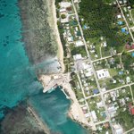
Aerial image shows the Pangai, Ha'apai ferry terminal—a vital link connecting Tonga's outer islands. Expanding accurate mapping across the archipelago supports planning and disaster resilience.
thisisplace.org
#PLACEdata #Tonga #Haapai

In 1643, Dutch navigator Abel Tasman made the first recorded European landing on Tongatapu, Tonga. Today, PLACE's aerial imagery preserves cultural sites through open mapping. Explore: thisisplace.org 🌊🗺️ #PLACEdata #Tonga #CulturalHeritage #AerialMapping #OpenData

A nadir aerial view of Veitongo Beach, Tongatapu, provides a vital baseline for tracking coastal erosion and supporting climate adaptation with open, high-accuracy mapping. 🌊📍
Learn more: thisisplace.org
#PLACEdata #Tonga #ClimateAdaptation #CoastalMonitoring #OpenData


The World Cup proves football thrives everywhere. We’re mapping community pitches in Cabo Verde, Turks and Caicos, Anguilla, Tuvalu, Saint Vincent, Tonga, and beyond with aerial & street-level imagery. ⚽ Small islands. Big football culture. #WorldCup #Football #PLACE #Geospatial

ALT Tuvalu

ALT Turks and Caicos

ALT SVG

ALT Anguilla
AI has a geography problem—and better data is the solution. Models trained on limited regions don't always generalize globally. Our CTO, Waddah Hago, explains why representative geospatial data is key to building AI that works everywhere. lnkd.in/gam6gg4Q
#AI #GeospatialAI

Vuna Wharf, Nukuʻalofa-Tonga’s main gateway for cruise ships and cargo, now mapped in stunning high-res detail. Data like this supports coastal monitoring and smarter infrastructure planning
Tongatapu, Tonga|@ThisIsPLACE
#Tonga #Nukualofa #DroneMapping #OpenData #PacificIslands

Happy to have worked with @IIPP_UCL to create the visualisation for the #DPImap
Learn more at the link below 👇

🧩There is an incomplete picture of the global state of DPI.
To fill this gap, IIPP has launched the DPI Map which allows users to explore the digital systems that are reshaping public service delivery around the world.
🔗Read more here: medium.com/iipp-blog/digital…

PLACE is proud to be working as part of the @DEarthPacific programme supported by @spc_cps . Read more about our recent work in #Tuvalu 👇

#Tuvalu is leading the way with high-resolution mapping to combat #climate change! SPC's Digital Earth Pacific programme @DEarthPacific and @ThisIsPLACE provided data and information that Tuvalu can use in its digital twin efforts!
Read more:
bit.ly/4empMZ2


PLACE retweeted

Curious what it looks like when national #mapping agencies partner with @ThisIsPLACE to capture #spatial data? Read about how the #Anguilla #survey department worked with PLACE and see how they are using the #imagery. thisisplace.org/anguilla_202…


PLACE retweeted
We are working @ThisIsPLACE to create a data trust of #mapping data in partnership with data started governments - a nuanced approach that is difficult to explain. @mapguy has done a great job capturing our model in the latest @maphappenings - give a read! maphappenings.com

PLACE retweeted

I am on more than a few boards but @ThisIsPLACE board is the one board meeting I look forward to eagerly as something exciting is always happening. As the author of this article said, Place is really making a difference in the world.
Learn more here:
maphappenings.com/
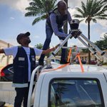
The @ThisisPLACE team uses the @Mosaic360camera to collect quality, high-resolution #PLACEGround street imagery. This work would not be possible w/o the partnership of @BNETD_CI.
Notre travail de collecte de données ne serait pas possible sans le partenariat avec @BNETD_CI.

🙌🏽🙌🏽Collaborating with partners is fundamental to PLACE's work -- proud of the progress made on this #GIS project with @SpatialCollect @OurRadiantEarth @SpaceAgencyKE
#PLACEDataTrust #PLACECommunity

From Aerial Imagery to Machine Learning. Learn how collaborative efforts by @SpatialCollect, @OurRadiantEarth, @SpaceAgencyKE, and @ThisIsPLACE are innovating high-res agricultural data accessibility.
spatialcollective.com/from-a…
#SustainableDevelopment @Geocartsurveys

The #PLACECommunity welcomes GeoSpace Engineering Consult Ltd -- bringing their significant experience in #landsurveying, GECL intend to use #PLACEData w/ their projects in-country, to support Digital Elevation Models for flood-prone areas of cities in #Ghana
#PLACEDataTrust

PLACE retweeted

Collaboration in action! @SpatialCollect & @SpaceAgencyKE, supported by @OurRadiantEarth & @ThisIsPLACE, joined forces to capture high-res aerial imagery in Kenol, Murang'a County. Here's a short video:
youtu.be/lxQVbanwE0I?si=IriQ…
@Geocartsurveys #aerialimagery
Join our co-founder Peter Rabley and @Mercycorps & @Floodbase panelists discussing “How can climate-smart data be used by #fintech startups to increase impact?” as part of @CFI_Action’s Financial Inclusion Week. ! Register to view this session. bit.ly/FinclusionWeek2023 #FIW23

We are living in an era with unprecedented levels of #dataavailability. This #FinclusionWeek on-demand session explores the role of #data in driving, shaping, and accelerating the intersection of #fintech and climate #resilience: bit.ly/3tnAbBn

How’s this for a car selfie? Que diriez-vous d'un selfie en voiture?
@ThisisPLACE + @BNETD_CI staff collecting #PLACEGround urban imagery in Abidjan w/ our @Mosaic360camera. The high-resolution imagery this camera captures is invaluable for mapping streets in African urban areas.
