

Exploring the world around me, inspiring others with what I find, and creating a lasting impact. Founder of TRACE, Inc. & TRACE Foundation.
Joined March 2010
- Tweets388
- Following972
- Followers758
- Likes2K





Pinned Tweet
Finding Truth. Creating impact.
Explore. Find. Document. Impact.
Real People. Real places. Real stories.
TRACE goes where the story is. We explore remote places, find what's been overlooked, document it honestly, and turn it into impact.
Follow for more.

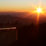
Sunset from the Kuwohi Observation Tower, the highest point in the Smokies at 6,643 feet. The walk up is a steep paved path, 1 mile round trip, and on a clear evening the tower gives you a 360-degree view across the ridges. Kuwohi Road is open again after an ice closure last weekend and runs through Nov. 29. Pack a warm layer, because the top can be 10 to 20 degrees colder than town.
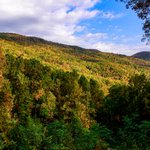
Photos: NPS (sunset from the tower; fall view from Kuwohi)


1. Fog rising over fall color from Heintooga Ridge Road. That "smoke" is what gives the Smokies their name; the Cherokee called these mountains Shaconage, "land of blue smoke." The road is open through Oct. 31, then closes for the season. Photo: NPS
2. Cades Cove in autumn. An 11-mile, one-way loop road circles the valley, open sunrise to sunset, past historic homesites, churches and a working gristmill. Allow two to four hours. Photo: NPS
3. Fall color from the parking lot at Newfound Gap, 5,046 feet up on the state line and the lowest drivable gap through the park. The Appalachian Trail leaves from the overlook. Photo: NPS
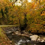
4. Cataloochee Creek in the fall, a popular fishing spot in Cataloochee Valley on the North Carolina side. Elk live here too; the fields are closed to visitors during the fall rut. Photo: NPS
Reply photo: fall color at Maloney Point. Photo: NPS / Kenzie Connor

Great Smoky Mountains National Park. October is the busiest month in the country's most visited national park, fall color is working its way down from the high country, and an early ice closure already shut the road to the top for a weekend.
Roads: Kuwohi Road (formerly Clingmans Dome Road) closed last weekend for forecast ice and is open again; it no longer appears on the park's alerts. Its season ends Nov. 29, and it can close sooner for snow or ice. Newfound Gap Road (US 441), Little River Road and Cades Cove Loop Road are open year-round, weather permitting. Heintooga Ridge Road closes after Oct. 31, Rich Mountain and Parson Branch roads after Nov. 9, and Roaring Fork Motor Nature Trail after Nov. 29. Straight Fork Road and the one-way Heintooga Round Bottom Road are still closed, Straight Fork because of Hurricane Helene damage. Cherokee Orchard Road is closed to pedestrians because of bear activity, so stay in your vehicle there. Carlos Campbell Overlook is closed while crews check cracked pavement.
Trails: Laurel Falls Trail stays closed for rehabilitation, and the park now expects it to reopen next year after crews hit unexpected ground conditions at the lower viewing platform. Bullhead Trail is closed Monday through Thursday through Nov. 19 for trail work. Helene damage still closes Caldwell Fork, Gunter Fork and Swallow Fork trails, and Big Creek Trail is open only for its first 2 miles, to Mouse Creek Falls. Twin Creeks Trail is closed for bear activity, and bears are active on Trillium Gap Trail.
Camping and fees: Cosby, Abrams Creek, Big Creek, Cataloochee, Deep Creek and Look Rock campgrounds close for the season after the night of Oct. 24. Balsam Mountain closed Oct. 12. Elkmont stays open through Nov. 28, and Cades Cove and Smokemont stay open all winter with fewer loops. Every campground needs an advance reservation on recreation.gov. There's no entrance fee, but any vehicle parked longer than 15 minutes needs a physical parking tag: $5 a day, $15 a week or $40 a year.
News: The park says several visitors were hurt recently after getting too close to elk during the fall rut, and one person got an arm puncture and a citation. It is illegal to come within 25 yards of elk, and the fields around Oconaluftee and Cataloochee are closed during the rut. Separately, the park and Friends of the Smokies finished a $465,000 reconstruction of the John Messer Barn in Greenbrier, funded by the Friends. The Friends are also funding and contracting repairs to Helene-damaged historic buildings in Cataloochee. Friends CEO Dana Soehn told Smoky Mountain News that park crews are "stretched so thin." As of July, the park had not released timelines for its storm repairs, the paper reported.
TRACE take: The National Weather Service has sunshine all weekend, with highs near 70 in Gatlinburg and the upper 50s up high, so expect full lots. Buy and print your parking tag before you go, be in the park by 8 a.m. or come after 3 p.m., and keep a quieter backup like the Foothills Parkway and Look Rock Tower.

Great Smoky Mountains quick facts:
-Became a national park: 1934
-Known for: 522,427 acres split almost evenly between Tennessee and North Carolina, from 875 feet at Abrams Creek to 6,643 feet at Kuwohi, with 16 peaks over 6,000 feet. People come for 848 miles of trail (including 74 miles of the Appalachian Trail), 2,900 miles of streams, waterfalls, elk and black bears, fall color and historic mountain farms and churches. It's a World Heritage Site with more than 22,000 documented species, and with around 12 million visitors a year it's the most visited national park in the country.
-Seasonal closures: Main roads are open year-round, weather permitting. Kuwohi Road runs April 1 to Nov. 29, and most other secondary roads close between Oct. 31 and Nov. 29. Cades Cove Loop Road is closed to vehicles on Wednesdays, typically May through September. Only Cades Cove and Smokemont campgrounds stay open all winter.
-Best time to visit: Mid-October to early November for fall color at lower and middle elevations, though October is the busiest month. Expect summer highs in the 90s in the lowlands, and pack layers in any season, since the top can be 10 to 20 degrees colder.
-Tip: Buy and print your parking tag at home. Most trailheads don't have tag machines, digital tags aren't accepted, and America the Beautiful passes don't replace a tag. There's no timed-entry reservation; the busiest hours are 9 a.m. to 2 p.m.
-Sources: NPS Great Smoky Mountains statistics, FAQ, fees, weather, fall color and seasonal road pages
Photo: NPS / Kenzie Connor (Little River Road)
nps.gov/grsm/learn/managemen… National Park Service (Great Smoky Mountains alerts, closures, seasonal roads, campgrounds and news releases), National Weather Service, Friends of the Smokies, Smoky Mountain News, Visit Gatlinburg & Pigeon Forge
nps.gov/grsm/planyourvisit/t…

Great Smokey Mountains National Park. One of the five trails to the top of Mount Le Conte is being rebuilt, one locust log staircase at a time.
Friends of the Smokies, the park's official nonprofit partner, funds the Trails Forever crew now restoring Bullhead Trail, a steep 6.8-mile route first built by the Civilian Conservation Corps. The 7-person park crew and youth crews from the American Conservation Experience and Southeast Conservation Corps are regrading 3 miles of trail, rebuilding stone walls and steps, adding staircases and drains, and clearing roots and rocks that trip hikers. Parts of the trail were hit hard by the Chimney Tops 2 wildfire, and that's where the crew has built the most stairs and walls. Volunteers join them on Wednesdays.
Bullhead will be the eighth trail the crew has restored, after Abrams Falls, Alum Cave, Chimney Tops, Forney Ridge, Rainbow Falls, Ramsey Cascades and Trillium Gap. The trail stays closed Monday through Thursday through Nov. 19, and the park plans to fully reopen it in November.
TRACE take: Safer footing, less erosion and easier rescues on a steep, rugged climb to Le Conte, funded by Friends of the Smokies donors and built by a crew that knows every step of it.

Sources: Friends of the Smokies (Bullhead Trail restoration update); NPS news release on the Bullhead Trail rehabilitation; NPS Trails Forever program nps.gov/grsm/getinvolved/sup…
Support Friends of the Smokies: friendsofthesmokies.org/dona…
Volunteer in the Smokies: nps.gov/grsm/getinvolved/vol…
Photo: NPS


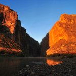
Golden light on Santa Elena Canyon, where the Rio Grande runs 20 miles between sheer walls with Texas on one side and Mexico on the other. The Santa Elena Canyon Trail is 1.7 miles round trip: cross Terlingua Creek, climb the paved steps to a vista, then follow the river in until the walls meet the water. The paved road to the trailhead past Cottonwood Campground is closed for now after storms, so check conditions before you go.
Photo: NPS / Mark Schuler


1. Sunset through the Window in the Chisos Mountains. The Window Trail is 5.6 miles round trip down Oak Creek Canyon to the pour-off, and the hike back is all uphill. Photo: NPS / Cookie Ballou
2. Claret cup cactus on the South Rim, 7,375 feet up. The rim hike is 12 to 14.5 miles round trip with about 2,000 feet of climbing. Photo: NPS / Reine Wonite
3. Sunset on the Sierra del Carmen in Mexico, the backdrop to the park's east side. The 0.75-mile Rio Grande Village Nature Trail is one of the park's best sunset walks. Photo: NPS / Cookie Ballou
4. The Milky Way over the Chisos Mountains. Big Bend is an International Dark Sky Park, with the darkest night skies of any national park in the lower 48. Photo: NPS
Big Bend National Park. The cool season is starting, but October brought the Chisos Basin nearly six times its usual rain for the month, and the storms left a long list of closed roads behind.
Roads: The park has closed the paved road from Cottonwood Campground to Santa Elena Canyon, along with Hot Springs, Grapevine Hills, Paint Gap, River Road East and West, Old Ore and Lone Mountain Trailhead roads, and Glenn Springs Road south of Pine Canyon. Black Gap Road is still closed from earlier flash flooding. Old Maverick Road reopened Oct. 20 after inspection. Expect mud on gravel roads, and never drive into running water.
Trails: The Santa Elena Canyon Trail starts with a crossing of Terlingua Creek, which can be dry sand, thick mud or flowing water after rain. If it's running high, don't cross. Hot Springs Road is closed, which shuts the usual way in to the Hot Springs.
Camping and fees: Chisos Basin and Rio Grande Village campgrounds are open, and both require reservations on recreation.gov. Cottonwood Campground opens Nov. 1. Because of the road closures, backcountry permits are in person only at the Panther Junction Visitor Center for now. Entrance is $30 per vehicle for 7 days, card only, and free for U.S. citizens and residents on Oct. 27. The Chisos Mountains Lodge restaurant is closed; a food truck in the Basin serves 8 a.m. to 8 p.m. (closed 10 to 11 a.m.).
News: The park's dispatch closed the Boquillas crossing into Mexico over the weekend because of high water and unsafe crossing conditions, until further notice. It normally opens Friday through Monday. Separately, federal Judge Kathleen Cardone in El Paso has blocked border barrier construction and other ground-disturbing work across the Big Bend Sector, including the park, while a lawsuit moves forward. Customs and Border Protection had planned roads, surveillance technology and vehicle barriers in the park, and crews began clearing land there in August. The plaintiffs, the Center for Biological Diversity, Friends of the Ruidosa Church and a local river guide, argue DHS wrongly waived dozens of environmental laws, and the judge found the sector has the lowest rate of illegal entry on the southwest border. DHS says its border security interest outweighs those harms, estimates the pause costs at least $462,800 a day, and says it intends to seek Supreme Court review. It has also told the court it is considering scaling back the park project after input from the Park Service.
TRACE take: Late October is when Big Bend opens up, with desert highs in the mid 80s and the mountains in the mid 60s this week. After this much rain, plan around the paved roads, read the park's daily report the morning you go, and watch the weekend, when the Weather Service has a chance of showers and storms Saturday into Sunday.

Big Bend quick facts:
-Became a national park: 1944
-Known for: 801,163 acres with 118 miles of border with Mexico along the Rio Grande, from desert at 1,850 feet to Emory Peak at 7,832. People come for more than 150 miles of trails, river trips through Santa Elena, Mariscal and Boquillas canyons, the 105°F Langford Hot Springs, birding (more than 450 species) and stargazing in an International Dark Sky Park.
-Seasonal closures: Park entrances are open 24 hours, year-round. The Rio Grande Village, Persimmon Gap and Castolon visitor centers open November through April, and Cottonwood Campground closes for summer. Parts of the South Rim close during peregrine falcon nesting season, and dirt roads close after heavy rain.
-Best time to visit: Fall through spring. The busy season runs November through April, and spring is the busiest. May through August are the hottest months, with the desert well above 100°F by late morning, and July through September is the rainy season.
-Tip: All park campgrounds are reservation-only on recreation.gov and fill on holiday weekends and from mid-January to mid-April. Entrance fees are card only, no cash. To visit Boquillas, Mexico, bring a passport book or passport card (enhanced driver's licenses don't work); the rowboat across is $5 round trip. Cell service is spotty, so download the NPS app for offline use.
-Sources: NPS Big Bend fact sheet, hiking, weather, stargazing, hours, camping, fees and Boquillas pages
nps.gov/bibe/learn/managemen…

Big Bend National Park could get bigger, and it's happening one willing landowner at a time.
The Big Bend Conservancy, the park's official philanthropic partner, has spent years working with willing landowners along Terlingua Creek on the park's west side. The largest piece is the Fulcher family's ranch of about 3,175 acres. The Big Bend National Park Boundary Adjustment Act would let the park take in about 6,100 acres there by donation or exchange only, with no eminent domain. The Senate passed its version by voice vote, and a House subcommittee held a hearing on the House bill, H.R. 2323, in September. The land holds rare creekside habitat, dinosaur remains and eggshells, and nesting gray hawks and yellow-billed cuckoos.
The Conservancy also funds the park's seasonal trail crews through its trails endowment, repairing weather damage, improving safety and building new routes.
TRACE take: This is conservation done the patient way, with willing neighbors, private donors and a nonprofit doing the groundwork so the land can join the park.

Sources: Big Bend Conservancy testimony on H.R. 2323 to the House Subcommittee on Federal Lands; S. 1112 as passed by the Senate; Big Bend Conservancy projects bigbendconservancy.org/proje…
Donate to the Big Bend Conservancy: bigbendconservancy.org/donat…
Join the Big Bend Natural History Association: bbnha.org/membership/
Volunteer in Big Bend: nps.gov/bibe/getinvolved/vol…
Photo: NPS / J. Swab

Sunset in Lost Horse Valley. For a hike out here, the Lost Horse Mine Trail starts off Keys View Road and runs 4 miles round trip with 550 feet of climbing to one of the most successful gold mines in the park. Stay outside the fenced millsite. Want more miles? The Lost Horse Loop is 6.5.
Photo: NPS / Samantha Laarman


1. Arch Rock, halfway around the loop at the end of a 1.4-mile trail from the Twin Tanks parking area. Photo: NPS / Robb Hannawacker
2. Golden hour in the Hidden Valley area, where a 1-mile loop leads into a rock-enclosed valley once rumored to hide cattle rustlers. Photo: NPS / Emily Hassell
3. The view from the top of Ryan Mountain, 3 miles round trip with 1,050 feet of climbing. Photo: NPS / Alison Taggart-Barone
4. Skull Rock under the Milky Way. Joshua Tree is an International Dark Sky Park. Photo: NPS / Hannah Schwalbe