Covering small town sports and weather here in Western North Carolina, @msjsports. Weather Forecaster @FHWxN,

Marion, North Carolina
Joined March 2009
Dan Crawley retweeted
Little fall break hitting sesh with dad!
2
7
230
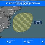
Off the southeast U.S. coast, a storm-force non-tropical low attached to an occluded front has a 20% chance to develop in 48 hours and 40% in 7 days. High winds, coastal flooding, and dangerous surf are expected along parts of the East Coast for the next few days.
43
Two McDowell High School golfers will participate in tomorrow’s 7A West Regional at Marion Lake Club. msjsports.net/2026/10/19/wom…
2
80
Storm-force non-tropical low along a frontal boundary a few hundred miles off the SE U.S. has a 40% chance to develop over 7 days. High winds, coastal flooding, and dangerous surf are expected along parts of the U.S. East Coast for the next few days.
1
51
A storm-force non-tropical low along a front a few hundred miles off the U.S. Southeast coast may briefly gain subtropical traits mid to late week. High winds, coastal flooding, and dangerous surf are expected along parts of the East Coast. 40% chance of development in 7 days.
42
Atlantic Tropical Weather Outlook for Atlantic from 2 AM EDT Monday through 9:04 AM EDT Monday. #1 48h 0% / 7d 40%.
31
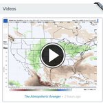
Does anyone at @weatherbell actually monitor what they do on their own website? Someone just uploaded @BigJoeBastardi Atmospheric Avenger from early August and labeled it as from two hours ago? 🤦‍♂️🤷‍♂️
1
149
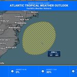
A storm-force non-tropical low is developing along a frontal boundary off the southeast U.S. coast and may gain subtropical characteristics later this week. High winds, coastal flooding, and dangerous surf are possible along parts of the East Coast. 7-day development chance 40%.
59
Growing season officially over for the Northern Mountains and Buncombe County. #ncwx
A broad area of the central/northern NC mountains had freezing temps Sunday morning 10/18, and this likely ended the growing season in that area. Therefore we will not issue any more Frost Advisories or Freeze Watches/Warnings in those zones until Spring 2027. See map. #ncwx
3
200
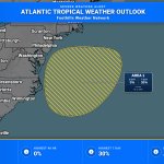
A storm-force non-tropical low is expected to form later today/tonight off the southeast U.S. coast and move slowly and erratically through midweek; some subtropical development is possible. High winds, coastal flooding, and dangerous surf are likely. 7-day chance 30%.
46
Storm-force non-tropical low is expected to form later today or tonight off the southeast U.S. coast, moving slowly and erratically through midweek; some subtropical development is possible (30% in 7 days).
1
69
A storm-force non-tropical low is expected to form later today/tonight off the southeast U.S. coast, then move slowly and erratically into midweek. High winds, coastal flooding, and dangerous surf are likely. 7-day development chance: 30%.
51
A strong non-tropical low is expected to form by Sunday night off the southeast U.S. coast and move slowly through midweek, with some subtropical development possible. Regardless, expect high winds, coastal flooding, and dangerous surf. 7-day formation chance: 30%.
54
A strong non-tropical low is expected to form within 1-2 days off the U.S. East Coast, moving slowly and erratically through midweek; some subtropical development is possible. High winds, coastal flooding, and dangerous surf are likely. Formation chance: 20% in 7 days.
57
Snowflakes falling on some of the high peaks in western North Carolina. Let’s go!!!!
FIRST SNOW!!! ❄️❄️❄️❄️❄️ Above 5,000 feet on the Blue Ridge Parkway in North Carolina!
5
238
Frost Advisory issued for Rabun, Habersham & Alexander, and the NC/SC mountains through 9:00 AM EDT Sun. Temps as low as 36F may form frost from 1–9 AM; cover sensitive plants to prevent damage.
38
Tomorrow is going to be a major shock to the system as highs could be 25-30 degrees below today’s values. Mid-upper 80’s ➡️ Upper 50’s/Lower 60’s. Northerly winds will be howling tomorrow in excess of 30 mph in gusts. If you are having outdoor events, make sure inflatables, tables, tents, etc…are secured. #ncwx
63
It’s a beautiful start to your Friday as patchy fog burns off. Enjoy today, it will be quite warm in the 80’s. Big changes are in store tomorrow as it will be windy and much colder! #ncwx
2
97