

Cycloidal Analysis - Blender Artist - Christian ✞ | Civil Engineering Undergraduate - University of South Carolina
Joined May 2024
- Tweets42
- Following18
- Followers497
- Likes841




Pinned Tweet
#Tornado
📌 GRAETTINGER, IA - 4/13/2026
Utilizing cycloidal debris swaths seen in aerial footage following the EF2 tornado on April 13th, 2026, preliminary analysis found a sustained 3 second wind gust between 104-124 mph! This falls in line with the official EF scale estimate.
The impacted residence directly behind the calculated cycloidal marks found estimated wind speeds of 110 mph. Another residence downstream was rated in upwards of 120 mph. This suggests cycloidal debris swaths correlate well with EF scale ratings, similarly to the findings of Roegner et al. (2026). These markings are created through soil and crop deposition, rather than surface scouring. To learn more about this methodology, check out some of my other posts!


Saltical retweeted

After a year of reviewing high-resolution satellite imagery, radar data, and storm-chaser video, SalticalWx and I have completed a forensic analysis of the April 26, 2024, Iowa tornado family that impacted Treynor, Minden, Shelby, and Harlan.
Our analysis suggests the two currently mapped tornado tracks may instead represent five distinct tornadoes, with multiple rapid non-occluding cyclic mesocyclogenesis (NOCM) cycles occurring in quick succession.
Our proposed analysis is:
- Treynor, Iowa EF3 (145 mph) | 5:08-5:25 PM CDT
- Bentley, Iowa EF0 (74 mph) | 5:26-5:30 PM CDT
- Minden, Iowa EF0 (85 mph) | 5:34-5:39 PM CDT
- Minden, Iowa EF3 (160 mph) | 5:39-5:52 PM CDT
- Harlan, Iowa EF3 (140 mph) | 5:53-6:35 PM CDT
The evidence is based on high-resolution satellite imagery, cycloidal debris marks, radar data, and triangulated storm-chaser video. These rapid cycles occurred so close together that they likely produced the appearance of one continuous damage path in several locations.
We are sharing our findings with NWS Omaha shortly for their consideration. Regardless of any future changes, this was an incredibly fascinating case study in tornado evolution and rapid cycling.


Saltical retweeted
INCREDIBLE cycloidal markings left behind by a powerful tornado in Washburn, Illinois from yesterday. This is the most impressive tornado damage I’ve ever seen, I’m in awe of these photos I took.


Saltical retweeted
Two high-end EF3 (165 mph) DIs from the 2023 Robinson, Illinois tornado were just removed from the DAT. Not sure what NWS Lincoln is up to.

📍Mayfield, KY - Cycloid Analysis
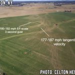
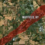
OTD: Four years ago, one of the most impressive tornadoes in recorded history struck the city of Mayfield. This long-tracked EF4 later impacted parts of Princeton, and eventually Bremen. This devestation is believed to be of EF5 intensity. [1/5]


Most notably, cycloid analysis observes the highest wind speeds to the southeast of Mayfield, KY and near Bremen, KY. Additionally, tangential velocities of 182±10 mph calculated in Princeton match the observations by Roegner et al. (2024) using Ted Fujita’s method (1970). [4/5]


The devastating structural and contextual damage observed across this track has been a source of controversy over the years. Overall, cycloid analysis suggests winds possibly reaching into the EF5 threshold were present. While the EF rating is an important factor in categorizing historic events, the devastating human impact is by far the most important consequence of these events. [5/5]


On November 17th, 2013, a high-end EF4 impacted Washington, Illinois. This tornado devastated multiple subdivisions in Washington; sweeping away homes. Official surveys finalized the tornado at 190 mph. However, detailed cycloid analysis suggests higher winds were present. [1/7]


Interestingly, analysis of cycloidal marks in this region of the tornado path suggests the tornado once again harbored EF5 winds. Due to the rapid constriction of the RMW, the tornado’s sustained 3s wind gusts increased up to 205±7 mph. This continued temporarily before the tornado began to slowly weaken for the rest of its life. [6/7]

Overall, cycloid analysis suggests the Washington, IL EF4 contained sustained winds reaching into the EF5 criteria. Tangential velocities as the tornado left town were calculated at 89±3 m/s, agreeing with the analysis of Roegner et al. (2024) conducted in the same area using Fujita’s formula (1970). [7/7]


Saltical retweeted

Interesting unique mathematical approach to assessing tornado intensity based on cycloidal scars


