

Official account of the Southwest Florida Water Management District. Follow ≠ endorsement. View our social media policy: https://xitter.cf/t.co/MKKbWhqwdh
- Tweets5.8K
- Following126
- Followers4.3K
- Likes110
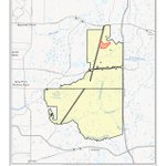



ALT Map of Starkey Wilderness Preserve depicting a 155-acre prescribed burn unit (ST2026W6) filled with red cross-hatching in the upper portion of the preserve. The yellow-shaded preserve boundary spans south of State Road 52 and west of the Suncoast Parkway, positioned north of Odessa and Trinity.

ALT Water Restriction Reminder graphic showing a hand pouring water from a glass pitcher into a drinking glass. Text on the right reads, "Restaurants can only serve water upon request." The bottom-left corner features the Southwest Florida Water Management District "Water 101" logo.

ALT A high-angle, close-up photograph of rain falling on a puddle or still body of water, creating a multitude of concentric ripples across the surface.

ALT A Water Restriction Reminder graphic from the Southwest Florida Water Management District stating that non-commercial car washing at home is only permitted on lawn watering days using a shutoff nozzle, accompanied by an image of a man washing his car.

ALT Map of Edward W Chance Reserve - Gilley Creek Tract highlighting a 160-acre burn unit (GC2026F1) marked in red cross-hatching at the northeastern corner of the preserve boundary. The yellow-shaded preserve is situated north of State Road 64 and Lake Manatee, with Oak Knoll Road running near its central section.

ALT "Florida-Friendly Landscaping: 5 Ways to Attract Wildlife" from the Southwest Florida Water Management District. The five tips are: Plant vines, shrubs and trees to create cover, nesting areas and food. (Illustrated with a bird's nest holding three blue eggs.) Provide a water source like a birdbath or small pond. (Illustrated with a birdbath and several small birds.) Provide wildlife shelters such as a bathhouse, birdhouse or brush pile. (Illustrated with a pile of dry branches and twigs.) Protect the health of wildlife visitors. Limit pesticide use by spot treating only areas that need attention. (Illustrated with a pest-sprayer bottle.) Consider including native plants in your landscape. They are the natural food, shelter and nesting plants of our local wildlife. (Illustrated with potted plants, a trowel, and a watering can.) The left side features illustrations of a deer, rabbit, and fox. A URL for more information is listed at the bottom: WaterMatters.org/Yards.

ALT Map of Starkey Wilderness Preserve showing a 155-acre burn unit (ST2026W6) highlighted with red cross-hatching in the northern section of the preserve. The yellow-shaded preserve boundary sits south of State Road 52 and west of Suncoast Parkway, with Trinity and Odessa located to the south.

ALT Map of Halpata Tastanaki Preserve highlighting a 92-acre burn unit (HT2026F2) cross-hatched in red near Ross Pond. The yellow-shaded preserve is located south of Marion County Airport and SW Highway 484, bordered by the Withlacoochee River along its southern boundary.

ALT Map showing the Green Swamp Wilderness Preserve - West Tract, highlighting a 234-acre prescribed burn unit (GW2027F1) outlined in red near Owensboro Swamp. The yellow-shaded preserve boundary sits east of US Highway 301 and Dade City, bounded by State Road 471 to the east and US Highway 98 to the southwest.

ALT A location map from the Southwest Florida Water Management District shows the boundary of the Starkey Wilderness Preserve outlined in black with yellow shading. The specific burn unit, designated ST2026W7 and highlighted in red crosshatching, covers approximately 98 acres near the northern border of the preserve, south of State Road 52.

ALT An infographic by Southwest Florida Water Management District promoting Florida Water Star, showing a map of Florida with locations marked and stating annual household savings up to $530 on utilities and up to 48,000 gallons of water.

ALT A Southwest Florida Water Management District map displays the Halpata Tastanaki Preserve boundary in light yellow, located south of SW Highway 484 and Marion County Airport. Highlighting a 172-acre area, the red cross-hatched Burn Unit (HT2026F1) is situated near the northeast border of the preserve, just west of Ross Pond.

ALT Map of the Green Swamp Wilderness Preserve - East Tract, published by the Southwest Florida Water Management District, showing a 155-acre prescribed burn unit outlined in red. The red hatched burn unit is located near the center of the preserve, near the Sumter and Lake county borders.

ALT A photograph merged with a public service announcement graphic. The image shows a fire professional wearing a yellow hard hat, sunglasses, and protective gear, walking along a sandy dirt road. The person is using a drip torch to apply fire to the dry grass and palmettoes in a controlled manner, as part of a prescribed burn. Smoke and small flames are visible in the background under a bright blue sky. The right side of the image has text that reads: "SIGN UP for District Prescribed Burns Alerts". The Southwest Florida Water Management District logo is in the bottom right corner.


ALT Water Restriction Reminder graphic from Southwest Florida Water Management District featuring a person pressure washing house siding on a deck, with text stating: "Pressure washing in preparation for painting and sealing is allowed."

ALT A family of four—a man in a green shirt, a woman in orange holding an apple, a boy in an olive shirt, and a girl in a purple shirt—sitting around a picnic table covered with a red-and-white checkered tablecloth. The table is filled with fresh fruit, sandwiches, red cups, and an open picnic basket in a sunny, wooded setting surrounded by palmetto plants.