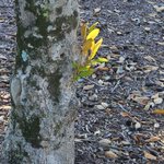
A little friend finds the light for our #FF photo fun at NC #NationalGuard HQ and yes it is a #FF for @ProjectWETNC
@NC_Markers
@ncstatefair
@ForEverythingNC
@NorthCarolinaEE and now . . .
And you can get paid to take the photos folks, ask a recruiter ng.nc.gov/join-guard
Check out some of the best photos from around the National Guard this week!
📸flickr.com/photos/thenationa…
Our NC #NationalGuard 440th Army Band has the best fans. You can join the fun @NCStateFair @NCAgriculture today our concerts at 1:15, 4, 6 p.m.
#AMemoryWorthMaking #AStoryWorthTelling
#NCNG
Oh @NCStateFair NC #NationalGuard 440th Army Band brought friends @NCAgriculture #AMemoryWorthMaking #AStoryWorthTelling
Hello @NCStateFair the NC #NationalGuard recruiters here and they can help everyone have #AMemoryWorthMaking and #AStoryWorthTelling
Hello #NCStateFair the NC #NationalGuard 440th Army Band is setting up. @NCAgriculture #AMemoryWorthMaking #AStoryWorthTelling
Happy @DukeEnergy Military Appreciation Day! Join us to show our U.S. military members some love at our special events. 🇺🇸 The #NCStateFair fun is waiting! #NCStateFair
Out ya go! Check out what your NC #NationalGuard is up and down to! flickr.com/photos/ncngpao/al…
SFC (ret.) Robert Jordan retweeted
❗️Sunday 10/18/26 Nor’Easter Update
🌀 Not much change in the forecast to report since yesterday. A Nor’easter off the NC Coast will continue to strengthen Sunday through early to mid-week.
💨🌊 This slow-moving system will bring strong winds, high waves, coastal flooding, and extremely dangerous marine conditions well into next week.
🚨 Conditions will continue to deteriorate though the weekend, and the greatest coastal impacts are expected on the ocean side of the Outer Banks.
⚠️ The mandatory evacuation order for Hatteras Island visitors remains in effect. Ferry service is suspended with only Southport/Fort Fisher running.
📌 Full Sunday Hazardous Weather Update: ReadyNC.gov/weather
#ReadyNC #ncwx
𝗧𝗵𝗶𝘀 𝗶𝘀 𝗡𝗢𝗧 𝘆𝗼𝘂𝗿 𝘁𝘆𝗽𝗶𝗰𝗮𝗹 𝗷𝗼𝗯 𝗳𝗮𝗶𝗿. 𝗟𝗮𝘀𝘁 𝗱𝗮𝘆 𝘁𝗼 𝗿𝗲𝗴𝗶𝘀𝘁𝗲𝗿!
No cost. No lines. No résumé drops. You’ll be prescreened, matched to roles that fit your skills, & interviewed by employers who are ready to hire: bit.ly/4dc3NFU
Some birds of a feather for our NC #NationalGuard HQ #FF photo fun. And yes it is a #FF for
@ProjectWETNC
@NC_Markers
@ncstatefair
@ForEverythingNC
@NorthCarolinaEE
And now . . .
North Carolina benefits you earned by military service.
myarmybenefits.us.army.mil/B…
SFC (ret.) Robert Jordan retweeted
.@NCEmergency is working with local emergency management teams to survey damage alongside the National Weather Service as we start the week. I am relieved to share that there have been no reported injuries from this weekend's storm. Since Helene, our local and state public safety community has invested in building resilience to be better prepared for the next emergency or disaster. From flood notification sirens to communications systems, Isaias showed the value of continuing to work to make our communities safer from future threats.
Thank you to first responders, emergency managers, meteorologists, state search and rescue teams, and all the neighbors who stepped up ready to assist wherever needed. We are safer and stronger together.
Governor Josh Stein has proclaimed Oct. 12 Indigenous Peoples' Day!
Today, we recognize NC's nine state-recognized tribes, four urban Indian organizations, and their lasting contributions to our state.
🗺️ Learn more about DOA's work: doa.nc.gov/divisions/america…

ALT A vibrant parade features dancers in colorful, traditional Native American regalia with feathers and beadwork. A large, diverse crowd watches the procession in an urban setting.

ALT This image is a map of North Carolina, highlighting tribal and urban communities. Areas are colored and labeled to show locations of state and federally recognized tribes, such as the Eastern Band of Cherokee Indians and Lumbee. Urban Indian organizations like Triangle Native American Society are also indicated. Stars mark significant locations. A legend provides further details, and the map is published by the N.C. Department of Administration Division of Indian Affairs.
.@NCStateFair is running from Oct. 15–25. All active-duty military members & Veterans—including National Guardsmen & reservists—plus up to 3 guests can enjoy free entry on Military Appreciation Day, Oct 21. On all other days, you can purchase discounted $8 admission at the gate.
Some fall foliage for our #FF photo fun at NC #NationalGuard HQ and yes it is a #FF for
@ProjectWETNC
@NC_Markers
@ncstatefair
@ForEverythingNC
@NorthCarolinaEE
And now . . .
SFC (ret.) Robert Jordan retweeted
As Hurricane Isaias brings the potential for localized flooding and gusty winds this weekend, I encourage everyone to prepare now. Make sure you’re signed up for local emergency alerts, have an emergency kit ready in case you lose power, and never drive through flooded roads.
@NCEmergency Management is prepositioning resources across the state so they can respond quickly if communities are impacted. Take care of your loved ones, and check on your neighbors, too.
SFC (ret.) Robert Jordan retweeted
North Carolina, today is the last day to register to vote online or by mail, but remember that you can still register in person during early voting. Early voting runs October 15 – 31, and Election Day is Tuesday, November 3.
SFC (ret.) Robert Jordan retweeted
‼️Hazardous Weather 10/09/26‼️
⛈️ Periods of moderate to heavy rain are expected for much of North Carolina Saturday into Sunday as tropical moisture associated with Hurricane Isaias moves into the region.
⛈️The greatest rainfall is forecast across portions of the mountains and along the coast over the weekend.
📍Full forecast at ReadyNC.Gov/Weather
SFC (ret.) Robert Jordan retweeted
⚠️ Friday Evening Tropical Weather Update⚠️
🌬️ Strong winds and tropically enhanced rainfall is forecast to impact NC over the weekend.
❗️The greatest rainfall is forecast across portions of the mountains, where numerous flash floods are likely Saturday and Saturday night.
🌧️Widespread rainfall totals of 2-4” are forecast across much of the mountains, with southeast facing slopes and portions of the Blue Ridge Escarpment possibly accumulating 4-6” of rainfall through Sunday morning. Locally higher amounts of 8”+ cannot be ruled out for these areas.
With periods of moderate to heavy rainfall forecast for portions of the NC mountains, the threat of isolated landslides and debris flows will increase for areas across the southern mountains and Blue Ridge Escarpment. Especially during the heaviest rainfall Saturday evening into Sunday morning where rainfall rates have the best chance to reach 5” over 24 hours.
Rainfall amounts of 2-4” remain possible across portions of eastern NC through Sunday. Locally higher amounts of 6”+ are possible where heavy rain bands continue to develop over the same areas and especially along the coast.
Elsewhere across the Piedmont and western Coastal Plain, widespread accumulations of 1-2” are forecast with areas of locally higher amounts possible.
🚨North Carolinians should:
1. Be Informed- have multiple ways to receive alerts, especially overnight Saturday into Sunday. Follow reputable sources of information like the National Weather Service, local media outlets, and local emergency management offices.
2. Have a Plan- know where you will go to seek higher ground in flood prone areas or if you need to take shelter for severe weather.
📌 For the full Friday P.M. Tropical Weather Update, visit ReadyNC.Gov/Weather
📌 For the latest preparedness information, visit ReadyNC.Gov/Isaias
#ReadyNC #IsaiasNC


