

53 Weather Reconnaissance Squadron Hurricane Hunter, Soccer, Golf, Classic Rock, Meteorologist, Penn Stater, hardcore weather enthusiast.
Biloxi, MS
Joined April 2018
- Tweets428
- Following367
- Followers2.3K
- Likes1.6K




Ryan Rickert retweeted

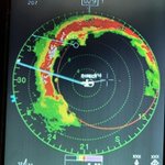
Overall that was one of the more wild missions of my career… the eye was crazy shaped and closed on the first pass and then open on the second. On the third pass we had a call from the Air Force Rescue Coordination Center about a boat with an emergency beacon that was transmitting just outside the eye. We dropped down and searched for them for a bit. That’s all the wind arrows clumped together sorta in the middle. The beacon was loud but we didn’t get any response on the radio or see anything visually or with radar. Coast Guard was headed out in a helo but storm was well north by the time they made it on scene so no idea what happened with that. Then there was a bunch of severe turbulence on the open south side of the eye, clear air with nothing on radar but pilots had to do all their pilot stuff to keep us flying. Took a radar fix because the turbulence was too violent on the fourth pass. Then made it back in for one final fix before calling it a day. Pics and vids tomorrow… Our PA office got a bunch of them up on DVIDs if anybody wants to use them.

Ryan Rickert retweeted

Off to mess with Texas 🤠✈️
We will continue our mission collecting data from #TropicalStormFrancine for forecasters from Joint Base San Antonio-Lackland, Texas. Shoutout to everyone who works hard to keep our mission going wherever it takes us.
#ReadyNow
Ryan Rickert retweeted

Awesome day in Biloxi #Mississippi. Thanks, @oneyounglee, for your great hospitality at Ground Zero—& big thumbs up for all you're doing to revitalize city's historic downtown. 👊 Also great to see Hurricane Hunter @RyanRickert4. (Lunch conversation was Cat-5 hurricane nerdout.)

Ryan Rickert retweeted

#Beryl is still packing a punch. We were stuck in the soup all day. Every radar blip in the northern half was rough. Went from an open eyewall to fully closed as it approached Jamaica with a really nasty NE eyewall. Got hail the last two passes. This thing is a fighter. @53rdWRS


Ryan Rickert retweeted

Here is a full list of all of the records Hurricane #Beryl has broken. Truly historic.

Ryan Rickert retweeted
#Hurricane #BERYL is up to 145 knots now—earliest Atlantic Cat 5 on record. Next threatened landmasses are Jamaica (pink) & Mexico's Yucatan Peninsula. But it's likely peaked & should be much weaker when it impacts these places. Not sure of my next move—thinking about it.

Ryan Rickert retweeted

After #Beryl impacts the Yucatan Thursday night and Friday, hopefully as a weaker hurricane, more and more guidance starts to turn it north once it reemerges over the Bay of Campeche on Saturday. Even though some guidance has Beryl a TS at this point, some keeps it as a hurricane so the western gulf needs to be on alert potentially for the later part of the holiday weekend and early next week.
Much of the future fluctuation and strength will depend on shear and land interaction, but we still have lots of warm ocean out there to keep it going or strengthen it up at times. Stay tuned!

Ryan Rickert retweeted
Concerns about being trapped somewhere after a #hurricane do not factor into my decision about whether to chase. I've been trapped many times, & I go into these chases just accepting that's gonna happen. The single & only factor in my decision: my odds of penetrating the core.
Ryan Rickert retweeted
Powerful #Hurricane #BERYL is racing W, toward S end of Windward Isles. Me: After days of obsessive deliberation, I've decided to hold off on this round & focus on next impact (Mexico or Central America). I'll sometimes play Island Roulette, but I like to go in with better odds.

Ryan Rickert retweeted

Hurricane #Beryl continues to quickly strengthen this Sunday morning. The storm is now a very dangerous category 3 hurricane with maximum sustained winds of 115 mph. Life-threatening winds and storm surge are expected in portions of the Windward Islands by early Monday. Latest at hurricanes.gov


Ryan Rickert retweeted
TS #BERYL is closing in on Barbados (orange) & Windward Islands (pink). Likely to be a decent #hurricane when it crosses the islands Monday. Me: weighing my options. Ain't sold on any one scenario yet—& there are many. There always are with Caribbean Cruisers. The trick with these setups is picking the right penetration point along the conveyor belt.


Ryan Rickert retweeted

The diamond ring effect at totality in Houlton, Maine! Cindy and I are emotional. It was so incredible and one of the most spectacular things I’ve ever seen in my life. #scwx #ncwx #Eclipse #Eclipse2024

Ryan Rickert retweeted

Just to emphasize how poorly hurricane & global models performed for Hurricane Otis... here's the intensity forecasts initialized 24 hours ago, with the dotted black line showing verification:

Ryan Rickert retweeted

Tropical Storm #Ophelia has formed off of the North Carolina coast - the 11th Atlantic named storm to form since August 20. The only season with more Atlantic named storm formations between August 20 - September 22 is 2020 (12 formations). #hurricane
Ryan Rickert retweeted
Even though almost all of the ensemble blend members don't touch the USA, its all about the trends at this point versus actual individual operational model output. Therefore, lets watch how the some of these western players shake out. The farther west we go the harder it is to miss eastern North America. There is no reason to believe #Lee will weaken considerably over the next week.

Ryan Rickert retweeted

#Jova Wednesday, September 6, 2023, 9:33 PM PDT: Jova is now a horrific category five monster with sustained winds of 160 mph moving NNW at 10 mph. This is the strongest storm on earth right now this is eerily, similar to Linda in September 1997 when she also became a category-five hurricane as well during a strong El Niño too. The water temperatures are running at 91 to 95° south of Cabo San Lucas right now which is fueling this monster. The trajectory of Jova does take her north into much cooler waters about 455 miles off of Southern California however because she is a category five right now our waters are much warmer due to El Niño. It’s something I’m going to have to continue to watch very closely into the upcoming weekend and early next week, for maybe more remnant moisture into possibly Southern California, and working with the monsoonal moisture into Arizona into Vegas, but this is again something that needs to be looked at very closely.
Ryan Rickert retweeted

New Episode!
This week we go #OffTheRadar with Lt. Col. @RyanRickert4 about the history, the dangers and the forecast breakthroughs that come with flying into the eye of the storm!
Find it anywhere you listen to podcasts- lnkd.in/guZqKriK
Ryan Rickert retweeted
NHC has determined that a subtropical storm formed in the Atlantic basin off the northeastern U.S. coast in mid-January 2023, and it will be designated as the first cyclone of the 2023 Atlantic season with ID AL012023.
nhc.noaa.gov/archive/text/PN…

Ryan Rickert retweeted
Thanks to @theWeatherboy for all you do to make this conference possible and for the awesome cookies. Check out his website for some really cool stuff that inspires the next generation of meteorologists!

Presentation pro tip: energize with a boost of caffeine and a sugary Weatherboy cookie before presenting at #NTWC23 😁
