



Can northern Ontario’s growing electricity needs be understood without looking at the transmission network behind them?
#Rextag helps teams see why the answer is no.
Hydro One and Hydro One Sault Ste. Marie have filed for approval to construct the North Shore Link, an approximately 105 km, double-circuit 230 kV transmission line.
The proposed corridor would connect Mississagi Transformer Station near Wharncliffe with Third Line Transformer Station in Sault Ste. Marie.
The $1.3 billion project also includes upgrades at Mississagi TS and Third Line TS, plus expansion of Algoma TS, with the new line planned to enter service in 2029.
This Rextag map, powered by Energy DataLink, places the proposed North Shore Link inside Hydro One’s broader Ontario transmission network.
It shows operational 230 kV+ powerlines and substations across the province, with the proposed corridor and its key project stations highlighted separately.
That context matters because transmission expansion is not only about adding new line mileage.
It is about where new capacity connects into the existing high-voltage network, which substations anchor the corridor, and how regional connectivity changes as electricity demand grows.
For #Power, transmission, industrial development, and market intelligence teams, the key question is not only where a new line is planned.
It is how that line fits into the network around it.
Read more in our blog: hubs.ly/Q04BMr7_0
Can major transmission projects be fully understood without mapping the high-voltage network they connect into?

Can West Virginia dry gas growth be understood by production volumes alone?
#Rextag helps teams see why the answer is no.
#Antero Midstream said it began construction on East Side Express in Q2 2026, describing it as the company’s first intrastate regional pipeline.
The project is an east-west bi-directional pipeline designed to improve regional connectivity within Antero’s operating areas and support future dry gas growth in West Virginia.
This #Rextag map, powered by Energy DataLink, shows the approximate East Side Express corridor alongside Antero Midstream pipelines, acreage context, EGTS, Rover, Columbia Gas Transmission, compressor stations, fractionators, and Marcellus / Utica shale context.
The #EastSideExpress route is shown approximately because the company release does not provide a detailed route alignment.
That infrastructure context matters because Appalachian gas growth is not only about higher production volumes.
It is about how gathering systems, regional pipelines, long-haul transmission corridors, compression, fractionation, and market access connect in one network.
Antero Midstream gathered over 4.1 Bcf/d during the quarter, a company record, with gathering volumes up 19% and compression volumes up 17% year over year.
For #Midstream, #NaturalGas, upstream, and market intelligence teams, the key question is not only how much gas is moving through the system.
It is how that gas connects to the regional infrastructure around it.
Read more in our blog: hubs.li/Q04BCTNM0
Can #Appalachian gas growth be understood without mapping the connectivity behind it?

400 MW of AI compute. Its own gas-fired power. No waiting on the grid.
#PowerPlay AI just announced an initial 400 MW behind-the-meter #AI #datacenter in the greater Abilene area of West Texas, developed through a joint venture with a Nasdaq-listed neocloud partner. Behind-the-meter power delivery is targeted for 2028.
Abilene is already one of the most closely watched AI power markets in the country. PowerPlay AI says the site is anchored by existing #naturalgas and fiber infrastructure, near multiple GW-scale AI campuses that are operating, under construction, or proposed.
So why map the grid around a project built to run on its own power?
Because behind-the-meter doesn’t mean isolated. Future interconnection options, backup supply, and competition from neighboring large loads all shape how a campus like this develops.
This #Rextag map, powered by Energy DataLink, places the Greater Abilene project alongside Texas’s operational and under-development data centers, 345+ kV and 138+ kV transmission lines, and substations statewide.
Read more in our blog: hubs.li/Q04B8J-30
Is behind-the-meter gas becoming the default path for AI campuses in West #Texas, or a bridge until the grid catches up?

Is #Targa’s ExxonMobil agreement really a Permian system buildout story?
#Rextag helps teams see why the answer is yes.
#TargaResources announced new 20-year integrated midstream agreements with #ExxonMobil across the Permian Basin.
The agreements add and extend acreage dedications in the Permian Delaware and Permian Midland, covering gathering, processing, treating, NGL transportation, and fractionation through 2046.
But the story is not only a long-term commercial agreement.
This #Rextag map, powered by Energy DataLink, shows Targa operational and under-development natural gas pipelines, Bull Run II, ExxonMobil and XTO acreage, the Bone Spring / Wolfcamp shale outline, Waha Hub, and Mont Belvieu downstream NGL context.
The buildout is significant.
Targa announced three new Permian Delaware gas processing plants, Wrangler, Ranger, and Ranger II, adding approximately 825 MMcf/d of aggregate new processing capacity.
It also announced Bull Run II, an approximately 70-mile natural gas pipeline designed to move residue gas from the new plant additions to the Waha Hub.
That matters because Permian midstream growth is not only about acreage dedications or plant capacity.
It is about how producer acreage, gathering systems, processing plants, residue gas takeaway, Waha access, and downstream NGL services connect in one system.
For #Midstream, #NaturalGas, #NGL, upstream, and market intelligence teams, the key question is not only what Targa and ExxonMobil agreed to.
It is where that agreement translates into physical infrastructure across the Permian.
Read more in our blog: hubs.li/Q04B1jL-0
Can Permian midstream growth be understood without mapping the system behind it?

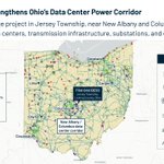
The largest battery in PJM is now under construction, right next to one of America’s busiest #datacenter corridors.
#Eolian has started building Flint Grid, a 200 MW / 1.06 GWh battery energy storage system in Jersey Township, Licking County, Ohio.
A few numbers that stand out:
· 5.3 hours of duration, longer than the typical 4-hour battery
· More than 50% of all new battery capacity that cleared PJM’s 2027/2028 capacity auction
· The first grid-scale battery storage project permitted by the Ohio Power Siting Board
Location matters as much as size. Flint Grid sits beside the New Albany / Columbus corridor, which Eolian calls one of America’s fastest-growing data center and industrial load centers.
This #Rextag map, powered by Energy DataLink, puts Flint Grid on the same view as Ohio’s operational and under-development data centers, transmission lines, substations, power plants, and other battery storage projects.
That’s how storage should be evaluated: not just by megawatts, but by where those megawatts sit relative to demand, substations, and the rest of the grid.
Read more in our blog: hubs.li/Q04zwH__0
Will long-duration storage like this become standard next to every major data center cluster in PJM? Curious what grid planners are seeing.

Is #ATCO’s #Yellowhead Pipeline only a pipeline approval story?
#Rextag helps teams see why the answer is no.
ATCO announced that Canadian Utilities, an #ATCO company, received Alberta Utilities Commission approval to construct and operate the Yellowhead Pipeline Project.
The approved project includes a 235-km, 36-inch natural gas transmission pipeline from the Peers area to the Fort Saskatchewan area, plus one compressor station.
ATCO says the project is fully contracted and, once in service, is expected to deliver more than 1 Bcf/d of natural gas to Alberta’s industrial heartland.
But the infrastructure story is bigger than route length or diameter.
This #Rextag map, powered by Energy DataLink, shows the #Yellowhead Pipeline corridor within #Alberta’s broader natural gas infrastructure context.
The map includes ATCO / ATCO Next transmission pipelines, ATCO compressor stations, operational gas processing plants, operational natural gas power plants, and the Duvernay shale area.
That context matters because major gas projects are not only about new pipe.
They are about how supply areas, transmission systems, compression, processing, power generation, and industrial demand connect in one regional network.
For #Midstream, #NaturalGas, power, industrial development, and market intelligence teams, the key question is not only where the route runs.
It is how that route fits into Alberta’s gas supply and demand corridor.
Read more in our blog: hubs.li/Q04zlVnC0
Can Alberta gas infrastructure growth be understood without mapping the corridor around it?

Can you understand tomorrow's natural gas supply picture by looking only at today's production?
#Rextag #NaturalGas #Analytics incorporates satellite-driven drilling activity intelligence that identifies activity such as operating rigs, completion crews, and frac crews.
#Upstream activity can provide an important additional layer of context.
Instead of viewing production, pipelines, and upstream development separately, teams can examine where field activity is occurring in relation to the surrounding natural gas system.
- Which areas are seeing new drilling activity?
- Where are completion crews becoming more active?
- Which operators and producing regions deserve a closer look?
It is another way to connect what is happening #upstream with the #infrastructure and market data further #downstream.
Explore #Rextag Natural Gas Analytics: hubs.li/Q04zlxCw0
What changes when you can see drilling activity and the gas network in the same analytical environment?

Is #Solitude the next big test for Permian gas takeaway?
#Rextag helps teams see why the answer may be yes.
#WhiteWater, #DevonEnergy, #MPLX, #Diamondback Energy, and #WesternMidstream reached a positive FID for the Solitude Pipeline System.
The project includes two 48-inch natural gas pipelines from the #PermianBasin to Katy, Texas.
It is designed for approximately 2.25 Bcf/d of initial capacity in late 2029, with another 2.25 Bcf/d expected in 2030.
But the story is not only a new route from basin to market.
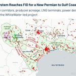
This #Rextag map, powered by Energy DataLink, shows the broader infrastructure context around the announcement.
The map includes Devon and Diamondback acreage, selected natural gas transmission corridors, operational gas processing plants, operational #LNG terminals, and operational gas-fired power plants.
Those selected corridors are shown for context and do not represent Solitude’s exact route unless specifically labeled.
That context matters because Permian gas takeaway depends on more than pipeline capacity.
It depends on how producer acreage, processing plants, long-haul pipelines, LNG demand, and power generation connect across the same regional system.
For #Midstream, #NaturalGas, LNG, power, and market analysis teams, the key question is not only how much new capacity is being added.
It is how that capacity fits into the existing Permian-to-Gulf Coast gas corridor.
Read more in our blog: hubs.li/Q04yN9f50
Can Permian gas takeaway be understood without mapping the infrastructure corridor behind it?

Can a former DOE site become a major AI power hub?
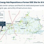
#Rextag’s map, powered by Energy DataLink, places the proposed #Paducah American Energy Hub alongside the power and gas infrastructure around it.
It gives data center, utility, and investment teams a regional view of the systems they need to examine as projects grow to gigawatt scale.
#Brookfield, #NextEra Energy, #BigRivers Electric Power Corporation, #JacksonPurchase Energy Cooperative, and #PaducahPower System have announced plans to redevelop the former DOE Paducah Site in western Kentucky. The project has been described as a $100 billion private investment.
By 2032, plans call for up to 1.8 GW of utility capacity supporting more than 1.2 GW of compute capacity. Proposed dedicated energy resources include up to 2 GW of #naturalgas generation and up to 2.6 GW of battery storage.
#Rextag’s map shows the proposed site with nearby transmission lines, substations, natural gas pipelines, power plants, and operational and under-development data centers. These layers show regional infrastructure context; they do not establish which nearby assets will serve the project.
#Paducah illustrates a broader shift in AI site selection: the question is increasingly how land, power, and supporting infrastructure come together in one location.
Read more in our blog: hubs.li/Q04yCWz10

A price tells you what the market is doing. But can you see what is happening around it?
Regional #naturalgas #pricing becomes more useful when it can be viewed alongside the physical system moving the gas.
#Rextag #NaturalGas #Analytics brings regional pricing together with pipelines, flows, production, storage, and other market context, helping analysts look beyond the price point itself.
A regional move can then be explored against questions such as:
- What is happening to flows in the surrounding systems?
- Are infrastructure conditions changing at the same time?
- How has the relationship between regional pricing and physical gas movements changed over time?
The goal is not to look at pricing and infrastructure as separate datasets, but as different parts of the same natural gas market.
Explore #Rextag #NaturalGas #Analytics: hubs.li/Q04yt7Nt0
When a regional gas price moves, what does the infrastructure around it show you?

Is Continental’s FireBird acquisition only an acreage deal?
#Rextag helps teams see why the answer is no.
Continental Resources announced an agreement to acquire FireBird Energy II, adding approximately 54,000 net acres in the Midland Basin.
The acquired assets include approximately 147,000 net resource acres across more than six stacked-pay reservoirs, about 32,000 boepd of current production, a 69% oil mix, and 307 gross operated development locations.
But the bigger story is how that position fits into the basin.
This #Rextag map, powered by Energy DataLink, shows #ContinentalResources acreage across the broader Permian area, with FireBird Energy II acreage highlighted as the Midland Basin acquisition target.
The map also shows major crude oil transmission pipelines, major natural gas transmission pipelines, and operational gas processing plants around the acreage.
That infrastructure context matters because adjacent positions can support longer-term development planning across a growing basin portfolio.
Continental also said its Permian acreage has grown by more than 40% over the past 14 months, inclusive of the #FireBird acquisition.
For #Upstream, #Midstream, M&A, and market intelligence teams, the key question is not only how much acreage changed hands.
Read more in our blog: hubs.li/Q04y89670
Can Permian M&A be understood without mapping the wells, pipelines, and processing plants around the acreage?

Can #SanMateo’s #Cardinal deal be read as more than a bolt-on acquisition?
#Rextag’s Energy DataLink map shows why the answer is yes.
San Mateo Midstream entered into a definitive agreement to acquire Cardinal Midstream’s operating subsidiaries for $752 million.
The deal adds Cardinal’s cryogenic natural gas processing plant complex in Loving County, Texas, with approximately 320 MMcf/d of designed inlet capacity.
It also adds about 145 miles of natural gas gathering pipelines across West Texas and southern Eddy County, New Mexico.
The infrastructure story is about how those assets connect.
This #Rextag map, powered by Energy DataLink, shows Cardinal’s plant complex and gas pipeline system alongside San Mateo Midstream pipelines, planned pipeline infrastructure, San Mateo gas processing plants, and #Matador Resources Company acreage across the northern #DelawareBasin.
After the acquisition, San Mateo expects its designed natural gas processing capacity to exceed 1 Bcf/d and its gathering systems to exceed 800 miles of pipeline.
For #Midstream, #Upstream, and investment teams, the key question is not only what San Mateo is buying.
It is how the Cardinal system extends gathering and processing coverage across southeast New Mexico and West Texas.
Read more in our blog: hubs.li/Q04y5Sjw0
Can Delaware Basin gas growth be understood without mapping the systems that gather, process, and move the gas?

Where is the gas actually moving today?
#Rextag pipeline maps tell you where the infrastructure is. Meter-point flow data adds another dimension: how gas is moving through that system.
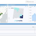
#Rextag #NaturalGas #Analytics brings daily interstate pipeline flows into an interactive dashboard where teams can examine receipt, delivery, bidirectional, and throughput points across pipelines and regions.
That means you can move from the network view to questions such as:
* Which receipt points are gaining volume?
* Where are deliveries changing?
* How has flow through a specific corridor shifted over time?
And because #Rextag has collected historical #pipeline flow information for years, current movements can be viewed alongside the longer history of the system.
Explore Rextag Natural Gas Analytics: hubs.li/Q04xXDdM0
A pipeline is more than a line on a map. What is the flow data telling you about it?

Is #Matador’s Paloma deal more than an acreage add in the Delaware Basin?
#Rextag helps teams see why the answer is yes.
Matador Resources Company announced a definitive agreement to acquire Paloma Permian LLC for $1.275 billion in cash.
The Paloma acquisition includes 16,235 net undeveloped acres in Eddy and Lea counties, New Mexico, with the majority held by production. The acquired properties are expected to produce approximately 10,600 to 11,600 BOE/d in Q3 2026, with a 57% oil mix.
The deal also adds over 156 net locations, primarily in the Bone Spring and Wolfcamp formations, along with 55 MMBOE of proved reserves.
This Rextag map, powered by Energy DataLink, shows Matador acreage and Paloma Permian AssetCo acreage across Southeast New Mexico, framed by Eddy and Lea county boundaries and the Bone Spring / Wolfcamp fairway.
It also shows operational major crude oil pipelines, operational major natural gas pipelines, and operational gas processing plants as surrounding infrastructure context.
Those layers do not imply Matador ownership of the surrounding infrastructure.
They show why location matters when upstream teams evaluate how new acreage, existing production, future locations, and takeaway infrastructure fit into a broader Delaware Basin development plan.
For #Upstream, #Midstream, M&A, and investment teams, the key question is not only how many acres were acquired.
It is where those acres sit relative to formations, production corridors, crude takeaway, gas takeaway, and processing infrastructure.
Read more in our blog: hubs.li/Q04xGXP70
Can Delaware Basin acquisitions be understood without mapping the infrastructure around them?

Is #Kimbell’s $215.4 million Drop Down acquisition really a multi-basin royalty platform story?
#Rextag helps teams see why the answer is yes.
Kimbell Royalty Partners announced a Drop Down acquisition focused on the Eagle Ford, Permian, Mid-Con, and Appalachia.
According to the company, the acquired portfolio includes approximately 2,568 net royalty acres, spans more than 3 million gross acres and 29,000 gross producing wells, and is supported by 9 active rigs and 177 DUCs and permits.
This #Rextag map, powered by Energy DataLink, shows Kimbell acreage across those core basins alongside operational transmission crude oil pipelines, operational transmission natural gas pipelines, and operational processing plants.
The story is bigger than the purchase price.
Because Kimbell is a royalty owner, the value is tied to basin exposure, producing activity, and surrounding infrastructure context, not to operated wells or pipelines.
The map helps show how the acquisition expands Kimbell’s platform across several active Lower 48 oil and gas regions at once.
For #Upstream, #Minerals, #Royalties, and investment teams, the key question is not only what acreage was added.
It is how that royalty exposure is distributed across producing basins with active development and market-access infrastructure.
Read more in our blog: hubs.li/Q04xx7zC0
Can a royalty-platform acquisition be understood without mapping its basin exposure and surrounding infrastructure context?

Is Williams’ M6 deal really a Haynesville-to-Gulf Coast demand corridor story?
#Rextag helps teams see why the answer is yes.
#Williams has agreed to acquire Momentum Midstream, also known as M6, in a transaction valued at up to $5.5 billion.
The acquired platform adds more than 4,000 miles of gathering and transmission pipelines, over 1 million dedicated acres, and approximately 6 Bcf/d of system capacity.
But the infrastructure story is bigger than pipeline mileage.
This #Rextag map, powered by Energy DataLink, shows M6 gathering and transmission pipelines across East Texas and Louisiana, connecting the Haynesville / Bossier supply area with major gas hubs and Gulf Coast demand.
The map highlights Bethel, Carthage, and Silsbee hubs in East Texas, plus the Gillis hub in Southwest Louisiana.
It also shows Momentum compressor stations, gas processing plants, operational and under-development #LNG facilities, and operational natural gas-fired power plants.
That matters because M6 serves more than 140 customers, including industrial users, power plants, city gates, and LNG facilities.
For #Midstream, #NaturalGas, LNG, power, and investment teams, the key question is not only who owns the pipe.
It is how the system connects supply, hubs, compression, processing, and demand in one regional network.
Read more in our blog: hubs.li/Q04x4D-y0
Can Gulf Coast gas demand growth be understood without mapping the supply corridors behind it?

Can a Permian royalty acquisition be understood by looking only at the minerals being bought?
#Rextag helps teams see why the answer is no.
#ViperEnergy, a subsidiary of #Diamondback Energy, completed its acquisition of Riverbend mineral and royalty interests.
The transaction included $337 million in cash and approximately 3.7 million Viper Class A shares.
But this is not a conventional operated-asset story.
This #Rextag map, powered by Energy DataLink, shows #Diamondback Energy acreage, #Viper Energy acreage, active rigs, operational crude oil transmission pipelines, and operational natural gas transmission pipelines across the #PermianBasin.
The map does not show the acquired Riverbend interest polygons.
Instead, it frames the acquisition through the broader development and infrastructure context around Viper’s royalty platform.
For mineral and royalty owners, surrounding activity matters.
Active rigs, nearby operator acreage, oil takeaway, natural gas transmission, and basin development density all help explain why Permian exposure remains strategically important.
For #Upstream, minerals, royalties, M&A, and investment teams, the key question is not only what was acquired.
It is where that royalty exposure sits within the larger Permian development system.
Read more in our blog: hubs.li/Q04wZ2Bg0
Can royalty acquisitions be understood without mapping the acreage, rigs, and takeaway infrastructure around them?

Is #TraceMidstream’s Apollo Gas Plant really a Northern Delaware Basin system-expansion story?
#Rextag helps teams see why the answer is yes.
Trace Midstream announced plans to construct the Apollo Gas Plant in Eddy County, New Mexico.
The project will add 250 MMcf/d of cryogenic natural gas processing capacity, along with 36 miles of new gathering pipelines and two new compressor stations.
But the infrastructure story is bigger than a single processing plant.
This #Rextag map, powered by Energy DataLink, shows Trace Midstream natural gas pipelines, compressor stations, the planned Apollo Gas Plant site, and natural gas wells across Eddy and Lea counties.
The map helps show how Apollo extends Trace’s existing gathering, compression, and transportation footprint into natural gas processing.
#Naturalgas wells are included as regional producer activity context, not as Trace-owned assets.
Once the project is complete, Trace expects to operate more than 200 miles of pipelines, 14 compressor stations, and over 125,000 horsepower of compression, with the ability to gather and transport more than 800 MMcf/d.
For #Midstream, #NaturalGas, #upstream, and investment teams, the key question is not only how much processing capacity is being added.
It is how pipelines, compressor stations, processing capacity, and producer activity connect across the Northern #DelawareBasin.
Read more in our blog: hubs.li/Q04w4Xbd0
Can Northern Delaware gas growth be understood without mapping the infrastructure system behind it?

Can AI power demand be solved by adding generation alone?
#Rextag’s Energy DataLink map helps show why the answer is no.
#Google is backing the Steel River Energy Center in Mississippi County, Arkansas, as an anchor investor and offtaker for the project’s first two phases.
Those first phases are expected to add 1.6 GWdc of solar generation and 1.9 GWh of battery storage to the regional grid.
The full project is expected to reach 2.5 GWdc of solar generation and 2.9 GWh of battery storage once fully operational in 2029.
But the larger story is not only renewable procurement.
This #Rextag map, powered by Energy DataLink, shows the Steel River Energy Center site alongside operational solar projects, battery storage projects, operational 230 kV+ transmission lines, and major substations across Arkansas, Tennessee, and Mississippi.
The map helps show how solar generation, battery storage, transmission access, and substation infrastructure connect around growing power demand.
For #Power, #Renewables, data center, utility, and investment teams, the key question is not only who is buying clean power.
It is where that power connects to the grid infrastructure needed to support large-load growth.
Read more in our blog: hubs.li/Q04vXS4S0
Can AI-driven power demand be understood without mapping the solar, storage, transmission, and substation infrastructure behind it?
#Rextag #SolarEnergy #BatteryStorage #AIInfrastructure #Arkansas

Can Logan Energy’s higher 2026 guidance be explained by production numbers alone?
#Rextag’s Energy DataLink map helps show why the answer is no.
#Logan Energy increased its 2026 average production guidance to 17,000–18,000 BOE/d and raised second-half guidance to 19,000–20,000 BOE/d.
The company also expanded its 2026 capital budget to $230M–$240M, added five net wells to the program, and acquired 47.1 net sections of Montney acreage in Simonette.
But the story is not only about higher guidance.
This #Rextag map, powered by Energy DataLink, shows Logan Energy acreage, natural gas wells, crude oil wells, operational natural gas transmission pipelines, operational crude oil transmission pipelines, compressor stations, and gas processing plants across two core growth areas: Pouce Coupe / Fort St. John and Simonette / North Simonette.
The map helps show how Logan’s Montney growth connects to physical development areas and surrounding infrastructure.
Pouce Coupe points to near-term well performance and drilling momentum.
Simonette points to land expansion, added drilling inventory, oil battery development, and a larger platform for future growth.
For #Upstream, #NaturalGas, #Montney, and investment teams, the key question is not only how much production guidance increased.
It is where acreage, wells, pipeline access, compressor stations, and gas processing plants come together to support development.
Read more in our blog: hubs.li/Q04vcj6T0
Can Montney production growth be understood without mapping the infrastructure and development areas behind it?
