
This is the State-wide feed which works in conjunction with @SEQIncidents Do not use in a decision making process. Feedback to qldincidents@gmail.com
Brisbane QLD
Joined December 2011
- Tweets64.9K
- Following108
- Followers5.7K
- Likes7
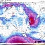
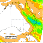
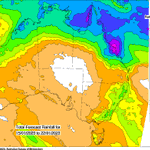

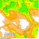
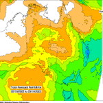

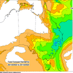
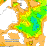
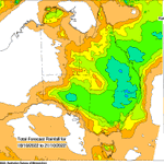
#Maryborough #HerveyBay #FraserIsland Tropical low now forming 1004hpa dropping to 1002hpa with clockwise winds out to 300nm
was detected near Mount Mee and Wamuran. This thunderstorm is slow moving.
126mm in 2 hours at Upper Caboolture.
Severe Thunderstorm Warning - Southeast Queensland
For people in parts of Moreton Bay and Somerset Council Areas.
Issued at 9:54 am Tuesday, 30 January 2024.
INTENSE RAINFALL WEST OF CABOOLTURE.
The Bureau of Meteorology warns that, at 9:50 am, a VERY DANGEROUS THUNDERSTORM
QLDincidents retweeted

.@QldFES performed 13 swiftwater rescues overnight, as 300mm of rain battered areas of Central and South East Queensland.
More than 30 roads have been closed in the region, with several schools also forced to close their doors for at least a day.
Emergency alerts have been issued for the Lockyer Valley, areas west of Brisbane, and for the Western Downs.
The South East is expected to have conditions improve over the coming days, but areas of inland Queensland are being told to continue to prepare for a deluge.
Wednesday, which may have an impact on which areas could expect the heaviest rainfall.
A separate Severe Thunderstorm Warning will be issued if very dangerous thunderstorms with intense rainfall are detected.
which may lead to DANGEROUS AND LIFE-THREATENING FLASH FLOODING is also possible over the warning area with six-hourly rainfall totals between 150 mm to 200 mm.
There is some degree of uncertainty around the exact position and movement of the surface trough during Tuesday and
FLASH FLOODING is forecast for areas north of about Toowoomba, Ipswich and Beenleigh, east of Dalby, and south of Cherbourg and Maryborough from early Tuesday morning, including Brisbane. Six-hourly rainfall totals between 80 mm to 120 mm are likely.
Locally INTENSE RAINFALL
FROM EARLY TUESDAY
Weather Situation:
A surface trough over southeast Queensland is expected to sharpen during Tuesday, then gradually move north during Wednesday, which will enhance the already very moist onshore flow over the region.
HEAVY RAINFALL which may lead to
Severe Weather Warning
for HEAVY, LOCALLY INTENSE RAINFALL
For people in parts of Wide Bay and Burnett, Darling Downs and Granite Belt and Southeast Coast Forecast Districts.
Issued at 4:23 pm Monday, 29 January 2024.
HEAVY, LOCALLY INTENSE RAINFALL OVER SOUTHEAST QUEENSLAND
to Burdekin Falls Dam
Burdekin River downstream of Burdekin Falls Dam
Don and Proserpine Rivers
Pioneer River
Comet and Nogoa Rivers
Connors, Isaac and Styx Rivers and Plane Creek
Catchments likely to be affected include:
Tully River
Murray River
Herbert River(Major flood warning current due to recent rainfall)
Black River
Ross and Bohle Rivers
Haughton River
Belyando and Suttor Rivers to Burdekin Falls Dam
Cape River to Burdekin Falls Dam
Burdekin River
River level rises, including widespread minor to major riverine flooding, is possible from Thursday. In addition, localised flooding, including flash flooding, is likely. Flooding is also likely to result in disruption to transport routes and isolation of some communities.
Widespread rainfall is likely in the Flood Watch area from overnight Wednesday into Thursday. The heaviest rainfall is forecast during Thursday and Friday.
Refer to the Tropical Cyclone Advice for the latest information on the developing tropical cyclone.
by the Flood Watch will be reassessed and updated daily based on the latest rainfall and storm surge forecasts.
Catchments across the North Tropical Coast are wet following rainfall over recent weeks, whilst catchments further south in the Flood Watch area are moderately dry.
Tropical Cyclone approaches the coast, abnormally high tides are likely.
There is potential for heavy rainfall to extend further south and inland, including to South East Queensland catchments later in the week, depending on the movement of the weather system. The area covered
A tropical low in the northern Coral Sea is likely to develop into a Tropical Cyclone during Tuesday and move towards the Queensland coast over the next few days.
Widespread heavy to locally intense rainfall is likely across the Flood Watch area from late Wednesday. As the
Initial Flood Watch for coastal catchments between Tully and St Lawrence
Issued at 2:38 pm EST on Monday 22 January 2024
Flood Watch Number: 1
MINOR TO MAJOR FLOODING LIKELY TO DEVELOP FROM THURSDAY
QLDincidents retweeted
Chances of a tropical cyclone forming off the QLD coast have increased dramatically, with the @BOM_Qld labelling the low tropical system "extremely unpredictable".
Tropical low 05U now has a 55% chance of becoming a cyclone, and carries the potential to hit the same areas that Tropical Cyclone Jasper ravaged a month ago.
"Whatever these systems do, whether they deepen or not … we’re still in the monsoon season, wet weather is still the forecast,” Senior Meteorologist Miriam Bradbury said.
If 05U does develop into a cyclone, there is potential that it could also combine with a monsoon trough that is still developing over the Gulf of Carpentaria and Cape York Peninsula.
The BOM is unsure of an exact time frame, or areas that could be affected, but expects further developments early next week.
