

#GIS volunteers providing early #situationalawareness to the #firstresponder and #emergencymanager communities using #geospatial #technology.
United States
Joined July 2026
- Tweets8
- Following27
- Followers12
- Likes1
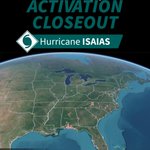


Big thanks to all the #PhotoMappers volunteers who supported the activation for hurricane #isaias. Volunteers mapped 249 photos and videos!
Data links in bio.
#geospatial #publicsafetyGIS #emergencymanagement #volunteerGIS #situationalawareness #disasterresponse

#PhotoMappers is now activated for hurricane #Isaias. Tag us in posts that show storm damage and flooding. Visit our Photo Gallery to see the mapped photos and videos of storm damage throughout the Gulf Coast and the Southeast.

Grateful for the recognition & to our incredible volunteers and Admin Team who make #PhotoMappers possible. Every photo mapped helps turn imagery into actionable geospatial intelligence when communities need it most. 🗺️📸

We’re honored to announce that @Photo_Mappers has been recognized with the High Impact Community Solutions Award at the 2026 GeoGov Summit!
Read more here: linkedin.com/feed/update/urn…
#GISCorps #GPN #GeoGovSummit #PublicSafetyGIS #EmergencyManagement #VolunteerGIS #DisasterResponse

Our #PhotoMappers activation supporting Hawaiʻi & FEMA Region 9 after Hurricane Lowell is complete!
Our AMAZING volunteers mapped 97 photos in just 3 days, helping reveal impacts across multiple islands.
More in bio
#Geospatial #PublicSafetyGIS #VolunteerGIS #DisasterResponse

#PhotoMappers is now activated! Visit our Photo Gallery to see the mapped photos and videos of storm damage in Hawaii caused by Hurricane Lowell

Our #PhotoMappers activation supporting Hawaii & FEMA Region 9 after Hurricane Lala has concluded. Our team mapped 68 storm-damage photos, helping provide clearer situational awareness.
Explore the Photo Gallery in the link in bio.
#HurricaneLala #StormDamage

Did you miss our webinar?
Watch it full on GPN's YouTube Channel here: tinyurl.com/ytv49xnf
Join us at GPN's #climate and #communityresilience committee #webinar series to learn about #PhotoMappers! This presentation will demonstrate how we provide early #situationalawareness.
Reg link: tinyurl.com/photomappers
@URISA @GISCorps @napsgfoundation
