

Official account of the Photogrammetric Vision Laboratory of the Department of Civil Engineering and Geomatics of Cyprus University of Technology
Limassol, Cyprus
Joined August 2018
- Tweets146
- Following277
- Followers175
- Likes129


Photogrammetric Vision Lab retweeted

Thanks a lot SPECTRUM for giving me the opportunity to share my experiences in #underwater CH #3dmodeling. It is always a joy to inspire young professional on the field sc.isprs.org/media/vwumrw33/… @CyUniTech @ISPRS_SC @UNESCO_DCH_ERA

For those interested in underwater benchmark datasets, please visit the webpage of our new project Nautilus nautilus-isprs.fbk.eu/about-… funded by #ISPRS Scientific Initiatives 2023 program

Getting ready for #Mazotos shipwreck excavation period 2023. The #BlueRoboticsROV of @CyUniTech is under preparation.


Photogrammetric Vision Lab retweeted

ENGINEER members have visited the UNESCO World Heritage site of Timios Stavros Byzantine Church in Pelendri village, Limassol, to support the documentation of the monument through a series of advanced surveying instruments.

Photogrammetric Vision Lab retweeted
CUT members had the opportunity to work on the data collected the day before at the Tombs of the Kings. Laser scanner registration and cleaning the noise, orthophoto production of the low altitude cameras, GNSS Rinex correction, cross-sections in a CAD environment, and many more!

Photogrammetric Vision Lab retweeted
First Workshop and Summer School of the ENGINEER project! Read More engineer-twinning.eu/2023/06…

Photogrammetric Vision Lab retweeted

An interesting talk by Dr. Dimitrios Skarlatos (@phvislab) led to the end of the @honor_frost #Cyprus Regional Development #Photogrammetry Workshop! More to come!
@HffLebanon @cmmicyprus @felix_pedrotti @DrLucyBlue
#maritimearchaeology #buildcapacity

Photogrammetric Vision Lab retweeted

📣 We are organizining an #ISPRS #Underwater #Mapping Workshop -#Geospatial techniques for underwater documentation, mapping and #monitoring- in the context of ISPRS Geospatial Week 2023! Follow the link for more!
🔗gsw2023.com/index.php/projec…
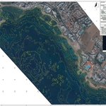
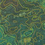
This is the expected quality of alignment, when SBES data are properly georeferenced and the Orthophoto is created using water refraction corrected photos. SBES by #TakisSartampakos, orthophoto by @PhVisLab @3DeepVision #coastal #trueopticalbathymetry


Photogrammetric Vision Lab retweeted

🎉Glad to present our 1st #Drones #webinar which will explore the state-of-the-art and #applications of drones #technologies!
👥Chairs: Prof. González-Aguilera & Dr. Rodríguez-Gonzálvez
🗓️Save the date: 30 June 2022 - 10:00am CEST
👉 Register for free at drones-1.sciforum.net/

An informative short video about wine trade, created as part of the VR underwater serious game

Interested in ancient containers (amphorae)? Then this short 360 video is for you! youtube.com/watch?v=Pdb-eXao…
Photogrammetric Vision Lab retweeted
Thank you very much for the invitation. Looking forward to contribute with my presentation in this
@Drones_MDPI webinar @CyUniTech @phvislab
drones-1.sciforum.net

Very happy and proud co-editing this SI with my PhD supervisor. We are now open for submissions!
The Use of UAV platforms for Cultural Heritage Monitoring and Surveying mdpi.com/si/121820 #mdpiremotesensing via @RemoteSens_MDPI

Photogrammetric Vision Lab retweeted
Very proud that our project is still attracting attention, two+ years after its completion.

Underwater🌊cultural heritage⚓️offers the chance to explore sites that bridge civilizations🗺️
That's why the @imareculture project🇪🇺wants to bring unreachable underwater culture within #digital reach💻 & offer methods to build European identity🫂
🔗imareculture.eu/

Photogrammetric Vision Lab retweeted

Tutorial: #Underwater #photogrammetry - methods & challenges for mapping & monitoring
When: 5th June 2022
Where: XXIV @isprs congress, Nice, France
Duration: 4 hours
Organizer: www2.isprs.org/commissions/c…
Registration: isprs2022-nice.com/index.php…
#rov #odometry #SLAM


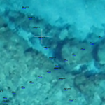
Our most recent project for #coastal #trueopticalbathymetry covered 4km of coastline, using archive (2019) Microsoft (VEXCEL) aerial photos with 0.10m GSD


Documenting ancient Amathounta port both from air and underwater, was a very challenging project with depth varying from 0.60m to 3.5m. Great teamwork @MMarelab @PAgrafiotis @Massi_UW #trueopticalbathymetry #coastalprotection #dronemapping


Drone survey of Ayios Ermogenis church in Cyprus, partial results from diploma thesis skfb.ly/oqYYN