

Puerto Rico Climate & Weather News. Current And Past Events.
- Tweets124K
- Following938
- Followers6K
- Likes33.8K


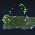


ALT This graphic displays a special weather statement plotted on a map. The statement is in effect until 3:15 PM AST. The statement includes Manatí PR, San Sebastián PR and Utuado PR. AN AREA OF STRONG THUNDERSTORMS WILL IMPACT NORTHERN INTRIOR AND NORTHWESTERN PUERTO RICO UNTIL 315 PM AST. The threats associated with this storm are wind gusts up to 40 MPH and no hail is expected. Seek shelter in a sturdy structure until the storm passes.

ALT National Weather Service San Juan graphic showing a Special Weather Statement for North Central, Central Interior, Northwest, West Interior, and West PR, valid until Mon Oct 19, 3:15 PM AST. The highlighted area identifies where locally hazardous weather may occur; the graphic describes the specific threat. | Gráfico del Servicio Nacional de Meteorología en San Juan que muestra un Comunicado Especial del Tiempo para Norte Central, Interior Central, Noroeste, Interior Oeste, and Oeste PR, vigente hasta lun, 19 oct, 3:15 p. m. AST. El área resaltada identifica dónde pueden ocurrir condiciones localmente peligrosas; el gráfico describe la amenaza específica.

ALT This graphic displays a flash flood warning plotted on a map. The warning is in effect until 4:15 PM AST. The warning includes Carolina PR, Guaynabo PR and Trujillo Alto PR. This warning is for Northern Carolina in Puerto Rico, Northern Guaynabo in Puerto Rico, San Juan in Puerto Rico and Trujillo Alto in Puerto Rico. Avoid walking or driving through flood waters! Move immediately to higher ground! There are 559,131 people in the warning along with 169 schools and 22 hospitals.

ALT Este gráfico muestra la localización en el mapa de un aviso de inundación repentina. El aviso estará en efecto hasta las 4:15 PM AST. El aviso incluye a Carolina PR, Guaynabo PR, Trujillo Alto PR. El aviso incluye el norte de Carolina en Puerto Rico, el norte de Guaynabo en Puerto Rico, San Juan en Puerto Rico y Trujillo Alto en Puerto Rico. ¡Evite caminar o manejar su vehículo a través de áreas inundadas! ¡Muévase a un terreno más alto inmediatamente! Hay 559,131 personas bajo este aviso incluyendo 169 escuelas y 22 hospitales.


ALT National Weather Service San Juan graphic showing a Flood Advisory for Carolina, Guaynabo, San Juan, and Trujillo Alto, valid until Mon Oct 19, 4:00 PM AST. The highlighted area identifies where minor flooding is possible or occurring, especially on roads and in urban, low-lying, or poor-drainage locations. | Gráfico del Servicio Nacional de Meteorología en San Juan que muestra una Advertencia de Inundaciones para Carolina, Guaynabo, San Juan, and Trujillo Alto, vigente hasta lun, 19 oct, 4:00 p. m. AST. El área resaltada identifica dónde son posibles o están ocurriendo inundaciones menores, especialmente en carreteras y áreas urbanas, bajas o de pobre drenaje.

ALT National Weather Service San Juan graphic showing a Flood Advisory for Lares and San Sebastián, valid until Sun Oct 18, 5:45 PM AST. The highlighted area identifies where minor flooding is possible or occurring, especially on roads and in urban, low-lying, or poor-drainage locations. | Gráfico del Servicio Nacional de Meteorología en San Juan que muestra una Advertencia de Inundaciones para Lares and San Sebastián, vigente hasta dom, 18 oct, 5:45 p. m. AST. El área resaltada identifica dónde son posibles o están ocurriendo inundaciones menores, especialmente en carreteras y áreas urbanas, bajas o de pobre drenaje.

ALT National Weather Service San Juan graphic showing a Flood Advisory for Moca, and San Sebastián, valid until Sat, Oct 17, 6:00 PM AST. The highlighted area identifies where minor flooding is possible or occurring, especially on roads and in urban, low-lying, or poor-drainage locations. | Gráfico del Servicio Nacional de Meteorología en San Juan que muestra una Advertencia de Inundaciones para Moca, and San Sebastián, vigente hasta sáb, 17 de oct, 6:00 PM AST. El área resaltada identifica dónde son posibles o están ocurriendo inundaciones menores, especialmente en carreteras y áreas urbanas, bajas o de pobre drenaje.

ALT National Weather Service San Juan graphic showing a Flood Advisory for Lares and Utuado, valid until Sat Oct 17, 6:00 PM AST. The highlighted area identifies where minor flooding is possible or occurring, especially on roads and in urban, low-lying, or poor-drainage locations. | Gráfico del Servicio Nacional de Meteorología en San Juan que muestra una Advertencia de Inundaciones para Lares and Utuado, vigente hasta sáb, 17 oct, 6:00 p. m. AST. El área resaltada identifica dónde son posibles o están ocurriendo inundaciones menores, especialmente en carreteras y áreas urbanas, bajas o de pobre drenaje.

ALT This graphic displays a special weather statement plotted on a map. The statement is in effect until 5:00 PM AST. The statement includes Manatí PR, Florida PR and Imbéry PR. The threats associated with this storm are wind gusts up to 40 MPH and pea sized hail. Seek shelter in a sturdy structure until the storm passes.

ALT National Weather Service San Juan graphic showing a Flood Advisory for Camuy, Hatillo, Isabela, and Quebradillas, valid until Mon Oct 12, 5:00 PM AST. The highlighted area identifies where minor flooding is possible or occurring, especially on roads and in urban, low-lying, or poor-drainage locations. | Gráfico del Servicio Nacional de Meteorología en San Juan que muestra una Advertencia de Inundaciones para Camuy, Hatillo, Isabela, and Quebradillas, vigente hasta lun, 12 oct, 5:00 p. m. AST. El área resaltada identifica dónde son posibles o están ocurriendo inundaciones menores, especialmente en carreteras y áreas urbanas, bajas o de pobre drenaje.

ALT National Weather Service San Juan graphic showing a Flood Advisory for Bayamón, Cataño, Dorado, Guaynabo, San Juan, and Toa Baja, valid until Sun Oct 11, 3:00 PM AST. The highlighted area identifies where minor flooding is possible or occurring, especially on roads and in urban, low-lying, or poor-drainage locations. | Gráfico del Servicio Nacional de Meteorología en San Juan que muestra una Advertencia de Inundaciones para Bayamón, Cataño, Dorado, Guaynabo, San Juan, and Toa Baja, vigente hasta dom, 11 oct, 3:00 p. m. AST. El área resaltada identifica dónde son posibles o están ocurriendo inundaciones menores, especialmente en carreteras y áreas urbanas, bajas o de pobre drenaje.


