

York County Public Information Officer. Posting news, events and information from York County Government.
- Tweets17.5K
- Following422
- Followers7K
- Likes2.5K


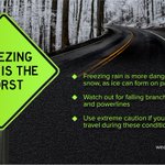





ALT Winter Storm Watch in effect Saturday morning through early Monday afternoon across the entire NWS GSP forecast area (extreme northeast Georgia, Upstate of South Carolina, and western North Carolina. Heavy mixed precipitation possible. Total snow and sleet accumulations between 1 and 6 inches and ice accumulations between four tenths and one inch possible. Significant ice accumulation on power lines and tree limbs may cause widespread and long-lasting power outages. Ice and snow covered roadways will become treacherous and impassable. Widespread power outages are likely due to the weight of the ice and snow on tree limbs and power lines. The outages could last for days in some areas. The hazardous conditions could impact the Monday morning commute. Highest snow and sleet accumulations are possible north of I-40. Highest ice accumulations are possible across the southern mountains of North Carolina, the mountains of northeast Georgia, and the mountains of South Carolina.

ALT Winter Storm Watch means be prepared. A Winter Storm Watch is issued when heavy snow, sleet, or freezing rain is possible. Be prepared to adjust travel plans in case a Warning is issued. Winter Storm Warning means take action! A Winter Storm Warning is issued when heavy snow, sleet, or freezing rain is expected. Travel will become dangerous. Delay or adjust travel plans until conditions improve.


ALT A thunderstorm watch is issued when a severe thunderstorm i possible. Stay tuned to forecast updates, monitor sky conditions, and know where to take shelter. A severe thunderstorm warning is issued when a it's happening or about to happen. Take shelter immediately.

ALT Getting a warning could save your life. Having multiple ways to receive a warning or alert is critical to safety. These can be done with activating your wireless emergency alerts on your mobile device, weather apps, texts, emails, social media or from your friends/family.


