

Director of Henry Spatial Analysis | Professional Geographer | Writing elsewhere (https://xitter.cf/t.co/A4hCT5Im4v and 🦋)
Seattle
Joined September 2012
- Tweets7
- Following743
- Followers1.7K
- Likes2.8K

Pinned Tweet
I'm leaving Twitter — you can find me on Linkedin (linkedin.com/in/nathenry), Bluesky (@nathenry.com), my business website (henryspatialanalysis.com), and my blog (nathenry.com). See you later!
Today I'm launching Close, an interactive map that shows walkable, bikeable, and transit-friendly neighborhoods across every block in the United States. Try it out: close.city/
Seattle's cherry and plum blossom season is here again! If you want to find blooms near you, I made a map showing over 12,000 flowering cherries around the city🌸 nathenry.com/writing/2023-03…

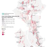
A striking finding: Seattle's Mandatory Housing Affordability program was supposed to create 17k more housing units (incl. 5,600 affordable) over 20 years. Instead, this study finds that the program led to ~4,300 FEWER units being permitted in MHA neighborhoods since 2019.

ALT Map showing Mandatory Housing Affordability (MHA) zones in pink across Seattle. Downtown, Uptown, South Lake Union, and University District were subject to MHA but were not included in this study.

This is a potentially disturbing result about the possible effects of upzoning with additional requirements in Seattle papers.ssrn.com/sol3/papers.…

I'm thrilled to announce that I am founding Henry Spatial Analysis, a mission-driven geography consulting firm focused on health and urban sustainability!
Full announcement here, then a short 🧵: henryspatialanalysis.com/new…

ALT Header showing maps and graphics from past spatial analysis projects
I made an interactive map showing every single block in Seattle where you can live within walking distance of daily necessities:
nathenry.com/writing/2023-02…
