

The State Weather Risk Communication Center at @UAlbany is a partnership with the New York State Division of Homeland Security and Emergency Services.
Albany
Joined March 2023
- Tweets259
- Following118
- Followers1.3K
- Likes258




Pinned Tweet
We finished our first ever SWRCC newsletter! Click the link to learn all about our center and what we've been up to these past 2 years! heyzine.com/flip-book/e65420…

This evening, October 16th, there is an elevated risk for damaging winds. Stay weather aware, especially between 4-8 PM as the line of storms tracks across eastern NY.

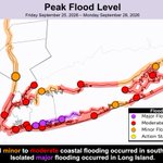
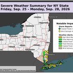
This map of hazards and impacts from the nor'easter makes it pretty easy to see what part of the state was most affected (hint: downstate).
Why the wind damage north of NYC, where gusts were "only" about 45 mph? The winds were from the northeast, which is a rare wind direction.


A Nor’easter will bring prolonged rain, strong winds, and dangerous storm surge to southeastern NY. Coastal flooding is likely across the lower Hudson Valley, NYC, and Long Island. Strong winds combined with rain may cause hazardous travel, tree damage, and power outages.

While #NYC and Long Island managed to avoid significant rainfall yesterday, parts of Westchester County were not so lucky. 10 flood reports were noted yesterday morning (with one near Buffalo). Also in upstate NY, severe thunderstorms produced scattered wind damage.

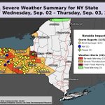
Yesterday was quite an active weather day for NYS, with double digit tornado warnings and triple digit storm reports! Here is the full breakdown:


⚠️ A Tornado Watch has been issued for western and central NY. Storms will be strongest this evening through overnight. DAMAGING STORMS ARE POSSIBLE WHEN SLEEPING. MAKE SURE WEATHER ALERTS ARE TOGGLED ON IN YOUR PHONE SETTINGS. Nocturnal tornados are twice as likely to be fatal.

Heads up: Western NY has been upgraded to an "Enhanced Risk" (level 3 of 5) for severe thunderstorms this PM (9/2). Damaging winds, heavy rain, large hail, and isolated tornadoes are the main hazards. An isolated strong tornado cannot be ruled out. Stay weather aware.

Yesterday was a busy weather day in NY!
There were 5 tornado warnings, 31 severe thunderstorm warnings, and 9 flash flood warnings. There were also numerous wind, hail, and flooding storm reports as of this morning. We are also waiting on the designation of at least one tornado.

We're keeping a close eye on Thursday's forecast. Severe thunderstorms and flash flooding are possible.

Impressive lake-enhanced precipitation for August-- little preview of what's to come this winter? 👁️👄👁️

Heads up #NYC: potentially significant flooding is possible over the remainder of the evening. Stay tuned to @NWSNewYorkNY and keep your phone at hand to receive update regarding any flooding.


A fairly rare "moderate" risk of flash flooding has been issued by @NWS for the #NYC area (the red area). Did you know our community stats tool now allows you to examine population statistics and building information within these outlooks? Try it out: nyswrcc.org/community-stats

Our next "Introduction To Weather Interpretation" class is underway! This time we're back at @UAlbany, for our fourth installment of this class. Over the next two days, participants will get a crash course in how to gather and interpret weather information.

Our partners at the @nysmesonet have recorded some truly eye-opening rainfall totals over the past 1-2 days. Numerous locations in the #Catskills, Albany area, and Hudson Valley have recorded over 5" of rain, with several stations over 8" - most within the past 24 hours.

We're nearing 10" of rain in Schodack, NY. This broke the station's all time 24-hour rainfall record, and may break the 24-hour rainfall record across all NYS Mesonet stations if it exceeds 9.40", which appears likely. Rain will likely persist in the area into the evening.

There are currently almost one million New Yorkers currently under a flash flood warning (seen in brown here), which will make morning travel quite hazardous in spots. The city of Albany is under a warning tagged "considerable", denoting a higher level of local concern.


Significant flooding likely ongoing across parts of central #NYC. @NWS has given this flash flood warning a "Considerable" designation.
The left map shows areas that have exceeded the city's sewer capacity of 1.75". The right map shows why: up to 2.51" of rain in that time!


Flash Flood Warning including Queens NY until 3:30 PM EDT

ALT This graphic displays a flash flood warning plotted on a map. The warning is in effect until 3:30 PM EDT. The warning includes Queens NY. This warning is for Kings (Brooklyn) County in southeastern New York and Queens County in southeastern New York. Avoid walking or driving through flood waters! Move immediately to higher ground! There are 1,973,744 people in the warning along with 394 schools and 13 hospitals.