
Official Twitter account for the National Weather Service Wichita. Details: https://xitter.cf/t.co/rmH0qnntGq
- Tweets51K
- Following257
- Followers45.9K
- Likes7.3K
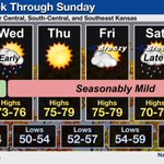







ALT Graphic highlighting the daily forecast through next weekend. Forecast high temperatures are mostly in the 70s, with mostly 50s for overnight lows. Breezy south winds will prevail Friday and Saturday with some light showers today-tonight and again next weekend.

ALT Graphic highlighting the daily forecast for combined central, south-central, and southeast Kansas tonight through Saturday. Forecast high temperatures are mostly in the 70s, with mostly 50s for overnight lows. Breezy south winds will prevail Friday and Saturday.


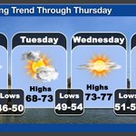
ALT Graphic highlighting a warming trend from near normal Today and Tuesday with highs in the upper 60s to lower 70s. Then on Wednesday and Thursday, highs will climb into the mid and upper 70s. Lows are forecast to be in the upper 40s through Tuesday with 50s on Wednesday and Thursday. Mostly sunny skies are expected through this period.

ALT Graphic highlighting a warming trend from near normal on Monday and Tuesday with highs in the upper 60s to lower 70s. Then on Wednesday and Thursday, highs will climb into the mid and upper 70s. Lows are forecast to be in the upper 40s through Tuesday with 50s on Wednesday and Thursday. Mostly sunny skies are expected through this period.

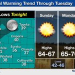
ALT Graphic highlighting a warming trend from near normal today and Monday with highs climbing into the mid and upper 70s by the middle of the week. Lows are forecast to be in the 40s through Tuesday with 50s by Wednesday.

ALT Tonight: clear with lows in the mid 30s to low 40s. Sunday: Mostly sunny with highs in the mid 60s and lows in the mid 40s. Monday: Mostly sunny with highs in the upper 60s and lows in the low 50s. Tuesday: Partly cloudy with highs in the upper 60s to low 70s.

ALT Forecast through Monday with a gradual warming trend and breezy southerly winds returning on Sunday and Monday. Seasonably mild temperatures are expected to return by Monday with high temperatures around 70 and lows in the 40s.

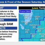
ALT Saturday morning temps will range from 29 in Russell to 37 in Coffeyville.

ALT Forecast through Wednesday for central, south-central, and southeast Kansas. High temperatures in the 50s Today and Saturday with gusty north winds Today. Breezy south winds will return on Sunday, with forecast high climbing into the 70s next week. Overnight lows are in the 30s Tonight and Saturday night, warming into the 40s and 50s thereafter.

ALT Graphic showing lows in the upper 20s to lower 30s across much of the region tonight into Saturday morning.

ALT Graphic showing lows in the upper 20s in western Kansas to the lower 30s across the rest of the area.

ALT Forecast through Wednesday for central, south-central, and southeast Kansas. High temperatures in the 50s Friday and Saturday with gusty north winds Friday. Breezy south winds will commence by Sunday, with forecast high climbing into the 70s next week. Overnight lows are in the 30s Friday night and Saturday night, warming into the 40s and 50s thereafter.

ALT Rain chances today range from 50 to 80 percent across central and eastern Kansas. Forecast high temperatures range from upper 50s over central Kansas, to 70s over far southeast Kansas.

ALT Forecast through Sunday. AM Thunderstorms and breezy conditions for Thursday. Breezy and partly cloudy conditions for Friday. Mostly sunny to partly cloudy skies for Saturday and Sunday. Highs in the 50s and 60s are expected through the weekend with lows in the 30s and 40s.

ALT Graphic with two maps. One showing a flood watch in effect for portions of south-central and southeast Kansas. The other image show expected additional rainfall. Widespread amounts up to 1 inch are expected with up to 2 inches possible for far southeast Kansas.
