

NLI Weather is the weather division of @BallState's award winning broadcast news program, NewsLink Indiana (@NewsLink_BSU).
Muncie, Indiana
Joined September 2012
- Tweets6.5K
- Following257
- Followers706
- Likes786



Pinned Tweet
Our mission is to keep the @BallState community, along with surrounding counties, safe and informed of impeding weather. Follow us on Twitter, Facebook, and Instagram, @NLIWeather!
#INwx

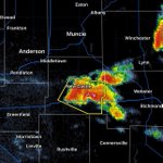
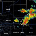
A severe thunderstorm warning has been issued for a western Wayne County until 6:45 PM. This includes the towns of Dalton, Hagerstown, and Cambridge City. Wind gusts up to 60 mph and 1 inch hail are associated with this storm. #INwx

A severe thunderstorm warning has been issued for the southeastern portion of Henry County until 6:45 PM. This includes the city of New Castle. Wind gusts up to 60 mph and 1 inch hail are associated with this storm. #INwx

A severe thunderstorm warning has been issued for a small portion of eastern Wayne County until 5:45 PM. This includes the city of Richmond. Wind gusts up to 60 mph and quarter-sized hail are associated with this storm. #INwx

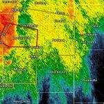
A tornado warning has been issued for Delaware County 6:00 PM… Ball State University Campus is in this area. Radar indicated rotation is the reason for this warning. Make sure to get to your safe space and take shelter immediately. #INwx

A flash flood EMERGENCY is in effect for Madison County, Delaware County, Henry County, and Wayne County until 9:15 PM. This is an extremely dangerous and life-threatening situation. Do not attempt to travel unless you are fleeing a flooded area. #INwx

A flash flood warning has been issued for Grant County, Blackford County, and Jay County until 3:00 PM. These areas have seen 2 to 6 inches of rain over the past 24 to 36 hours. An additional 1 to 3 inches of rainfall are possible as showers and thunderstorms continue to develop.

Life threatening flash flooding of low water crossings, small creeks and streams, urban areas, highways, streets and underpasses. This is an extremely dangerous and life-threatening situation. Do not attempt to travel unless you are fleeing a flooded area. #INwx (2/2)
A flash flood EMERGENCY has been issued for Delaware County until 4:15 PM. This Muncie, Yorktown, Chesterfield, Albany, Eaton, Daleville, Gaston, Selma, Ball State University. Between 3 and 6 inches of rain have fallen and an additional 2 inches are possible. (1/2)

The flash flood warning has been extended for Madison County, Delaware County, Randolph County, Henry County, and Wayne County until 1:00 PM. Between 3 and 6 inches of rain have fallen and an additional 1.5 inches is possible in the warned area. #INwx

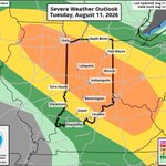
The Storm Prediction Center has placed our viewing area in an Enhanced risk (level 3/5) for today’s storms. Severe storms capable of strong wind gusts and large hail are expected across our area through tonight. Tornado’s are always possible with storms like these. #INwx


A severe thunderstorm warning has been issued for Jay County until 5:30 PM. Wind gusts up to 60 mph and quarter-sized hail are associated with this storm. #INwx

A severe thunderstorm warning has been issued for Madison County and Delaware County until 6:00 PM in addition to the approaching tornado warning in Grant and Blackford County. Wind gusts up to 60 mph and quarter-sized hail are associated with this storm. #INwx

A tornado watch has been for our area until 1:00 AM. Primary threats include a few tornadoes with some becoming intense. Widespread damaging winds and isolated significant gusts to 80 mph are likely. Isolated large hail events to 2.5 inches in diameter are possible. #INwx

A severe thunderstorm warning has been issued for most of Jay County until 9:45 PM. Wind gusts up to 60 mph and quarter-sized hail are associated with this storm. #INwx

The Storm Prediction Center has placed most of our viewing area in a Slight risk (level 2/5) for today’s storms.
Strong winds, hail, and tornadoes are possible with these lines of storms that will begin popping up in our area around 8 p.m. this evening.
#INwx


A severe thunderstorm warning has been issued for the southwest corner of Madison County until 10:00 PM. Wind gusts up to 60 mph and quarter-sized hail are associated with this storm. #INwx

A severe thunderstorm watch has been issued for our entire viewing area until 10:00 PM tonight. The primary threats include isolated very large hail events up to 1 inch in diameter and scattered damaging wind gusts up to 70 mph. A tornado or two is also possible. #INwx

A severe thunderstorm warning has been issued for the southern half of Madison County and a small part of Delaware County until 3:30 PM. This includes the city of Anderson. Wind gusts up to 60 mph and quarter-sized hail are associated with this storm. #INwx

The Storm Prediction Center has placed our viewing area in a Slight risk (level 2/5) for tonight’s storms. There will be multiple lines of thunderstorms that will move through this afternoon.
Strong winds, hail and even a few tornadoes are possible with these storms.
#INwx


A severe thunderstorm warning has been issued for Grant County until 11:00 PM. This includes the cities of Marion and Gas City. Wind gusts up to 60 mph and quarter-size hail are associated with this storm. #INwx
