

The weather source in the N.C. Sandhills for #Weatherhounds everywhere. If cancer's gonna kill me, it'll have to try harder #FightLikeHell True son of Clemson.
Fayetteville NC
Joined April 2009
- Tweets68.9K
- Following1.1K
- Followers5.4K
- Likes22.5K






Chick Jacobs retweeted
❗️Sunday 10/18/26 Nor’Easter Update
🌀 Not much change in the forecast to report since yesterday. A Nor’easter off the NC Coast will continue to strengthen Sunday through early to mid-week.
💨🌊 This slow-moving system will bring strong winds, high waves, coastal flooding, and extremely dangerous marine conditions well into next week.
🚨 Conditions will continue to deteriorate though the weekend, and the greatest coastal impacts are expected on the ocean side of the Outer Banks.
⚠️ The mandatory evacuation order for Hatteras Island visitors remains in effect. Ferry service is suspended with only Southport/Fort Fisher running.
📌 Full Sunday Hazardous Weather Update: ReadyNC.gov/weather
#ReadyNC #ncwx
As my #Weatherhound partner in crime @DaDaBuh says: Watch late-season stalled fronts for shenanigans.
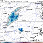
The Euro and #Club384 team up for this example. Entertainment purposes only. Remember the mantra #OMOR.

The wind may not reach yesterday's top gust of 33 mph, but FAY will still be breezy as high pressure continues to build over the region.
Yesterday's high in FAY, 57 degrees, was one degree away from tying the "low-high" record for the dates. That was 56 degrees, back in 1991.
With plenty of sun, we may actually top 60 degrees in the city today, depending on how cold the north wind is.
Today's high in FAY was 72 degrees. I say "was" because that was the temp at midnight. We're not getting anywhere close to that temperature for the rest of the weekend.
The rain moves out around lunchtime as north winds really kick in.

If you're in the Sandhills, the rain isn't going anywhere for a while. If you can, have another cup of coffee and watch the raindrops.

FAY didn't quite reach 90 today, snapping the city's record setting streak.
The wind will shift to the north and pick up before sunrise, and we may well not see the high side of 60 degrees until Tuesday -- if then.
Chick Jacobs retweeted
⚠️A state of emergency has been issued for Hatteras Island and a mandatory evacuation order for visitors on Hatteras Island takes effect at 8 p.m. on Friday, October 16. Info at darenc.gov/storm. Long duration Nor'easter impacts becoming increasingly likely. #ncwx


The Sandhills will make a run toward an unprecedented hat trick of 90-degree days in mid-October today.
Then, the bottom drops out overnight. FAY will see temperatures begin to slide toward sunset and just keep on sliding. 1/x

Saturday's north wind will be constant and blustery, continuing into the night. After a daytime high of maybe 60, the Sandhills will hunker down as temperature drop into the low to mid-40s. Wind chill readings return for the first time this fall.

If you can remember the last time FAY had back-to-back 90-degree days this late in October, congratulations! You should have your birthday picture in the paper with a conflagration of candles.
Until yesterday, it had been more than a century (1925) since it happened.
Chick Jacobs retweeted

🌪️ New this morning! The path has been extended for the Bonnie Doone/Fayetteville NC tornado.
Local Emergency Managers found additional damage along Sandstone Drive consistent with tornado damage which prompted the expansion. #NCwx

ALT Preliminary Damage Result for the confirmed Bonnie Doone/Fayetteville Tornado. Update 1, Tornado path has been extended to roughly 6 miles and occurred from approximately 11:56 am until 12:07 pm October 11, 2026.
Chick Jacobs retweeted

PEAK WEEK:
Leaf alert! Time to head to the High Country!
Peak color has either arrived or is quickly approaching for elevations at and above 5,000 ft in western NC.
Lower elevations are showing less color, but the next couple of weeks should get good there, too.

Meanwhile, #Club384 hasn't turned off the lights just yet. Trick or treat! This time, the storm remembers it left its wallet in Daytona and comes back for it.
Remember the mantra.
