

Archived account that explored Earth's sea ice, land ice, snow and permafrost.
- Tweets4.6K
- Following89
- Followers106K
- Likes575




ALT An aerial photograph of a glacier in mountainous terrain, flowing intoa frozen sea. There are bare rock peaks to the left of the image, and a few to the right, and a glacier with winding ridges cuts through them. At the bottom of the image is a flat white surface where ice covers the sea, broken up by icebergs trapped in it.


ALT A photo of the calving front of a glacier in Greenland, as seen from an airplane in 2017. The ice has broken off in a way to make the front heart-shaped, with ridges rippling in the ice behind it.

ALT The wing of NASA's DC-8 plane, seen out the window against a vivid sunset. The plane is flying over rugged Patagonian mountains, covered in glacial ice. Dark water carves thick channels between the snowy mountains. The sunset casts a faint pinkish glow over the entire scene, which is dimly lit. In the distance, the sunset paints in the sky in three distinct bands, dark purple near the horizon, peachy pink in the center, and a dusky blue higher up.


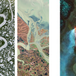
ALT The words "NASA ICE" spelled out in Landsat imagery of Earth from space. The N is lowercase, created by a green meandering river arching through a bright red landscape in an enhanced color image. The first A is capitalized, created by snow on a green field. The S is a river winding through green landscape dotted with small silver lakes. The second A is capitalized, created by a river delta branching out as it flows to the sea. The I is a straight line of lava burning bright orange against a green landscape, emitting a plume of smoke. The C is a caldera island, with the land at the 3 o'clock position sunk into the dark ocean. The E is capitalized, created by brown dirt exposed in a glacial alluvial plain.


ALT “Earth Day” is spelled out by satellite views of Earth features in the middle of the image. The “letters” are colorful, represented by views of water and land in shades of blue, brown, green, and even red. Underneath are the words “Earth Day” and “Celebrate Earth from space with NASA.” The “day” is written in a vibrant blue, while the rest of the words are white. The background of the poster is black. “National Aeronautics and Space Administration” is written at top left, “nasa.gov” is written at bottom left, and the NASA “meatball” logo appears at top right in black and white. Credit: NASA/USGS


ALT Satellite imagery in the background. The word "webinar" is shown on the left side, just above the webinar title, "Laser Altimetry Applications for a Changing World." Below that is the webinar's subtitle, "Working with ICESat-2 Bathymetry Data." The NASA Earthdata logo is in the lower left corner.

ALT A data visualization with a bright blue background and dots, representing height measurements taken by ICESat-2 of an ice sheet, high clouds, and low clouds. A vertical green line marks the satellite's 2 trillionth laser pulse. An inset map of Antarctica shows a green line from the interior of the continent, through a spot labeled Vanderford Glacier, and out into the southern ocean, locating data shown on the larger plot.
