

Senior Meteorologist and Storm Chaser for EUSM (European Storm Map) and Amateur Photographer.
North East, England
Joined December 2015
- Tweets651
- Following96
- Followers149
- Likes418




Pinned Tweet
It's been over a year since I took this... and it's still my favourite picture of all time! Feb 16th 2016 #Sunrise at #Saltburn #stormhour

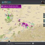
With active thunderstorm on ongoing in West France and Switzerland, i expect these systems to keep moving north deeper into southern Germany and more to develop. @EUStormMap

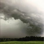
#eustorm Severe thunderstorm impacted Aachen, germany with flooding. Picture taken by Kevin Brendel – at Aachen, Germany

A lot of moisture feeding into Irmas eye it has shown on the recent Reconnaissance... Still shown to gradually deepen

BV Radar could be picking up winds near Irmas eye near 140mph as she nears keys west still trying strengthen! surge reported at 2ft atm!
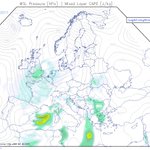
TSMs likely for the UK today with a chance of severe weather in W Bulgaria which could see some frequent lightning and heavy rain

AF307 Recon aircraft going back in to Irmas Northern Eyewall... Weakened over Cuba likely to restrengthen over open water before landfall

Sean O'Hare retweeted

No Q, interacting w/Cuba has temporarily affected #Irma
HOWEVER, once it turns north it could intensify further.
EXPECT A MAJOR HURRICANE
The Cuban mountains have definitely had an effect, with warm cloud showing around her South eastern eyewall and lack of moisture in eye
Recent Air recon data showing Irma at Category 3 wind speeds, i expect her to strengthen more as she goes into open water @TropicalTidbits

Hurricane Irma is struggling atm! Recon shows no moisture in the eye and very unorganised on satellite! still dont rule her out!


2 Major Hurricanes... wow! Joses eye is really showing off her stadium effect as the sun goes down! Fantastic images by GOES-16!

Air recon over Irma is showing a slight increase in winds... see what it says in the South Eastern eye wall and central pressure
Oh jose you have a beautifully structured eye! Air Recon doesnt show good news for the North Leeward Islands!
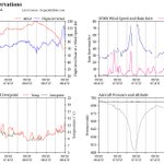
Hurricane Jose seems a lot more powerful than has been expected on the recent Recon Graph! Potential upgrade to Cat4 status?

(2) still a destructive force and with Ocean Temps at 30C could still potentially see it strengthen again over the next day... hope not
Irma being downgraded doesn't surprise me, on SAT images she seemed unorganised this morning and ERC... (1)
Hurricane Irma in a Eye-Wall replacement Cycle as it striked Turks and Caicos... could of reduced its strength abit as the eyewall passed!

Why do people provide false information... really fucks me off! Now we just look like idiots well done! xitter.cf/eustormmap/status/9059…

UPDATE we are being made aware that this video is actually from USVI yesterday... this is not Turk and Caicos! xitter.cf/eustormmap/status/9059…
Sean O'Hare retweeted

Forecast productivity (in red) for weather nerds during Irma's lifespan. 😉 #cantstopwatching
