
🌩️Meteorologist WCVB-TV Boston. 📺CBM Seal Holder. 🏍️Member NEMRR 👪Happily married father of 3 wonderful children 👶Grandfather to 4 amazing grandchildren
Boston, MA
Joined February 2010
- Tweets20.1K
- Following459
- Followers25.7K
- Likes2.2K
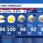




The extreme heat will last all the way into the weekend. There are chances for thunderstorms most days. The most likely is late Tuesday and again toward the weekend.

The hottest of the hot will be on Thursday. Humidity combined with the heat will make it feel like 110. Probably setting a record.

Get ready for some heat. Near record heat combined with high humidity will likely translate to Extreme Heat. A Watch has been issued but will likely be upgrade to a warning tomorrow. Take it easy.

It's going to get hot and humid next week. 90s and high humidity will lead to scattered afternoon thunderstorms by mid week

The weekend is basically rain free for most of us. On Saturday a few showers are possible along the South Coast and Cape. The showers on this map will pop up inland on Sunday afternoon, but they will be scattered at best. That why I say it will be dry for most of us.

With 2 rounds of rain on Friday we've made it an Impact Weather day. The showers on Saturday morning will be confined to the South Coast. A few pop-up showers for inland areas on Sunday, but it doesn't look like much of a threat. Warmer and more humid next week.

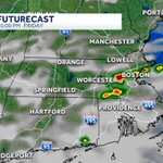
The second round of rain Friday will be in the afternoon/evening. It has more potential for strong to severe storms. Th biggest concern will be from 5-10pm. These will be scattered so not everyone will see rain.

I'm expecting 2 rounds of rain on Friday. This is the first one and this map is around 5am,. It's early and will be off shore by around 8am, Expect a few downpours to slow the early commute. ,

This is the area most likely to see strong to severe thunderstorms Friday afternoon/evening. Lightning and gusty straight-line winds are my biggest concerns.

After Friday the chances for rain this weekend are minimal. If we get rain on Saturday it looks more toward the South Coast, and Cape. Sunday is pop up afternoon showers and the best chance will be inland. A warming trend next week.

You may have heard about the heat wave in Europe. Here were the high temperatures today. Blistering heat and much of Europe has AC.

It looks like we have 2 chance for rain Friday. The first is with the warm front in the morning, the second is with the cold front in the afternoon. The afternoon storms could get strong, if it can develop. Several things have to come together to fire up the afternoon storms.
After a couple of nice summer days on Wednesday & Thursday, thunderstorms are possible on Friday. The showers threat on the weekend looks scattered. Showers Saturday along the south coast and pop-up showers Sunday afternoon. Still lots of dry time this weekend.

There is a thunderstorms threat on Friday. It looks to be arriving during the morning and that would help to prevent severe thunderstorms. A later arrival with afternoon heat and humidity could produce stronger storms.
Water temperatures are still in the 50s but Wednesday looks like a decent beach day. Pack lots of sunscreen.

The gray skies and showers will make for a cool day on Tuesday. Sunshine and summer warmth are back the rest of the week. Out next best chance for thunderstorms will be Friday afternoon. These could get strong.

After the rain and clouds depart Tuesday night we can enjoy a few days of summer sunshine. Our next rain maker is way out west and arrives Friday afternoon.
As of 10pm here are the latest rainfall totals. More showers overnight should push totals to around 1" with locally heavier amounts.

