

Chief Meteorologist in Dothan, AL, continuing my life-long passion for weather. B.S. Degree in Meteorology from Northern Illinois University.
Dothan, AL
Joined April 2013
- Tweets13K
- Following358
- Followers1.6K
- Likes2.9K


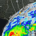

Modeling is consistent in showing the developing low pressure off the East Coast taking on subtropical characteristics this week. 🌀 A pretty good warm core could develop over the Gulf Stream, which could make it purely tropical for a period.
Later in the week the high pressure to the west with an incoming trough should push the system to the ENE, away from the US.
☀️ The Southeast US benefits the most with lots of sunshine all week and pleasant temperatures. Mornings will be cool with widespread 40s.

So often a taste of cool air arrives and then disappears after a couple days. Not this time! The weekend cooldown continues into next week. In fact…the South turns even cooler! 🥶
Looks like the chilliest morning will be Tuesday with widespread middle to lower 40s. Are you ready?!?!

‼️ 🚨 Pattern change incoming! 🚨 ‼️
The passing cold front Friday into Friday night won’t just provide a chill for the weekend, but will help keep the mornings chilly across the Eastern US next week, too. 🥶
This is an interesting setup. The upper-level energy (trough) that helps push the cold front through looks to split over the Atlantic Ocean early next week. Low pressure above should work down to the ocean’s surface. In a scenario like this, subtropical storm development is possible. 🌀 Given enough time in the same area, near the Gulf Stream, even tropical development can’t be ruled out.
Regardless, Eastern US impacts will be the same. High pressure dominating with cool air oozing all the way into the Deep South from Canada. End result: chilly mornings all week and pleasant days!


A *significant* cold front is set to pass the South from Friday into Friday night. A big temperature drop follows that will send 40s into parts of Mississippi, Alabama and Georgia by Saturday morning. The core of the cold settles over the northeastern part of the country by Sunday morning with frost/freeze potential. 🥶
These fronts will come more regularly and gradually turn colder as the transition to winter continues.


As a lifelong Bears fan, this is pretty special!

Honoring a sports legend from the eye of #HurricaneIsaias. ✈️💨
Our crew just launched dropsondes into the storm in honor of Coach Ditka on the landfall mission. It begs the ultimate question
"Who would win, Ditka or a Hurricane?"
@ESPN @ChicagoBears #Isaias #ChicagoBears #NFL


David Paul retweeted

Honoring a sports legend from the eye of #HurricaneIsaias. ✈️💨
Our crew just launched dropsondes into the storm in honor of Coach Ditka on the landfall mission. It begs the ultimate question
"Who would win, Ditka or a Hurricane?"
@ESPN @ChicagoBears #Isaias #ChicagoBears #NFL
Final Google DeepMind Ensemble run we’re going see before landfall of Hurricane Isaias Friday evening. I’ve been leaning on this model all week long and continue to at this hour. The centerpoint of the cone is focused on Destin for landfall as a category 2 hurricane. The official forecast from the NHC calls for a category 3 at landfall.
‼️ Make sure you are prepared! Widespread tree damage and power outages will impact the Florida Panhandle and a large swath of Alabama from Friday evening into Saturday morning.

Let’s discuss the tornado threat with Isaias. 🌪️ Every landfalling tropical cyclone is different. Time of day/night, time of year, location, etc. All these factors impact tornado potential.
There is going to be limited instability overnight in the prime area where tornadoes typically occur. I’m eying the Big Bend area of Florida into South Georgia for the main risk area.
Maybe you’re just learning about the AI tropical models this week, like the Google DeepMind Ensembles. They’re excelling at accuracy again. Do you know about the AI tornado prediction model from StormNet? It’s also been outperforming traditional forecasting methods and organizations.
These maps show the evolution of the tornado risk overnight. I’ve seen a lot of hype about the tornado risk online…here’s some of the best information available. Florida Big Bend into South Georgia, stay alert. 👀 🌪️


Hurricane Isaias is a powerful Category 3 storm Friday morning and the center is within view of radar. This strength should hold into early afternoon, then gradual weakening should commence leading to landfall. Isaias is still projected to be a Category 2 at landfall. 🌀
💧 General rainfall amounts of 2-4”, with 4-7”+ in bands.
💨 Widespread 40-60 mph gusts Friday evening across South Alabama, but 60-80 mph inland near the center of circulation. Stronger in the Western Florida Panhandle.
🌪️ The dry slot will limit the overall tornado risk for Southeast Alabama. I highlighted the tornado risk areas on the future radar images.
⏰ Rainy and windy weather dominates Friday, with the worst weather in the 5 pm to midnight window as Isaias approaches the coast and makes landfall. Stay safe!


Making a run at major hurricane status. 🌀 Isaias will move over a pocket of higher ocean heat content water. I still think it helps provide the boost to get this hurricane to Category 3…and hopefully no higher. A weakening trend should begin later Friday afternoon ahead of the evening landfall due to cooler coastal waters and increased wind shear. Isaias will still be incredibly impactful across Florida and Alabama.


Isaias is a Category 1 hurricane as of 8:30 Thursday morning, still organizing in the Central Gulf. Further strengthening is likely as the system churns towards the Northern Gulf Coast for landfall later Friday evening. The general consensus is for a landfall spot near Pensacola, especially favored by the top-performing AI models, most likely as a Category 2. Isaias could reach major hurricane status farther out in the Gulf, but there should be some weakening as the center approaches land and then much faster weakening after landfall.
Threats:
🌊 Storm surge along the coast
💨 Max winds along the coast, gusty inland
🌧️ Widespread 2-4”, but 4-7” along center track inland
🌪️ Possible tornado threat east of the center
These future radar images are a decent representation of what’s expected. Use Thursday to prepare before rain overspreads the South starting Friday morning.


Huge nocturnal convection burst around the center of Isaias late Wednesday evening. Looks like the circulation becomes vertically stacked on Thursday, allowing for significant strengthening. I still think major hurricane status is more likely than not. Lots to watch between now and the late-Friday landfall. Finish most of your preps on Thursday if you can.

The best Global model in verification studies is usually the AI-ECMWF model. It’s been really consistent with Isaias the past few days. Aligns well with the NHC cone focused on the Pensacola area. Have a look… 🌀


Here’s why I’m thinking a period of rapid intensification Thursday could send Isaias to Category 3 or even 4 status in the Central Gulf. Outflow is excellent around 75% of the circulation and that holds into early Friday. There’s a pocket of high ocean heat content water in the Gulf and the circulation looks to cross that. Think of it as an injection of energy. Combined with favorable outflow - boom, rapid intensification.
Rapid intensification is not captured well in modeling. It’s more of a synoptic pattern recognition skill. The AI modeling is better at it and the fact the Google DeepMind Ensemble is showing around a 40% chance of Cat 3 and 10% chance of Cat 4, it’s worth noting. There should be weakening before landfall, but seeing a major hurricane in the Gulf later this week wouldn’t surprise me one bit.


Lots of information to digest as Tropical Storm Isaias develops in the Gulf. There’s also a wide range of potential outcomes across the computer model data floating around.
🔴 A couple takeaways Wednesday morning. I am a believer in the Google DeepMind AI Ensembles for their proven accuracy. A track towards Pensacola, give-or-take, seems realistic. I’ve been pinpointing Pensacola to Mobile in my mind and that still looks reasonable.
💪 Strengthening into a major hurricane in the Central Gulf, then weakening some before landfall, also seems like a plausible outcome. I’ve seen this before. A storm hits its groove, jumps two or three categories, then moves north into cooler water and higher shear and weakens some before landfall.
💧 Rain totals will be widespread. Coming on the heels of several inches last weekend, the ground is wet and the extra rain could take down more trees and create widespread power outages. Especially near/along the inland center track.
🌪️ Isolated tornadoes east of the center are possible, but an overnight Friday-Saturday landfall diminishes that threat a little due to somewhat lower instability. Still a possibility to monitor, for sure, though.
🕰️ Landfall timing looks to be Friday evening or Friday night. I’m sharing the HWRF model future radar because the structure/timing/location align with my current thinking. It’s guidance now - not a guarantee.
🌀 Prep for impacts late this week, especially coastal areas. The wind threat around the core could extend hundreds of miles inland, the western half of Alabama into Eastern Mississippi are not off the hook.


Beyond the tropical system, I have increasing confidence in a meaningful pattern change that could send some legit cold air into the Deep South! 🥶 We’re talking 40s and perhaps even 30s.
This is still long-range, so exact numbers are not reliable. However, I’m seeing consistency in the pattern evolution and it’s supported by the best modeling available. Climatology also leans heavy into a significant cold front penetrating the Deep South in mid-October. Worth watching! 👀

The disturbed weather in the Gulf Tuesday morning is on the verge of becoming a tropical cyclone. 🌀 Deep convection is bubbling around an organizing center of circulation. Development conditions will be favorable into Thursday, before the system moves farther northward and wind shear increases.
The model tracks are consolidating, focused between New Orleans and Pensacola. The exact track and timing are still debatable, but the main impacts look to be Friday into Saturday. There’s a very good chance this will be our first hurricane of the season.
I’m always mindful of potential rapid intensification if the system becomes vertically stacked with excellent upper-level outflow. This is rarely captured in modeling, yet we’ve seen this time and time again when water temps are warm, motion is slow and the outflow is favorable. A major hurricane…there’s certainly a chance. We’ll keep watching how this evolves.
Coastal interests, beware of the potential storm surge threat east of the center, in addition to rain and wind. Inland areas, this looks to be a big rain-maker. The magnitude of the inland wind and any severe threat are still uncertain.


🚨 Stay weather-aware this week! 🚨
I’m continuing to watch the potential for tropical cyclone development in the Bay of Campeche in the Southwestern Gulf by the middle of the week. The ultimate strength and track is not set in stone, but the most-reliable computer model guidance, plus the flow in the atmosphere, suggest a track towards the Florida Panhandle by Friday or Saturday.
Lots to watch over the days ahead. This certainly looks like a big rain-maker down the road and if there’s significant tropical organization, then a wind-maker, too.

I’m keeping my eyes on the Gulf - especially the Bay of Campeche - as we head into October. 👀 There has been plenty of consistency and agreement among the most reliable long-range modeling that lower than normal sea level pressure will dominate for the first couple weeks of the month.
General low pressure does not mean a tropical cyclone will form. However, general low pressure is an ingredient for tropical cyclone formation. At this point, as a forecaster, I’d put those odds only around 10% or so. Worth watching, but certainly not worth worrying about. If nothing else, this could bring elevated rain chances to the Deep South for the second week of October. 🌧️


The atmosphere is setting up to unleash some significant rain across the South! 💧 Especially from Friday-Sunday.
The main corridor of highest totals looks to extend from the Louisiana/Mississippi/Alabama coasts up to North Georgia and beyond. Widespread totals of 2-3”, with heavier pockets. Amounts look less, but still decent, from Southeast Alabama into North Florida and South Georgia.
If you have outdoor plans, expect some interruptions at times this weekend. Future radar maps will become clearer as we approach the weekend. 🌧️
