

NASA alum 🌎 🚀 Working on my break dancing skills. Tweets/opinions are mine, all mine, etc.
- Tweets8.6K
- Following674
- Followers3.9K
- Likes1.7K

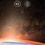












ALT The sun's first rays begin illuminating Earth's atmosphere in this photograph from the International Space Station as it orbited 260 miles above the central United States. At far left, the city lights of Chicago, Illinois, are outlined by Lake Michigan. At far right, the city lights of the Dallas/Fort Worth metropolitan area shine through the clouds. Image Credit: NASA / Jasmin Moghbeli


ALT A SpaceX Falcon 9 rocket with the company's Dragon spacecraft on top is seen at sunset on the launch pad at Launch Complex 39A


ALT A visualization of data from one of two PREFIRE CubeSats. The base of the image is an illustration of the globe showing Greenland, with Iceland in the lower-right corner and the blackness of space along the top of the image. Positioned above Greenland, a multicolored X represents infrared data from multiple layers of the atmosphere that was gathered during several orbits over the area. A color scale in the upper-left corner shows that dark blue represents the lowest brightness temperatures and then ranges through light blue, green, yellow, orange, and red, which represent the highest brightness temperatures. The data in the X is primarily dark blue in the upper layers. Lower layers show variations of green, yellow, and orange, especially along the coastlines of Greenland.
