

Cloud-based aerial imagery stitching and hosting service. Create up-to-date high resolution maps and 3D models from drone-taken images.
San Diego, CA
Joined September 2014
- Tweets686
- Following3
- Followers1K
- Likes115




Maps Made Easy retweeted

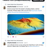
Drone survey from the eastern Amadeus Basin, central Australia. Photos taken with a DJI Air 2S #rayshader #QGIS #rstats #ntaustralia @MapsMadeEasy

Maps Made Easy retweeted
Low-altitude drone survey along the Todd River north of Alice Springs. Made with a DJI Mavic Air 2 @MapsMadeEasy #rayshader #QGIS – at Alice Springs, Northern Territory

Maps Made Easy retweeted
Drone survey from central Australia. Data collected by @RockDrCait with a DJI Mavic Air 2. Photogrammetry by @MapsMadeEasy. GIS with #QGIS. Rendered with the #rayshader package in #rstats – at Alice Springs, Northern Territory

Maps Made Easy retweeted
Drone survey from central Australia consisting of 349 photos from a DJI Mavic Air 2. Digital elevation model and stitched image created with @MapsMadeEasy. Topographic contours made with QGIS. Flyover created with the rayshader package in Rstats – at Alice Springs, Northern Territory
Maps Made Easy retweeted
Drone survey from the Amadeus Basin, central Australia #rayshader #QGIS #DJI #ntaustralia @MapsMadeEasy

Maps Made Easy retweeted

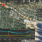
Today we got our 1st proper #albatross eye-view looking down from the Base of #TristanDaCunha. Terrain-following capability provided by @DronesMadeEasy allowed us to collect some stunning data! @volcanna got VERY excited seeing the 1st ever close-ups of this section of the cliff

ALT A preliminary low res processing output from this mornings' first mapping mission of the rockfall area behind the settlement of Edinburgh (of the Seven Seas). The forecast was bad! But it turns out that the weather models don't get it right all the time :-)

ALT Looking down into the heart of Hottentot Gulch (on the right hand side) and a scoria cone (middle/top)

ALT Looking down on an en echelon dyke (centre), new rockfall areas (and source areas) left and right.


Maps Made Easy retweeted

Congratulations to now 2X Olympic Triple Jumper (and former Drones Made Easy employee) @FlyyLikeChrisB for punching his ticket to #Tokyo2020 with @TeamUSA. You know we are rooting for you!
Maps Made Easy retweeted
Another drone model from #AliceSprings #Australia #rayshader #QGIS #DJI @MapsMadeEasy @CopterusApp – at Alice Springs, Northern Territory

Maps Made Easy retweeted
Another drone model from #AliceSprings #DJI #QGIS #rayshader @MapsMadeEasy @CopterusApp – at Alice Springs, Northern Territory


Maps Made Easy retweeted
Elevation data from #DJI #MavicAir2 near #AliceSprings #Australia #rayshader @MapsMadeEasy @CopterusApp – at Alice Springs, Northern Territory
Maps Made Easy retweeted

I'm on board with the Twitter feature leading to "Maps Made Easy tweeted for the first time in a while. See what they have to say" because that particular instance usually means really exciting news in the drone mapping world...

Maps Made Easy retweeted
The brand new Mavic 2 Pro is back in stock! Come get yours while we still have them. Judging by the first batch they won't last long.
Maps Made Easy retweeted

Big thanks to the @MapsMadeEasy team for a full #Integration of @SkyWatchAI #drone #insurance seamlessly into the workflow of Map Pilot 👏🏻💯 Read the press release here bit.ly/2oJQrYI
Maps Made Easy retweeted

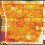
Our team currently conducting #hotspot #thermal #uav / #drone detection for #wildfire across 2500ha of fireline in @newzealand. @MapsMadeEasy @DJIGlobal @flir

Maps Made Easy retweeted
Practical application of #UAV #Drone #Infrared #Thermal #Zenmuse #XT with @MapsMadeEasy #TagPilot app with @DJIGlobal #Matrice, making a difference on the fire ground.

Maps Made Easy retweeted

@MapsMadeEasy your software is awesome. Flew this 100Ha with very steep slopes. Impossible without terrain following
Maps Made Easy retweeted
Check out the video from our Grand Opening as a @DJIGlobal Authorized Store! youtu.be/soNQrsUNoPY
