





Mapswipe has migrated to Mastodon. Connect, come & join us!
➡️floss.social/@mapswipe
☝️Verification is free and you get twice as many signs.
📷Credit: Mastodon

Help us improving mapswipe.org! We are currently working on a redesign of the website and are looking for your suggestions. Please share all your feedback through this form. Thanks a lot! forms.gle/JfsCSiNBgKeCKk5y6

Hear directly from @HasiruAqua on the impact of using our app to empower local farmers in 🇮🇳 Karnataka, #India! With @openmapping_ap they are unlocking new opportunities to improve food security & income generation by leveraging open mapping technology & community collaboration.

So cool to see the @hasiruaqua folk so excited about the impact of @mapswipe and the mapping community and #opendata on their workflows! youtu.be/9t68PUTbOTo @openmapping_ap @hotosm


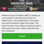
🔎The project set up by @MSF to assist their humanitarian work in 🇦🇫 #Afghanistan is almost complete! Identify buildings and join the 193 amazing mappers who have swiped through 1 553 km2!

mapswipe retweeted

Results of a @MapSwipe building validation for @MSF in Lankien, South Sudan🇸🇸: Over 1/2 of the contributors indicated a review of the #OSM data was needed. Let's experiment with a @maproulette project to check and fix the data! You can edit in iD or JOSM. maproulette.org/browse/chall…

🤩100% mapped! An immense thank you to the 435 mappers who have contributed to the pond mapping project set up by the @openmapping_ap for aquaponis farmers in 🇮🇳 Karnataka, #India!

📣 Calling all mappers! @hasiruaqua is an agriculture startup that helps farmers in India to utilize government subsidized inland ponds for fish farming. You can support the farmers in Karnataka by downloading the @mapswipe app and identifying the inland ponds for fish farming.


🔎🐟 Help @hasiruaqua reach aquaculture farmers to boost their fish farming yield in 🇮🇳 Karnataka, #India, by mapping small ponds on the project set up by the @openmapping_ap!
Are you curious about how MapSwipe is assisting humanitarian response? 📄✍️ Check out the latest blog post by @RedCross to learn about the new analytics and group features:
americanredcross.github.io/2…

In 2020, 🇬🇹 #Guatemala experienced catastrophic floods & landslides, and the communities are still feeling the repercussions. @hotosm is assisting local decision-makers with data & you can support them by validating building footprints with the latest project on the app! 🗺️🔍

Another project to assist @MSF's public health works in Mangochi, 🇲🇼 #Malawi is out! 🔎🗺️Identify buildings and support the teams and the community in their fight against cholera.


🗺️🔍Validate building footprints to assist @MSF teams in 🇸🇸 Lankien #SouthSudan
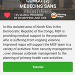
Up-to-date map data is needed for @MSF teams in 🇸🇸 #SouthSudan who are developing an accessibility estimation model to estimate travel times from villages to services such as health sites and water points in Lankien. 🔎🗺️ Validate building footprints on the app to assist them!
🗺️🔍 Key user stats are now accessible & updated daily on your user profile. What are your stats looking like?
Thank @GIScienceHD & @Togglecorp1 for making this possible!
📢Want to use #MapSwipe in Indonesian, Portuguese or Swahili? Then help us translate the app to make it accessible to more people around the world!
Have a look at the language list and start contributing by joining the project on Transifex 👇
explore.transifex.com/mapswi…
🙏Thanks!
MapSãoFrancisco, the joint initiative of @InfoSFrancisco and Canoa de Tolda, is working to map 🇧🇷 #Brazil's São Francisco River in @OpenStreetMap. 🔎🗺️ You can assist their remarkable efforts by identifying buildings with the latest project added to the app!

O MapSãoFrancisco, iniciativa conjunta da @InfoSFrancisco e da Canoa de Tolda, está trabalhando para mapear 🇧🇷 o Rio São Francisco no @OpenStreetMap.🔎🗺️ Você pode ajudar seus esforços notáveis, identificando edifícios com o projeto mais recente adicionado ao #MapSwipe app!